Dom na Gospincu - Kalška gora (via Dolga Njiva)
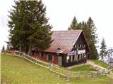
Starting point: Dom na Gospincu (1491 m)
| Latitude/Longitude: | 46,29570°N 14,52140°E |
| |
Route name: via Dolga Njiva
Walking time: 3 h 55 min
Difficulty: partly demanding marked way
Elevation gain: 556 m
Elevation difference along the route: 780 m
Map: Kamniške in Savinjske Alpe 1:50.000
Recommended equipment (summer):
Recommended equipment (winter): ice axe, crampons
Views: 17.980
 | 2 people like this post |
Access to starting point:
A) From the Ljubljana–Jesenice motorway, take the Vodice exit, then continue driving to the first traffic-light intersection in Vodice, where we turn left towards Cerklje na Gorenjskem and Brnik. When we reach the main roundabout in Spodnji Brnik, continue driving towards Cerklje and the Krvavec ski resort. At the end of the settlement Cerklje na Gorenjskem, leave the main road which continues towards Velesovo and Visoko, and continue driving slightly right onto the road towards the Krvavec ski resort. Park on a large organized parking lot by the bottom station of the gondola on Krvavec, where we buy a ticket and take the mentioned gondola to the upper station, which is located by the mountain hut Dom na Gospincu.
B) From the Jesenice–Ljubljana motorway, take the Kranj–east exit, then continue driving towards Brnik, Komenda and Mengeš. When we reach the main roundabout in Spodnji Brnik, continue driving towards Cerklje and the Krvavec ski resort. At the end of the settlement Cerklje na Gorenjskem, leave the main road which continues towards Velesovo and Visoko, and continue driving slightly right onto the road towards the Krvavec ski resort. Park on a large organized parking lot by the bottom station of the gondola on Krvavec, where we buy a ticket and take the mentioned gondola to the upper station, which is located by the mountain hut Dom na Gospincu.
C) From the Ljubljana–Jesenice motorway, take the Vodice exit, then continue driving to the first traffic-light intersection in Vodice, where we turn left towards Cerklje na Gorenjskem and Brnik. When we reach the main roundabout in Spodnji Brnik, continue driving towards Cerklje and the Krvavec ski resort. At the end of the settlement Cerklje na Gorenjskem, leave the main road which continues towards Velesovo and Visoko, and continue driving slightly right onto the road towards the Krvavec ski resort. Further on, we arrive at the village of Grad, where signs for the settlement Ambrož pod Krvavcem direct us right onto a steep asphalt road (straight ahead to the bottom station of the gondola on Krvavec and Štefanja Gora). When the gradient on the steep road eases slightly, we reach an intersection, where we continue left towards the settlement Ambrož pod Krvavcem (straight ahead to the settlements Ravne, Apno and Šenturška Gora). A little further on, the road temporarily descends slightly, then ascends through occasionally quite panoramic slopes. Higher up, we reach Ambrož pod Krvavcem, where we bypass the church of St. Ambrož and the tourist farm Pr Ambružarju on the left side. From the tourist farm onwards, the road enters the forest and ascends through it all the way to the mountain pasture Jezerca, where there is a large organized parking lot. Here the road levels out and turns left; about 500 m further it brings us to an intersection, where we continue slightly left (right to Kriška planina). We then drive on the macadam road for some time, to the upper station of the gondola.
Now the road from the mountain pasture Jezerca to Dom na Gospincu is closed to public traffic; this extends the path by approximately 30 minutes.
D) From the Jesenice–Ljubljana motorway, take the Kranj–east exit, then continue driving towards Brnik, Komenda and Mengeš. When we reach the main roundabout in Spodnji Brnik, continue driving towards Cerklje and the Krvavec ski resort. At the end of the settlement Cerklje na Gorenjskem, leave the main road which continues towards Velesovo and Visoko, and continue driving slightly right onto the road towards the Krvavec ski resort. Further on, we arrive at the village of Grad, where signs for the settlement Ambrož pod Krvavcem direct us right onto a steep asphalt road (straight ahead to the bottom station of the gondola on Krvavec and Štefanja Gora). When the gradient on the steep road eases slightly, we reach an intersection, where we continue left towards the settlement Ambrož pod Krvavcem (straight ahead to the settlements Ravne, Apno and Šenturška Gora). A little further on, the road temporarily descends slightly, then ascends through occasionally quite panoramic slopes. Higher up, we reach Ambrož pod Krvavcem, where we bypass the church of St. Ambrož and the tourist farm Pr Ambružarju on the left side. From the tourist farm onwards, the road enters the forest and ascends through it all the way to the mountain pasture Jezerca, where there is a large organized parking lot. Here the road levels out and turns left; about 500 m further it brings us to an intersection, where we continue slightly left (right to Kriška planina). We then drive on the macadam road for some time, to the upper station of the gondola.
Now the road from the mountain pasture Jezerca to Dom na Gospincu is closed to public traffic; this extends the path by approximately 30 minutes.
Route description:
At the upper station of the gondola on Krvavec we will notice numerous mountain signposts. We head in the direction of the Dom na Krvavcu hut and Marija Snežna on a poorly visible path that ascends almost straight up the grassy slope. The poorly visible path leads higher across a pasture fence, behind which it becomes somewhat easier to follow. The relatively steep path then brings us to the Dom na Krvavcu hut, which we can see from the upper cable car station (alternatively via a poorer macadam road).
From the hut, we continue towards Zvoh along the road that passes the chapel and transmitters on Krvavec to the Razor saddle (saddle between Krvavec peak and Veliki Zvoh), where there is a road junction. We continue straight along the ridge (right to Krvavec peak, 5 minutes) to the next junction, where signs for Dolga njiva direct us left (straight to Veliki Zvoh). The path to Dolga njiva then crosses a ski slope and brings us to a slope partly overgrown with dwarf pines. The traversing path leaves the Krvavec ski area after some time via a wire fence. Further on, the path begins to descend, first through dwarf pines, then diagonally across some smaller and partly overgrown screes. The path then stops descending, and from the left the path from Kokra (via Lojtra) joins us. A few more steps bring us to the old shepherd's hut on the Dolga njiva pasture.
From the mentioned hut, we continue along the left side of the pasture on a poorly visible trail that after 5 minutes of further walking brings us to another, renovated hut. We keep slightly left again, and the still poorly visible path soon enters a belt of dwarf pines, where it becomes more pronounced. This is followed by crossing a short steep gravelly slope, then a gentle path through dwarf pine-covered meadows brings us in a few minutes of pleasant walking to a junction at Škrbina.
Here we continue left towards Kalški greben and Cojzova koča along the path that after a few more steps brings us to the next junction. We continue slightly right towards "Kalce" (left to Kalški greben) along the path that after a few minutes of further walking begins to descend noticeably. After a few minutes' descent, the path turns slightly left and crosses the screes below Kalški greben. Here, on the right side at the foot of the screes, we can spot a small pond called Krvava lokev; we continue along the marked path, which gradually leads onto karst terrain. This is followed by a few short ascents and descents along the path past numerous small sinkholes, then we reach scree again. In the middle of the scree, at a sort of ridge, an abandoned climbing path branches left to Kalški greben; we continue along the marked path, to which a barely noticeable trail from Žagana peč joins from the right a little further on. We continue towards Cojzova koča; the path gradually brings us onto steeper and partly grassy slopes. A little further, with the aid of steel cables, the path ascends a steep slope, then levels out and brings us in a few minutes of further walking to a marked junction.
From the junction, located on a small saddle, we continue right towards Kalška gora (sharply left to Kalški greben via a very demanding path, straight down to Kokrsko sedlo). The path ahead leads onto steep grassy slopes that are especially slippery when wet. We follow this further relatively gentle path all the way to Kalška gora, which we reach after a good 5 minutes of further walking.
Dom na Gospincu - Dolga njiva 1:35, Dolga njiva - Kalška gora 2:20.

Photos:
 1
1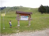 2
2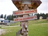 3
3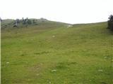 4
4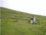 5
5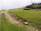 6
6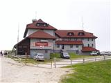 7
7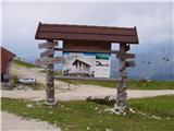 8
8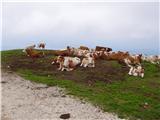 9
9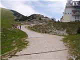 10
10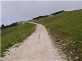 11
11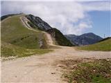 12
12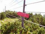 13
13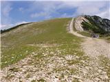 14
14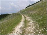 15
15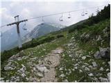 16
16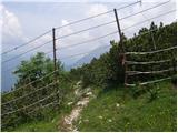 17
17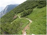 18
18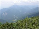 19
19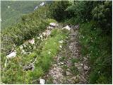 20
20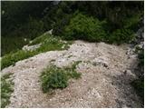 21
21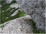 22
22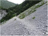 23
23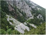 24
24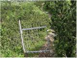 25
25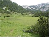 26
26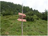 27
27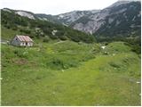 28
28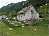 29
29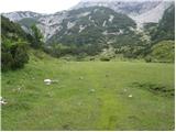 30
30 31
31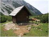 32
32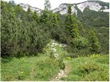 33
33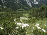 34
34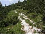 35
35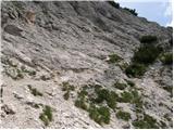 36
36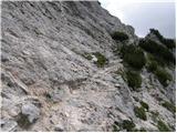 37
37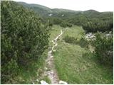 38
38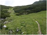 39
39 40
40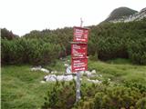 41
41 42
42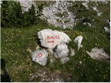 43
43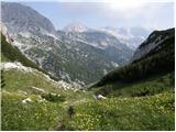 44
44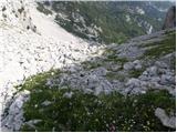 45
45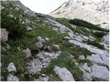 46
46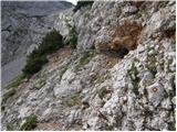 47
47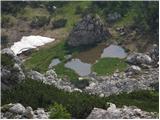 48
48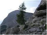 49
49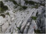 50
50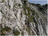 51
51 52
52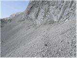 53
53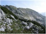 54
54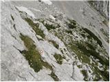 55
55 56
56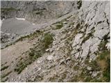 57
57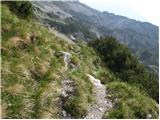 58
58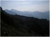 59
59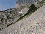 60
60 61
61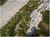 62
62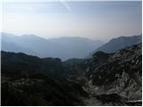 63
63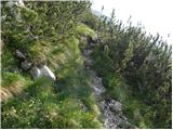 64
64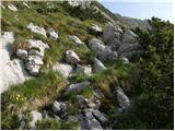 65
65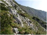 66
66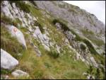 67
67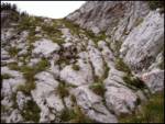 68
68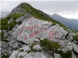 69
69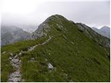 70
70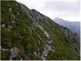 71
71 72
72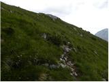 73
73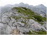 74
74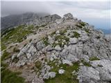 75
75 76
76
Discussion about the trip Dom na Gospincu - Kalška gora (via Dolga Njiva)
|
| Gost16. 08. 2007 |
Brane V.-Entering this morning for yesterday's hike. I started already at Kriška Planina, to Planina Dolge Njive, over Kalški Greben and then the ridge that runs from the top of Kalški Greben to Kalška Gora. The path is attractive, with demanding fixed cables in between, a real little Triglav. I returned via Kalci, which is poorly trodden, requires good orientation in places, because the path runs over boulders, rocky terrain and scree, there is still snow in the depressions. But it is well marked, you just have to watch the signs.
|
|
|
|
| frenk6525. 08. 2010 |
I would do the tour from Krvavec to Kokrško sedlo and I'm interested in how demanding it is, equipment probably, time.
|
|
|
|
| velkavrh26. 08. 2010 |
Yes, this is a full-day tour. Just getting to Krvavec is a whole procedure. You have to decide whether to take the gondola, I don't know exactly when they start in the morning, or by car only conditionally to the barrier at Planina Jezerce. Officially, driving is prohibited from the top of Ambrož, there is a nice wide asphalt, but only for parcel owners, weekend houses, various buildings and those employed up there. If you follow the rules, it takes a good hour's walk to Planina Jezerce. From Planina Jezerce, it's best to go via Kriška planina to the top of Krvavec and then under Zvoh to the left to Planina Dolge Njive, from there to the saddle, and on the saddle to the left to the top of Kalški greben. Up to here, nothing demanding. Then the path continues along the ridge to the saddle before Kalška gora. Here you descend to Korško sedlo to Cojzova koča. The descent here is a bit awkward, a bit exposed, be careful. The descent itself is not long - half an hour. The ridge path from the top of Kalški greben is demanding in two places, at the well-known notch, which can be seen nicely from the valley too, and somewhere in the middle, where we straddle the ridge, the cable is at the top of the ridge. The notch goes very steeply for several meters, but it is well secured with cables and pegs. For the path from the top of Kalški greben to Cojzova koča, a helmet is necessary-recommended, of course good shoes, I always have climbing gloves for the cables. But it's a long tour, so you need good fitness. For the return, it's recommended to go via Kalci, which you descend to at the saddle before Kalška gora. The path via Kalci is not demanding, but you have to watch the markers. This path takes you back to the saddle above Dolge Njive. On the way back, you can decide at the saddle to go left to Vrh Korena, via Jež ridge to Zvoh. The tour is beautiful, long, solitary, if the weather is nice, wonderful views. I've done it several times already. I recommend it! I wish you good, safe steps!
|
|
|
|
| leopold5. 01. 2020 |
When writing this it was already yesterday  . Beautiful and really nice tour. I drove by car to Planina Jezerce to catch the sunrise, but using the gondola starting at 8am doesn't work. . Beautiful and really nice tour. I drove by car to Planina Jezerce to catch the sunrise, but using the gondola starting at 8am doesn't work.  . At the machine wanting to pay 2€ parking I realized there's parking behind the barrier for 5€ of course, which I used as time was tight. Drove to Kriška planina then straight to the transmitter, no snow anywhere. At Krvavec summit waited for the glowing orb slowly rising from horizon, took some breathtaking photos, then on over Dolge Njive. Path lightly snowy but manageable without crampons. Only at junction at Škrbina proper snow starts, soon put on crampons and it went like 4x4 drive. Snow firm and hard enough, no ice just sinks a bit here and there. Ideal for crampons. Windy at top but views made up for it. Return via Planina Koren to avoid repeating steps. . At the machine wanting to pay 2€ parking I realized there's parking behind the barrier for 5€ of course, which I used as time was tight. Drove to Kriška planina then straight to the transmitter, no snow anywhere. At Krvavec summit waited for the glowing orb slowly rising from horizon, took some breathtaking photos, then on over Dolge Njive. Path lightly snowy but manageable without crampons. Only at junction at Škrbina proper snow starts, soon put on crampons and it went like 4x4 drive. Snow firm and hard enough, no ice just sinks a bit here and there. Ideal for crampons. Windy at top but views made up for it. Return via Planina Koren to avoid repeating steps.
|
|
|
|
| ejti5. 01. 2020 |
Are you sure you were on Kalška gora? Or weren't you on Kalški greben?
|
|
|
To post a comment you must log in:
If you do not yet have a username, you must first
register.