Dom na Govejku - Gontarska planina
Starting point: Dom na Govejku (734 m)
| Latitude/Longitude: | 46,11480°N 14,34650°E |
| |
Walking time: 35 min
Difficulty: easy marked way
Elevation gain: 160 m
Elevation difference along the route: 165 m
Map: Ljubljana - okolica 1:50.000
Recommended equipment (summer):
Recommended equipment (winter): crampons
Views: 11.754
 | 2 people like this post |
Access to starting point:
From Medvode we drive to the village Sora, from where we continue driving towards the village Topol (Katarina). After a few km of driving from the village Sora, we come to the inn Legastja, and immediately behind it we turn right onto a steep macadam road in the direction of the Dom na Govejku. We then follow the steep and often quite damaged by rain road to a marked parking lot near the Dom na Govejku.
If the road seems too bad, we can park already in the valley at an appropriate place next to the inn Legastja. This extends the path by approximately 45 minutes.
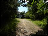
Route description:
From the parking lot, we first walk to the mountain hut, then continue on a marked footpath in the direction of Tošč. Before the sign (cross) we turn left, and the path brings us only a few 10 meters higher into a dense forest. The path ahead quickly flattens, then continues by crossing the slopes of Gontarska planina (894 m). A little further an unmarked path to the mentioned peak branches off to the right, and we continue on the marked path, which only a few minutes later brings us onto the main ridge, where we come to a marked junction.
We continue right in the direction of Gontarska planina and Osolnik (left Tošč) on the path which starts to ascend steeply. The steepness soon eases, and the path brings us in a few minutes of additional walking to a panoramic peak.
Photos:
 1
1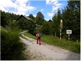 2
2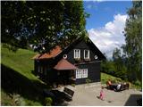 3
3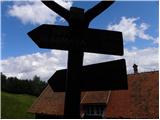 4
4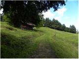 5
5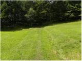 6
6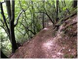 7
7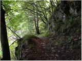 8
8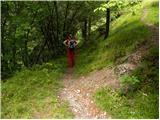 9
9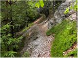 10
10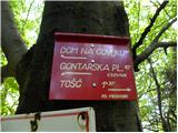 11
11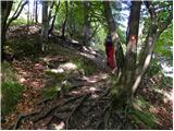 12
12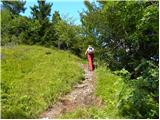 13
13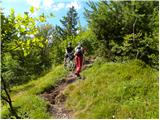 14
14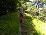 15
15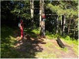 16
16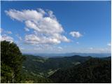 17
17
Discussion about the trip Dom na Govejku - Gontarska planina
|
| francimedved11. 12. 2017 |
Yesterday we were at Gontarska planina with the Šmarna gora mountaineering club. Very nice hike, sunny, there was quite a bit of snow, but on the top it started to blow strongly, so the snow was blowing everywhere. It was a nice hike despite the wind and snow squalls. In the afternoon it started to snow lightly.
|
|
|
|
| svetilka14. 02. 2021 |
Last time we encountered a snow blizzard at the top, but it was quite pleasant in the valley below. Ps: in mid-February we picked up a tick...
The path is very pleasant and offers nice views.
|
|
|
To post a comment you must log in:
If you do not yet have a username, you must first
register.