Dom na Osankarici - Tiho jezero (Falski ribnik)
Starting point: Dom na Osankarici (1193 m)
| Latitude/Longitude: | 46,44900°N 15,41960°E |
| |
Walking time: 1 h 50 min
Difficulty: easy marked way
Elevation gain: 73 m
Elevation difference along the route: 399 m
Map: Pohorje 1:50.000
Recommended equipment (summer):
Recommended equipment (winter):
Views: 15.189
 | 1 person like this post |
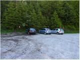
Access to starting point:
From the highway, take the exit Slovenska Bistrica-jug to the center of Slovenska Bistrica, where at the traffic lights by the church we turn left. We drive straight to the roundabout at the factory Impol, at the roundabout take the third exit - signpost Veliko Tinje. Further on, we follow the signposts for Veliko Tinje or Tri kralje, at Tri kralji we continue on the road to the mountain hut Dom na Osankarici.
Route description:
Before the mountain hut on the right side, where there is also an information board, we go slightly uphill through the forest. Then the path starts slowly descending to the monument, which marks the last battle of the Pohorje battalion (*20 min). Immediately after the main monument, the path goes right - signpost for Pesek and Ribniška koča - and in a few minutes brings us to the cart track, on which the signpost for Tri žeblji directs us left downhill to the stream (*10 min). We cross the stream and start slightly ascending, the path bypasses the peak on the right side, and again follows a descent to the next stream (*25 min). We bypass Jodlov vrh on the western side and arrive at Tri žeblji, characteristic area of Pohorje frats on a slight plain (*20 min). From the right side the path from Šumik joins us, we continue straight to the next intersection of mountain paths (*15 min). The signpost for Klopni vrh directs us right downhill along the path through wet terrain, then for a short time we ascend again over the eastern slope of Kurjeg hriba and then through a wide clearing descend to the forest road, which a little further ends. The marking on the tree for Tiho jezero directs us left along the road, after about 50 m we turn left and the path brings us in a few minutes to the edge of Tiho jezero (*20 min).
Note: The description is taken from the description of the path "Dom na Osankarici - Koča na Klopnem vrhu (via Tri žeblji)", where additional pictorial material is also available.

Photos:
 1
1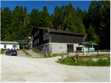 2
2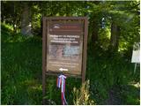 3
3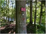 4
4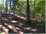 5
5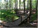 6
6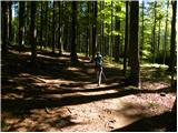 7
7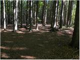 8
8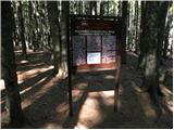 9
9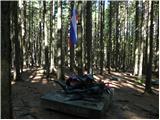 10
10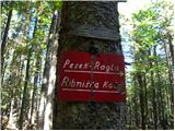 11
11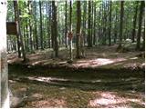 12
12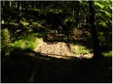 13
13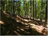 14
14 15
15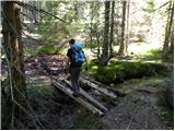 16
16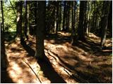 17
17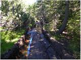 18
18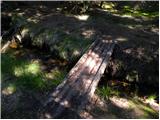 19
19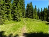 20
20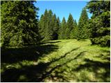 21
21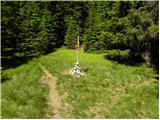 22
22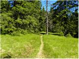 23
23 24
24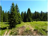 25
25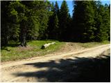 26
26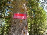 27
27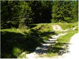 28
28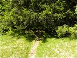 29
29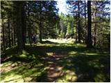 30
30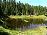 31
31
Discussion about the trip Dom na Osankarici - Tiho jezero (Falski ribnik)
|
| artur18. 11. 2010 |
We went with mates in winter from Osankarica to Klopni vrh and nearly got lost. In winter can be issue if more than half meter snow, as markers not visible.
That's it from my experience!
|
|
|
To post a comment you must log in:
If you do not yet have a username, you must first
register.