Dom na Paškem Kozjaku - Ostrica
Starting point: Dom na Paškem Kozjaku (960 m)
| Latitude/Longitude: | 46,38430°N 15,18830°E |
| |
Walking time: 1 h
Difficulty: easy marked way
Elevation gain: 222 m
Elevation difference along the route: 327 m
Map: Šaleška dolina z okolico 1:50000
Recommended equipment (summer):
Recommended equipment (winter):
Views: 2.180
 | 1 person like this post |
Access to starting point:
A) From the highway Ljubljana - Maribor we go to the exit Žalec, and then we continue driving in the direction of Velenje. In the main roundabout (2nd roundabout) in Velenje, below the ski jumping hill, we continue right in the direction of Slovenj Gradec. We drive through Velenje and the settlement Paka pri Velenju. After approximately 2 km after the settlement Paka pri Velenju, a sign with the caption Paški Kozjak points us right onto a local road towards the quarry. We turn onto it and we cross the bridge over the river Pako. Before the quarry the road turns left and after 6 km brings us to the mountain hut Dom na Paškem Kozjaku, where we park.
B) From Koroška we drive through Slovenj Gradec towards Velenje. Between the villages Gornji Dolič and Paka pri Velenju a sign with the caption Paški Kozjak points us left onto a local road towards the quarry. We turn onto it and we cross the bridge over the river Pako. Before the quarry the road turns left and after 6 km brings us to the mountain hut Dom na Paškem Kozjaku, where we park.
Route description:
From the parking lot at the mountain hut Dom na Paškem Kozjaku we continue on a macadam road. Behind the water catchment we leave the road and turn left onto a footpath which after a few minutes brings us to the parking lot of the parish church of St. Jošt.
A mountain sign points us towards Basališče lightly uphill, away from the macadam road. At the beginning, the footpath is wide and pleasant. The blazes are also well visible. The footpath slowly brings us to the ridge, which is at first wider, but soon narrows a little. First rocks appear. These are not high or precipitous, but caution is still needed on some spots. In snow or ice the path is a little unpleasant, in the dry it is very pleasant and full of small attractions.
Quite quickly we get used to the notched narrow footpath, which leads us along the left and right sides of the ridge, mostly along the ridge itself. At first the footpath leads slightly upwards, then a shorter descent follows, and before the summit itself it becomes steep.
The entire ridge is covered with trees. Views are only available on some spots, and even then only in winter, when the trees are bare.

Photos:
 1
1 2
2 3
3 4
4 5
5 6
6 7
7 8
8 9
9 10
10 11
11 12
12 13
13 14
14 15
15 16
16 17
17 18
18 19
19 20
20 21
21 22
22 23
23 24
24 25
25 26
26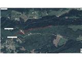 27
27
Discussion about the trip Dom na Paškem Kozjaku - Ostrica
To post a comment you must log in:
If you do not yet have a username, you must first
register.