Dom Planica - Ciprnik (hunting path)
Starting point: Dom Planica (931 m)
| Latitude/Longitude: | 46,47840°N 13,72700°E |
| |
Route name: hunting path
Walking time: 2 h 15 min
Difficulty: partly demanding unmarked way, easy marked way
Elevation gain: 814 m
Elevation difference along the route: 814 m
Map: Kranjska Gora 1:30.000
Recommended equipment (summer):
Recommended equipment (winter): ice axe, crampons
Views: 55.262
 | 1 person like this post |
Access to starting point:
From the Ljubljana - Jesenice highway, we head to the Jesenice - west (Hrušica) exit, then continue driving in the direction of Kranjska Gora and then towards Rateče. Right next to the settlement Rateče, we turn left towards Planica. Right before we get to the large macadam parking lots, we turn left towards Olympic Sports Centre Dom Planica. We park at an appropriate place by the mentioned hut, or we can also park on one of the previously mentioned parking lots in Planica.
Route description:
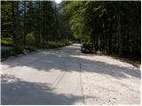
From Dom Planica we walk to the nearby boules court, above which we step onto the gravel of the nearby torrent. Further, we gently ascend for a few minutes along the mentioned torrent, after which a cairn directs us left into a belt of dwarf pines, where we step onto a nicely maintained but unmarked hunting path.
The path, which further starts to ascend more steeply through the forest, brings us after approximately 15 minutes of walking from the starting point to a smaller wooden log cabin, which in an emergency serves as a smaller bivouac, otherwise it is intended for cameramen during ski jumps or flights in Planica. At the log cabin, the path temporarily passes onto a smaller ridge, which soon ends on steep forested slopes. When the path enters dense forest, it turns right and starts to ascend steeply. Higher up, the path levels out and gradually leads onto fairly steep slopes that are especially dangerous for slipping when wet. Across these slopes continues a fairly level track, which is usually nicely cleared of leaves, so the path in dry conditions does not present any major danger. After a few minutes of traversing, a somewhat (actually quite) more difficult but marked path from Planica joins from the right (descent option to Planica).
From the junction, we continue along the marked mountain path in the direction of Ciprnik and Vitranc. The path ahead again starts to ascend steeply and slightly higher turns right, quickly bringing us to a panoramic ridge. For some time we ascend along the ridge, from which a nice view opens onto the rugged slope of Ciprnik as well as Jalovec and the Ponc ridge. Higher, the path passes into forest for a while, then returns to a partly exposed ridge and panoramic ridge. Further, the path returns to the forest, where it ascends more steeply for some time, then brings us to the main ridge of Ciprnik, where we join the path from Vitranc.
Here we continue right and ascend for some time longer through the forest, through which beautiful views open up ever more frequently. The forest is soon replaced by dwarf pines, and the path gradually leads onto fairly steep slopes, which are slightly exposed in a few places. We follow this path, which is quite steep in the final section, with views of the surrounding peaks all the way to the panoramic summit, which we reach after a few minutes of further walking.

Photos:
 1
1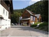 2
2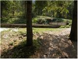 3
3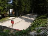 4
4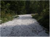 5
5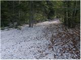 6
6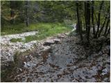 7
7 8
8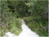 9
9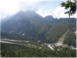 10
10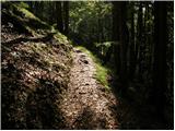 11
11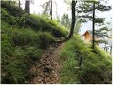 12
12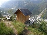 13
13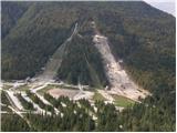 14
14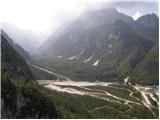 15
15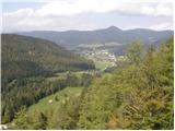 16
16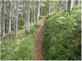 17
17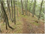 18
18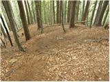 19
19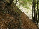 20
20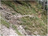 21
21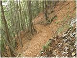 22
22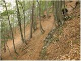 23
23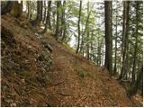 24
24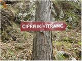 25
25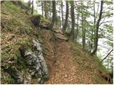 26
26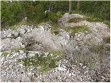 27
27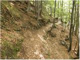 28
28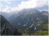 29
29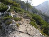 30
30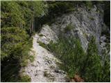 31
31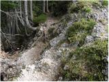 32
32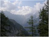 33
33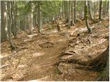 34
34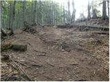 35
35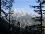 36
36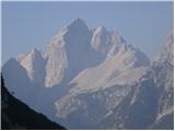 37
37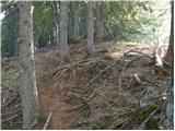 38
38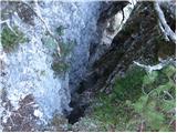 39
39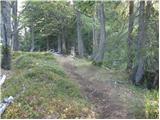 40
40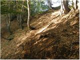 41
41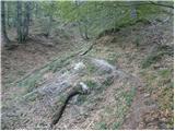 42
42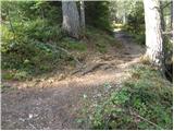 43
43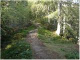 44
44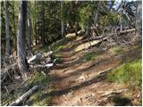 45
45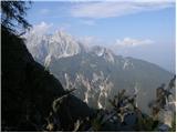 46
46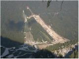 47
47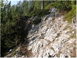 48
48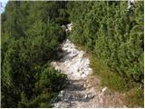 49
49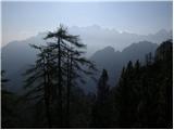 50
50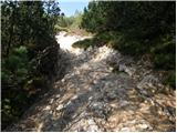 51
51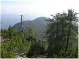 52
52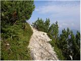 53
53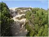 54
54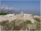 55
55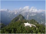 56
56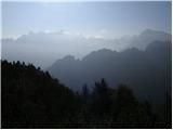 57
57
Discussion about the trip Dom Planica - Ciprnik (hunting path)
|
| limona225. 09. 2011 |
Here I repeat my comment that I attached to the Vitranc-Ciprnik path, because this hunting path to Ciprnik was not yet on the portal a month ago: Ciprnik from Planica, from Dom Planica - a few days ago we went along this path again, which "darh" described nicely. On the return, however, we decided to descend to Planica via another path that branches off somewhere in the middle. At this junction there is also a red sign, pointer "Planica". You do reach Planica (near the start of the path to Tamar), but this sign shouldn't be there because the path is dangerous! It's not for ordinary hikers who might circle down from Vitranc and Ciprnik towards Planica! It runs through a very steep, shrubby, broken gully where it's hard to find a stable rock to step on or hold onto. Only after returning did I check that Mihelič also describes this path in the guidebook as barely passable, once marked but then abandoned, unfinished and unmaintained. At certain points it is completely overgrown with brush, but at least there it's stable. At some points there was no other way down the slippery slope than partially hanging on a shrubby branch to the next foothold. Willy-nilly you dislodge stones. It's probably a bit easier uphill, provided you can even find the starting point in the extensive scree of shrubs. This section of "path" is only for those with lots of mileage in the mountains.
|
|
|
|
| Kozorog25. 09. 2011 |
Yes, there you have to go straight past the sign.. so stick to the forest path that leads straight regardless of the Planica sign that directs you left into the valley. On the rock, the path is painted, unfortunately the sign misleads and brings you to the path you wrote about. If you take the path I mentioned, you arrive in the valley right at the Dom Planica (CŠOD)!
|
|
|
|
| dprapr1. 04. 2012 |
Yesterday my wife and I enjoyed this trail.
For warming up we first "jumped" to the top of the Planica ski flying hill. Hats off to Kranjec and the other daredevils!
The hunting trail is extremely beautiful and scenic. I was already wondering last time while watching the jumps where the nice shots of the valley with Jalovec come from. Answer: from this trail - a small house built in between, from which there is a wonderful view of the scene and the valley.
The summit is also extremely panoramic - in my opinion even better than Slemenova špica. At the summit an elderly gentleman (79) kept us pleasant company, who had hiked it alone from Podkoren. I hope that some of what these vital people possess remains for us.
As for the marked trail to Planica - we returned via it out of curiosity - I wouldn't recommend it even to someone I would be very angry with!
Best regards to all who enjoy the mountains!
|
|
|
|
| zabonka21. 08. 2012 |
Regarding the path, I agree with what's written, wonderful view of the surrounding mountains and ski jumps, which are slowly getting a new look, what bothered me at the top was only that there were unlimited numbers of large red ants everywhere and you couldn't even accidentally sit on the ground, so I quickly turned back  but nevertheless the day was wonderful, already because of the peace, since I didn't meet a single mountaineer on the path but nevertheless the day was wonderful, already because of the peace, since I didn't meet a single mountaineer on the path 
|
|
|
|
| sirt117. 07. 2013 |
Very nicely laid out trail. Already from the bocce court we spot the first signpost, a bit higher there's another one, so it's very hard to miss. Also on the way back, at that junction a wooden signpost directs us along this trail, the red metal one pointing to the notorious trail is bent!
I returned via Vitranc and "admired" the hut on Vitranc and Bedanca! "People are tourism" was a slogan once, but I don't know which people are responsible for this shame!
|
|
|
|
| katja879. 10. 2013 |
On Saturday, 5.10.2013, at the top of Ciprnik 
View of the surrounding peaks was impossible due to clouds.
This path is regularly marked and also signposted with direction signs, so I don't know why it's marked here on hribi as unmarked. So no panic about getting lost 
Recommend for a family outing
Photos from the hike can be viewed on the website of Planinsko društvo Matica Murska Sobota: http://www.mojalbum.com/pdmaticams/20131005-ciprnik/dom-v-planici-zadaj-ciprnik/21166878
|
|
|
|
| limona10. 10. 2013 |
The path was equipped (cables) and direction signs were placed in autumn 2012. Therefore, the path presentation on hribi.net probably needs to be updated. Good luck!
|
|
|
|
| gonzales10. 10. 2013 |
On Saturday 5.10.13, we headed from Kranjska Gora via Vitranc to Ciprnik, descended to Planica. The views weren't particularly stunning, but there was something to see. I'm wondering if there's any stamp, as we didn't find one....??
|
|
|
|
| prizup10. 06. 2015 |
The path from Planica to Ciprnik-Vitranc, which until recently was full of fallen trees, is now cleared and nicely passable. Soon a tourist bus will run to Planica and it will be possible to make a nice circular tour along the ridge to Jasna.
The stamp from Ciprnik can be found at Mojčin dom on Vitranc.
|
|
|
|
| Salewa27. 10. 2016 |
Is the path very exposed?
|
|
|
|
| Salewa27. 10. 2016 |
Is the path very exposed?
|
|
|
|
| PFranci27. 10. 2016 |
No. Most of the trail runs through the forest, the last part along the ridge among the bushes.
|
|
|
|
| zajko3. 04. 2017 |
Yesterday from Planica to Ciprnik. Above 1,500 m still quite a lot of snow. Great views, only Jalovec didn't want to take off his hat. Back via Vitranc to Kranjska Gora. Total walking time under 5 hours, total ascent 915 m.
|
|
|
|
| Jusch17. 08. 2018 |
The path is marked with markers - it is easy and very safe. Suitable for walking with children... at the top there is a magnificent view of Jalovec, Ponce and Planica.
With a dog (large poodle) we needed less than 90 minutes for the ascent.
|
|
|
|
| cajer12. 01. 2019 |
We were at Ciprnik yesterday. From Dom Planica to the start of the path, need to cross the running track twice. Once on the path, it is visibly marked and you just climb steadily along it. Started at 9:30, the uphill path is mostly in shade. No snow at the start, then some for decoration along the path, higher up more. Used mini crampons only for the descent, they came in very handy. A bit higher (about halfway) the path fades a little and needs to be found (look for the track and marks), otherwise no problem. View from the top fantastic, no clouds. And cold, we quickly headed back to the valley.
Time: up 2h with breaks, down 1h 10min without break.
|
|
|
|
| lukecpukec22. 07. 2022 04:39:55 |
Has anyone walked this path recently - is the path normally open? How is parking in Planica now, is it paid? Thanks
|
|
|
|
| georgia25. 07. 2022 19:41:13 |
Hi, parking is paid, now 3.5 euros for 24 hours, anywhere in Planica. Regarding the trail, I don't know...
|
|
|
|
| megalodon25. 07. 2022 21:42:33 |
On Saturday I hiked this trail. 2-3 times need to duck well under fallen trees (for 186cm quite a challenge ), otherwise trail is BP. But part is narrow path crossing steep slopes (as described). Parking as #georgia wrote. Early arrival no help, no attendant but barrier.
Good luck.
|
|
|
|
| Majdag21. 07. 2025 18:31:31 |
Yesterday...Started at Dom Planica and found the path through the dwarf pines. It is well trodden and also nicely passable through the forest. Small obstacles have bypasses and on the ridge you can breathe easy. The summit of Ciprnik is not far anymore, but the path is more varied. Already some visitors on Ciprnik, who kept coming. Beautiful views, feelings in the middle of the mountains also beautiful. That's what counts. It's nice in the mountains.
https://jelenkamenmajdag.blogspot.com/2025/07/ciprnik.html
|
|
|
|
| Vrhovka7. 04. 2026 18:05:39 |
Conquered Ciprnik on 5. 4., the path is very nicely marked. There are still some snow patches along the path, and quite a bit at the top, since it has warmed up a lot, the snow was also very soft and quite uncomfortable for descent. But the views are really wonderful. The path passes quickly and views of Planica all the time.
|
|
|
To post a comment you must log in:
If you do not yet have a username, you must first
register.