Dom Planincev v Logarski dolini - Krofička (hunting path)
Starting point: Dom Planincev v Logarski dolini (837 m)
| Latitude/Longitude: | 46,38360°N 14,62160°E |
| |
Route name: hunting path
Walking time: 3 h 35 min
Difficulty: difficult pathless terrain
Elevation gain: 1246 m
Elevation difference along the route: 1246 m
Map: Kamniške in Savinjske Alpe 1:50.000
Recommended equipment (summer): helmet
Recommended equipment (winter): helmet, ice axe, crampons
Views: 9.803
 | 4 people like this post |
Access to starting point:
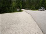
A) Via the mountain pass Volovljek (Kranjski Rak) or from Mozirje we drive to Luče, and from there we continue driving towards Logarska dolina. A few kilometers after the settlement Solčava we will come to a junction, where we turn left in the direction of Logarska dolina (toll payment). Further on, we drive through Logarska dolina to Dom Planincev v Logarski dolini. We park on the parking lot on the left side of the road. The parking lot on the right side is intended for guests of Dom Planincev.
B) Via the border crossing Jezerski vrh we drive to Austria, there in the valley Bela / Vellach we turn right in the direction of border crossing Pavličev vrh (Pavličevo sedlo) / Paulitchsattel. When we arrive on the Slovenian side we first descend to the valley, then at the junction a little before Solčava we turn right towards Logarska dolina (toll payment). Further on, we drive through Logarska dolina to Dom Planincev v Logarski dolini. We park on the parking lot on the left side of the road. The parking lot on the right side is intended for guests of Dom Planincev.
C) We drive to Črna na Koroškem (to here from Ravne na Koroškem or from Šoštanj through the pass Spodnje Sleme), then we continue driving towards Luče. Initially an asphalt road, higher it becomes gravel and brings us to the junction of several roads at the pass Spodnje Sleme. We continue on the main road, which starts descending transversely towards the settlement Podolševa. Lower at the junction we turn sharply left (right Solčava panoramic road - to the starting point we can arrive also via this road, in this case we join the road through the pass Pavličev vrh) in the direction of Solčava. When we descend into Solčava, at the junction where we join the main road we continue right. A few kilometers after the settlement Solčava we will come to a junction, where we turn left in the direction of Logarska dolina (toll payment). Further on, we drive through Logarska dolina to Dom Planincev v Logarski dolini. We park on the parking lot on the left side of the road. The parking lot on the right side is intended for guests of Dom Planincev.
Route description:
From the parking lot we continue on the main road which leads us over a bridge, after the bridge the signs for Klemenča jama direct us left onto the forest road, along which we continue the path, and it brings us in a few minutes to a junction, where we continue right in the direction of Klemenča jama. From the junction we walk along the road only a short time, then we continue left along the initially wide and gentle mountain path. Only a few steps further the path moves onto the slope and gradually starts to ascend steeper and steeper. The steep path continues ascending the steep slope, then crosses a torrential gully and a little further a streamlet. After the streamlet the path becomes even steeper and ascends a very steep slope, which is especially when wet dangerous for slipping. After less than an hour of walking from the starting point we arrive at a bench by a spring and just a little further to a junction, where we join the path from the starting point Na razpotju.
Here the steepness eases, and we continue gently uphill along the wide path, which soon brings us out of the forest. From here only a short ascent follows along the grassy slope to the mountain hut Koča na Klemenči jami pod Ojstrica.
From the hut, where a junction is marked, we continue straight in the direction of Ojstrica (left Strelovec and Krofička) along the path which goes into the forest after some 10 meters. Through the forest we ascend moderately to steeply, and higher the path brings us below rocky cliffs, which are not too crumbly. The path soon withdraws from the cliffs to the right and brings us to a junction, where we continue left in the direction of Ojstrica along Kopinškova pot (right Ojstrica, Planjava and Korošica over Škarje).
Further we pass from the forest onto panoramic slopes overgrown with dwarf pines, from which a beautiful view opens towards the north wall of Ojstrica and Rjavčki vrh. The path further brings us to the branch-off of the unmarked hunter's path to Krofička.
When we notice a cairn (approximately 10 minutes before Kopinškova pot crosses to the other side of the ridge) we head left onto a poorly visible pathlet, which over a partly rocky and partly grassy slope, surrounded by dwarf pines and individual trees, brings us below the foot of the northwest cliffs of Krofička. Further we ascend along a wide gravelly gully, from which soon to the right a nice secured and exposed passage opens (follow the cairns). A short very steep ascent follows, which we overcome with the aid of a steel cable, and the path brings us onto an initially narrow and exposed ridge. The ridge, which is lightly overgrown with dwarf pines, then quickly widens and with the aid of some fixed protections brings us to probably the most difficult part of the path. With the aid of a steel cable, which has been damaged for several years (data from 2013), we climb the almost vertical and exposed chimney, which is about 10 m high. The steepness then quickly eases and the path brings us to sunny meadows (the slope is called Zadnji travnik), where the path gradually disappears. We continue the ascent traversing in the direction north to northeast along a gradually steeper slope. When we reach an already quite steep slope, we stop the traversing ascent and continue straight up the very steep slope. If we want to avoid the last steep ascent, a little below the summit we can continue somewhat to the right and ascend to the summit along a somewhat less steep "path", which brings us to the summit along the right (eastern) side.
PS: From the place where we leave the marked path to Ojstrica, it becomes technically and orientationally difficult. Ascent in fog is not recommended, and due to falling rocks it is good to also have a helmet with you.

The trip can be extended to the following destinations: Matkov kot
Photos:
 1
1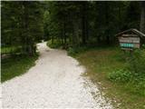 2
2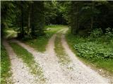 3
3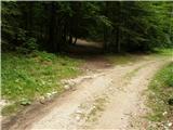 4
4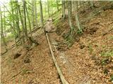 5
5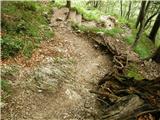 6
6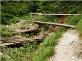 7
7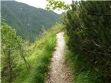 8
8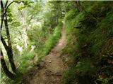 9
9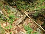 10
10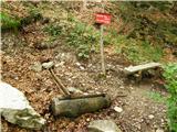 11
11 12
12 13
13 14
14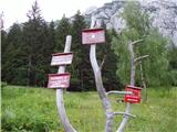 15
15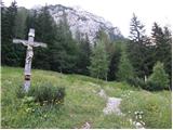 16
16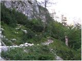 17
17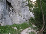 18
18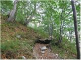 19
19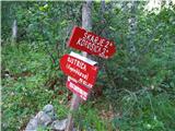 20
20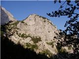 21
21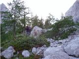 22
22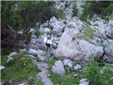 23
23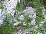 24
24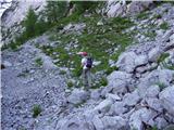 25
25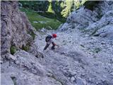 26
26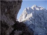 27
27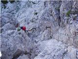 28
28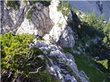 29
29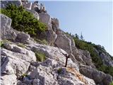 30
30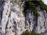 31
31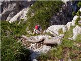 32
32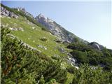 33
33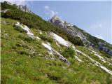 34
34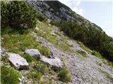 35
35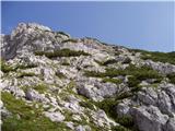 36
36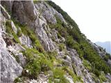 37
37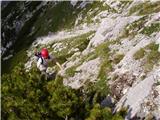 38
38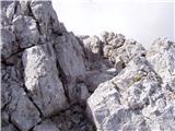 39
39 40
40
Discussion about the trip Dom Planincev v Logarski dolini - Krofička (hunting path)
|
| Stamp18. 07. 2014 |
Suggestion? Up this hunting path to Krofička, then down the marked trail or is it better the other way around? Thanks..
|
|
|
|
| garmont18. 07. 2014 |
That's better. The hunting path is considerably more demanding in descent than the marked one.
|
|
|
|
| franca18. 07. 2014 |
Better first via the hunting path, as it's easier to find the passages uphill, and downhill relaxed along the marked one.
|
|
|
|
| Stamp18. 07. 2014 |
Thanks.. I'm a bit afraid whether my company could pass the hunting path at all.. They are all young and fit men, but have no experience with ropes..
I don't know, maybe for the first time marked up and down.. 
|
|
|
|
| CarpeDiem24712. 08. 2016 |
Anyone afraid of getting lost or off track while using the HUNTER'S PATH, I suggest asking the caretaker at the Koča na Klemenči jami hut, who showed me a detailed sketch (route) of the path to the summit. Recommended!
|
|
|
|
| garmont13. 08. 2016 |
Regardless of the above comment, do not set off on the hunter's path if you don't have experience with similar paths. In the scree of Zadnji travnik, the "path" sketch won't help you much.
|
|
|
|
| suhy18. 11. 2018 |
Although my wife and I repeated the tour on the hunting trail after 25 years, there were quite a few orientation problems in the last 150 meters of elevation, where the trail disappears. The cairns at various spots show that everyone has trouble here finding passages through the scree and steep grass. So there are several variants to push through to the top. The published GPS track is one possible variant that in the last 10 meters below the summit enters a gully facing north, where you need to use your hands a bit. Still a wonderful trip for lovers of wild nature. Recommended descent is via the marked path.
|
|
|
|
| klukec0021. 07. 2025 12:40:06 |
Hello,
my colleague and I climbed to Krofička on Saturday, July 19, 2025. The fixed ropes are still holding for now. A few comments:
After leaving the path to Ojstrica, we cross the slope and reach the gully in picture 26. The path is still quite visible up to here. At the top of this gully, there is a chute to the left and it looks like the gully continues to the right. That's not our path. Our path goes right across this gully. A peg is clearly visible on the right, indicating where the path is. The peg is shown in picture 27.
The path along the ridge is quite exposed, with fixed ropes at key points. They also help in finding the way. The ridge leads us to the rock step shown in picture 31. The picture doesn't do this section justice. Before this rock step, there is a several-meter ridge with a drop on both left and right, and the entry into this chimney in the rock step is above a drop. We overcome the rock step with the help of the fixed rope. It's not exactly trivial. I won't go into what a slip would mean.
After overcoming this rock step, we reach an idyllic meadow. I suggest sitting down in the grass and admiring the view for a bit.
From this meadow, the summit of Krofička and the passages through the dwarf pines are clearly visible. We visualized the route here. Especially the final slope.
When you reach below the summit, go straight up. I don't know, but I'd say this is grade II climbing. Besides the climbing itself, you need to find the easiest variant. And if you choose poorly, it can mean grade III climbing. A bad choice can also mean downclimbing and finding a new path. Orientation is demanding because nothing is visible due to the dwarf pines. We studied the route from the meadow, where the passages through the dwarf pines were clearly visible, so we didn't get lost. This part seems quite demanding to me because you can't afford mistakes here.
When we emerge from the dwarf pines, a less visible path leads right back into the dwarf pines. The path goes through the dwarf pines along the wall and brings us to a gully right below the summit. This gully is full of scree and extremely dangerous for slipping. There is rock on the other side of the gully, but I didn't dare cross it over the scree. If I slipped, I'd end up in the abyss. We climbed the gully using its left edge, where holds were found.
The route description doesn't mention the path through this gully, but going directly up. Maybe that's the better variant, because this path through the scree-filled gully is really dangerous. The visible path misled us. From the gully, we climb a few more meters over solid rock to the summit. There is another gully on the left that leads directly to the summit. I hope no one tries to go up this gully to the summit, because it's also full of scree.
I would rate this path as very difficult. I believe that for an experienced mountaineer, such a path poses no problem, but maybe the description of this path is a bit underestimated 
|
|
|
To post a comment you must log in:
If you do not yet have a username, you must first
register.