Dom pod Storžičem - Storžič (through southwest groove)
Starting point: Dom pod Storžičem (1123 m)
| Latitude/Longitude: | 46,35860°N 14,39060°E |
| |
Route name: through southwest groove
Walking time: 3 h 50 min
Difficulty: easy marked way
Elevation gain: 1009 m
Elevation difference along the route: 1090 m
Map: Karavanke - osrednji del 1:50.000
Recommended equipment (summer):
Recommended equipment (winter): ice axe, crampons
Views: 61.440
 | 1 person like this post |
Access to starting point:
From the Ljubljana-Jesenice motorway, take the Ljubelj (Tržič) exit, then continue driving towards Ljubelj. Just before the petrol station in Bistrica pri Tržiču, leave the main road and continue right towards Tržič. Continue through Tržič towards Dolžanove soteske, then at the end of the town turn right towards Lom pod Storžičem and Grahovše. At the end of Grahovše village, the asphalt ends, and we follow the gravel road towards Dom pod Storžičem. Follow this steeper gravel road in the upper part to the parking lot near Dom pod Storžičem.
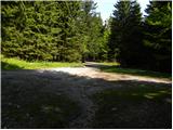
Route description:
From the starting point near Dom pod Storžičem, continue briefly along the road (direction Storžič), then head onto the parallel hiking path that gently ascends along the edge of the meadow. At the upper part of the meadow, reach a small wooden hut where the path splits into two. We take the slightly right path (left to Storžič through Žrelo and over Škarjev rob), which continues along and beside a relatively steep cart track. Higher up, the path levels out somewhat and turns right. Continue traversing upwards to the right for a while, then reach the edge of a steep gully, across which we traverse to a nearby wide cart track, reaching it just at its end. Immediately leave this cart track and continue slightly left into the forest. Continue through the forest on a path that gently descends for a while, then reach a small junction from where we continue towards Mala Poljana.
From the junction, the path starts ascending again, constantly traversing the slopes to the right. Higher up, reach a cart track along which we quickly walk to nearby Mala Poljana.
From Mala Poljana, where paths from Zalog and Povelj join us, continue left towards Velika Poljana (slightly right to Zavetišče v Gozdu, right to Tolsti vrh). The path, which continues along the cart track, soon enters the forest through which it ascends traversely. After a few minutes of walking, reach a viewpoint slope from which we get a nice view of the surrounding mountains. A little further, the cart track turns right and after a short ascent brings us to the upper edge of Velika Poljana, from where we can descend to Koča na Veliki Poljani in one or two minutes, otherwise continue left towards Storžič.
The path continues along the ridge of Psica (Psica is a kind of western subpeak of Storžič), occasionally veering slightly right from it. After about a half-hour ascent from the junction at Velika Poljana, reach the next marked junction located below the summit of Psica.
At this junction, a very demanding path continues left along the Psica ridge, while we continue right towards the easier path to Storžič. From the junction, the path traverses down and up several times, leading us along the slopes of Psica, from which we occasionally get some views, but the first part of the traverse mostly goes through the forest. After another 30 minutes of walking, reach a junction where the traverse ends, joining the path to Storžič through the southwest groove.
Follow this path left upwards (right down to Planina Javornik, Povlje, or we can also reach the Laško hamlet and Bašelj village) and begin a steep ascent along the path leading through the southwest groove of Storžič. Ascend through this groove, from which increasingly beautiful views open towards Gorenjska, for another good hour, then the path veers slightly right and brings us to the southwest ridge of Storžič, where an unmarked path joins from the right along this ridge.
Continue along the ridge, the marked path then veers slightly right and soon other paths from Dom pod Storžičem and Kališče join us. From here to the summit, which we can already see ahead, only a short ascent remains with wonderful views.
Starting point - Planina Jesenje 0:05, Planina Jesenje - Mala Poljana 0:55, Mala Poljana - Velika Poljana 0:15, Velika Poljana - junction below Psica 0:35, junction below Psica - junction in southwest groove 0:40, junction in southwest groove - Storžič ridge 1:05, Storžič ridge - Storžič 0:15.

Along the route: Planina Jesenje (1137m),
Mala Poljana (1325m), Sedlo nad Veliko Poljano (1406m), Razpotje pod Psico (1595m), Razpotje v jugozahodnem žlebu (1622m), Razpotje na grebenu Storžiča (2048m), Razpotje pod vrhom Storžiča (2114m)
Photos:
 1
1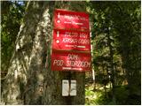 2
2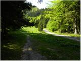 3
3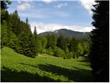 4
4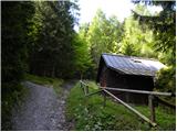 5
5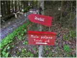 6
6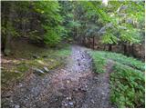 7
7 8
8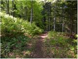 9
9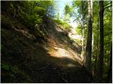 10
10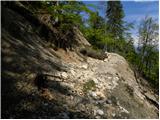 11
11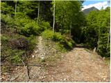 12
12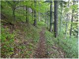 13
13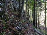 14
14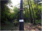 15
15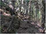 16
16 17
17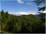 18
18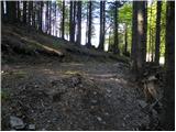 19
19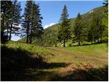 20
20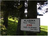 21
21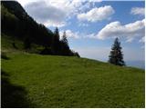 22
22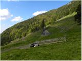 23
23 24
24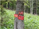 25
25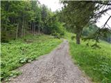 26
26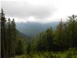 27
27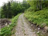 28
28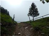 29
29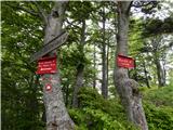 30
30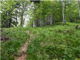 31
31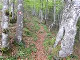 32
32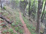 33
33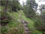 34
34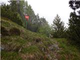 35
35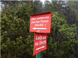 36
36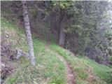 37
37 38
38 39
39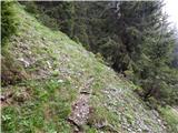 40
40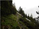 41
41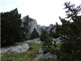 42
42 43
43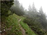 44
44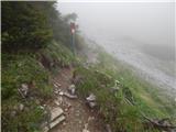 45
45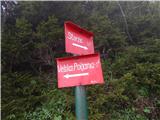 46
46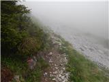 47
47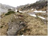 48
48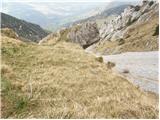 49
49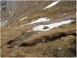 50
50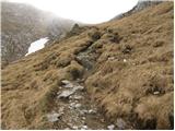 51
51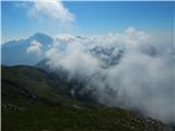 52
52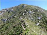 53
53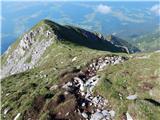 54
54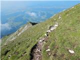 55
55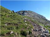 56
56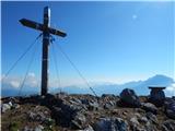 57
57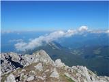 58
58 59
59
Discussion about the trip Dom pod Storžičem - Storžič (through southwest groove)
|
| seinfeld4. 11. 2017 |
I went down this path actually, just wanted to mention that in the second half it's quite steep. Not much less than the path to Grintovec via streha.
But the views of the Psica cliffs are wonderful.
|
|
|
|
| Planinecizgg21. 05. 2020 |
Hello,
does anyone know if this path is dry yet?
Thanks and best regards.
|
|
|
|
| robi85626. 05. 2023 23:23:37 |
Hello, does anyone know if the trail is already snow-free?
|
|
|
|
| ppegan27. 05. 2023 20:06:13 |
There is still snow on the path.
|
|
|
|
| Razgledka29. 06. 2023 21:36:22 |
Is the path suitable for an inexperienced mountaineer/hiker and without major precipices? Say for a trip next week. Would you recommend it also for a 9-year-old?
|
|
|
|
| sla30. 06. 2023 07:58:11 |
The path has no major precipices.
But the path itself through the gully is quite tedious. Quite steep and slippery due to scree terrain.
I wouldn't take such a small child here, the mountains will be ruined for him.
|
|
|
|
| saqo17. 09. 2025 16:03:48 |
Hello, is the path still in good passable condition? Has anyone been?
|
|
|
|
| DVas18. 09. 2025 07:26:35 |
Was. All OK. Never again.
|
|
|
|
| saqo18. 09. 2025 12:51:40 |
|
|
|
|
| pantharej18. 09. 2025 17:41:21 |
Of all paths to Storžič this is the worst due to erosion. In places full of scree, elsewhere slippery, uphill still okay, downhill not recommended. Best to go up the gully and down over the Škarjev edge.
|
|
|
|
| matej71218. 09. 2025 20:46:45 |
We can avoid the most damaged part of the path by going from Povelje to Velika Poljana and along the ridge towards Psica, then at the junction right and join the path through the gully higher up.
|
|
|
|
| DVas19. 09. 2025 09:04:37 |
As pantharej wrote. I went up via Psica and back through the gully. Uphill it would still be doable, downhill it was tormenting.
|
|
|
|
| Enka22. 06. 2026 11:22:14 |
This path is really strenuous, although not technically demanding. Well, in reality the part through the forest (which starts above the Javornik pasture) is wonderful, but through the gully it's really tedious. Stones, scree, mud. Erosion does its thing, every time I go, it's worse. But my friend said that she still preferred to descend here than over Škarjev rob, from where we came.
|
|
|
To post a comment you must log in:
If you do not yet have a username, you must first
register.