Dom pod Storžičem - Storžič (through Žrelo)
Starting point: Dom pod Storžičem (1123 m)
| Latitude/Longitude: | 46,35860°N 14,39060°E |
| |
Route name: through Žrelo
Walking time: 3 h
Difficulty: very difficult marked way
Via ferrata: B
Elevation gain: 1009 m
Elevation difference along the route: 1009 m
Map: Karavanke - osrednji del 1:50.000
Recommended equipment (summer): helmet, self belay set
Recommended equipment (winter): helmet, self belay set, ice axe, crampons
Views: 293.798
 | 10 people like this post |
Access to starting point:
From the Ljubljana - Jesenice motorway, take the Ljubelj exit. From this road, turn right into Tržič just before the petrol station. Follow the road through Tržič and on the other side of Tržič turn right towards Lom pod Storžičem. Follow this road towards the signs for Dom pod Storžičem. Park in the parking lot a few metres before the mountain hut.
Route description:
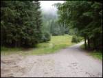
From the parking lot near Dom pod Storžičem, head onto the path towards Storžič, specifically the path through Žrelo and Čez Škarjev rob. The path initially leads parallel to the nearby road and ascends along the eastern edge of Planina Jesenje, where a small hut is located on the upper part of the pasture.
Here, continue left into the forest (the right path leads towards Mali Poljani), a few minutes further the path forks again.
This time, take the right path, alongside which there are signs for the very difficult path through Žrelo (straight ahead for the demanding path through Škarjev rob), and immediately begin a fairly steep ascent through the forest; higher up, the path leads along torrential deposits and soon brings us to the technically more demanding section, which we reach after about half an hour of walking from the starting point.
Before the steep section, put on a helmet, as there is a high risk of falling rocks in the continuation, and the very steep path, which is particularly prone to slipping when wet, first leads along the right side of the mighty gully Žrelo. Slightly higher, we withdraw from the gully even further to the right onto the slopes, where some safety devices assist on the exposed passages.
Higher up, the path turns slightly to the left and gradually returns to Žrelo; in the continuation, we steeply ascend towards the upper part of the gully, i.e., towards its headwall, which ends with a wall.
This is followed by the ascent of the wall, where numerous safety devices assist us, and we reach the main western ridge of Storžič at the Žrelo saddle, where there is also a marked junction.
Here, the equally very difficult path along the Psice ridge joins from the right, and we continue left towards Storžič.
The path ahead leads along and beside the western ridge of Storžič, which is quite narrow and very exposed in places. Higher up, the ridge widens somewhat; just below the summit, the technically easiest path to Storžič joins from the right, which leads from Planina Javornik and then up the south-western gully of Storžič.
Here, go left and ascend the summit slope of Storžič to the top in a few minutes.
Descent is possible via the somewhat easier path over Škarjev rob, or via the even easier but somewhat longer path over Mala and Velika Poljana back to Dom pod Storžičem.
Starting point - Planina Jesenje 0:05, Planina Jesenje - below Žrelo 0:25, below Žrelo - Žrelo 1:30, Žrelo - Storžič 1:00.

Along the route: Planina Jesenje (1137m), Razcep nad Planino Jesenje (1150m), Pod Žrelom (1322m), Vrh Žrela (1842m), Razpotje pod vrhom Storžiča (2114m)
Photos:
 1
1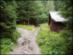 2
2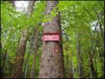 3
3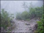 4
4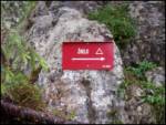 5
5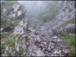 6
6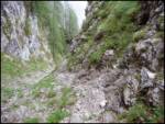 7
7 8
8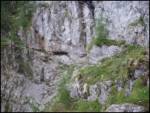 9
9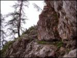 10
10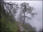 11
11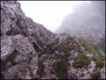 12
12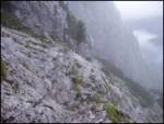 13
13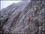 14
14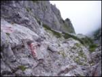 15
15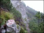 16
16 17
17 18
18 19
19 20
20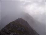 21
21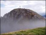 22
22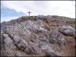 23
23
Discussion about the trip Dom pod Storžičem - Storžič (through Žrelo)
Show older messages
|
| beach_boy1. 07. 2007 |
Is helmet use really necessary?
|
|
|
|
| Gost1. 07. 2007 |
The path is quite crumbly, I think it's good if you have it.
|
|
|
|
| Gost24. 07. 2007 |
22.7.2007. Ružica HR
I managed to climb up despite all the fear of depths I have. The path is insufficiently secured and very crumbly. Exceptional views all around from the top. The logbook has been full for a long time. Return via Škarjev rob.
|
|
|
|
| Gost29. 07. 2007 |
The route is relatively undemanding and well protected. There are no exposed sections, but the terrain is quite crumbly and a helmet and caution when climbing are essential.
|
|
|
|
| fpetel130. 07. 2007 |
Personally, I find the path through Žrelo steep and crumbly, on the ridge it's 'airy' - scenic. Definitely beautiful, not too demanding
|
|
|
|
| jersy16. 09. 2007 |
The path through the gully seems undemanding to me, maybe some places lack pegs and pitons, otherwise at the top of the gully a beautiful view of Kranj awaits......I recommend NOT TO GO THROUGH THE GULLY in fog or after rain!!!..because the rocks are very slippery...and for the return the path over Škarjev rob is much more suitable!
|
|
|
|
| jersy16. 09. 2007 |
oh and one more thing I forgot...helmet I think is almost necessary
|
|
|
|
| Gost24. 10. 2007 |
You only have one head, helmet on the head
|
|
|
|
| Gost24. 10. 2007 |
The path through Žrelo is very nice and a bit demanding, helmet is mandatory when there are many people, otherwise not so much, just recommended. The view in sunny weather is wonderful!!! Whoever is still hesitating, should take advantage of a nice day for Storžič, even though it's already snowy now. Lp
|
|
|
|
| Gost6. 02. 2008 |
I know it's late but I can't pass without commenting. The path through the fifth gorge is and isn't demanding as for some, but helmet is mandatory whether you want or not. P.S. period
|
|
|
|
| Gost6. 02. 2008 |
Where is the fifth Žrelo even? Here it's talking about the summer path through Žrelo. Where does this winter approach through the fifth Žrelo go? Is it harder than from Kališče? I mean in winter. lp. franci
|
|
|
|
| KeyserSoze6. 04. 2008 |
Yesterday my colleague and I headed to Storžič; we took the path through Žrelo. The path is completely snow-covered (north face), higher up even completely icy, so it was quite interestingand the slope is really wild. Without crampons, ice axe, helmet I do not recommend the ascent at all!!!(ice axe comes in handy on the upper - icy part - across the short wall) When we somehow crawled (on all fours) to the pass, the path ahead to the goal was really enjoyable...at the top full sun. We returned via the eastern direction. All together 5.5 hours.
regards sas
|
|
|
|
| jupi24. 06. 2008 |
Tomorrow I'm heading to Storžič via Žrelo, I'm interested in what the trail is like, is it icy?
|
|
|
|
| trinity24. 06. 2008 |
The path is dry, the safety gear in excellent condition...... we were up there on Saturday 21.6.08
Best regards
|
|
|
|
| jupi24. 06. 2008 |
Many thanks for the information, best regards
|
|
|
|
| čebelar29. 06. 2008 |
Yesterday we were on Storžič via Žrelo. The kids really liked the path, especially the "rocks"
Too bad there was fog.
|
|
|
|
| urontu7. 07. 2008 |
The path to Storžič is excellent. I recommend it to everyone who regularly takes care of their fitness and loves the mountains. On 5.7.2008 the path through Žrelo and to the top was dry. No snow. For the return I used the path over Škarjev rob, back towards Dom pod Storžičem.
|
|
|
|
| Keco9. 10. 2008 |
Has anyone been up there recently? Is there any snow?
|
|
|
|
| maucec409. 10. 2008 |
Yes, on 07.10. my sister and I visited Storžič via Kališče. Wonderful, warm weather, no snow at all. Go ahead boldly. This weekend we expect nice weather again, which hikers have been waiting for quite a while.
|
|
|
|
| nevi9. 10. 2008 |
My husband and I went up on Sunday through Žrelo, down via Škarjev rob. The ascent path was dry and clear, but the summit part of the descent was quite tricky. Slippery ground, in some places icy below, and up to 30cm of fresh snow in places. Well, we had to step more carefully and we were definitely very satisfied with the tour. Oh, and this: some tough guys have removed the granite slab with the directions and distances of the mountains visible from Storžič. Heroes.
|
|
|
|
| sasogy1. 06. 2009 |
Has anyone been up there? What's the condition of the path, is it still all flooded or is some rock already visible?
|
|
|
|
| karlin13. 06. 2009 |
I'm planning to head to Storžič through Žrelo tomorrow and I'm also interested in the path condition - is there still quite a bit of snow? Thanks!
|
|
|
|
| karlin18. 06. 2009 |
I went to Kranj's little father today through Žrelo - at the entrance there's a large snow patch that can be avoided, higher up we must cross a small snowfield, but it's passable.
I returned through Škarjev rob, where there are also two small snow patches, the first is a bit tricky due to the sloping scree.
On the path need to watch for winter remnants - lots of scree that likes to slide...
|
|
|
|
| peterr19. 06. 2009 |
I cleared the path through Škrjev rob at places where it was obstructed by winter remnants (branches and fallen trees) on the afternoon of 18.6.2009 and it is now normally passable. The poorly visible markers in the upper part of the path will be renewed next week.
Peter Rožič
|
|
|
|
| simona virant27. 06. 2009 |
I'm interested in exactly this trail through Žrelo, does anyone know what the conditions are like these days?
thanks
|
|
|
|
| mad matheuss27. 06. 2009 |
Walked it today. Conditions are completely "summer-like" except for a small snow patch somewhere in the middle of the trail through Žrelo. That snow patch doesn't pose any major problem either.
LP
|
|
|
|
| BubikolRamios17. 09. 2009 |
Went today and 2 months ago. The rocks are wet regardless of the weather. As soon as we cross the scree below the wall, it was easy to miss the path, now at that spot the red blazes are specially outlined in white. Nothing fell, yet I wore a helmet (on my head ) because there are hikers above you, it's mandatory.
|
|
|
|
| Bizy22. 09. 2009 |
Yesterday went on this path, the ground a bit wet, rocks slightly wet but no problem for climbing. Otherwise varied and enjoyable.
Perhaps only on one rock, missing wire rope (otherwise nicely made rock steps and natural holds - but still) below the ridge junction - Polana, Storžič, when you come from the hardest part.
|
|
|
|
| pula22. 06. 2010 |
Is the path dry and normally passable?
|
|
|
|
| lajcicar22. 06. 2010 |
The path through Žrelo is dry and passable. Did the tour on Saturday 19.06. Best regards. Lajči
|
|
|
|
| majdicst27. 08. 2010 |
The protections are in excellent condition, the problem is only the friability, which is characteristic of all KSA anyway. Definitely, helmet use is practically mandatory, especially if someone goes ahead of you or if you're in a group. The self-belay kit is a matter of individual decision. The path is actually nowhere so exposed or steep that its use is necessary, but if someone feels better with it, it's of course recommended.
From the top of Žrelo along the ridge doesn't seem particularly exposed to me - but that's my personal opinion. It's very scenic though.
Given that complete beginners shouldn't hike very demanding paths anyway, I think the path shouldn't be too tough a nut for anyone.
|
|
|
|
| Inja30. 09. 2010 |
I would go on this path on Sunday, which should be a bit nicer, but I'm wondering if the rocks still remain wet at this time despite that? It would be my first time and I wouldn't want to climb wet rocks...
|
|
|
|
| ben30. 09. 2010 |
Rocks usually dry quite quickly, the problem is more the combination of transitioning from ground (mud) to rocks. In this case, caution is needed to avoid slipping.
LP B
|
|
|
|
| jprim1. 10. 2010 |
If you're going for the first time, I advise against this path, because you won't have good memories of it, it's nice if there's no wind, so the rock isn't cold and wet, and I think it will be windy, it blows strongly along the ridge.
LP!
|
|
|
|
| Inja1. 10. 2010 |
Thanks. I'll think about it some more, but I'm leaning towards going next year in summer (although this trip has been planned since last year ) )
|
|
|
|
| BT881. 10. 2010 |
Yes Inja, I would go because the weather won't be great for such a short hike but it's okay, a bit challenging and that's it. As for the ridge, it's not that bad, it's short and only partially exposed, and there it's also well secured. But I don't know how experienced you are
|
|
|
|
| jprim1. 10. 2010 |
I would go too, but I wouldn't have any good memories from it.
Come on, please BT88, if someone writes that they're going for the first time on this path, they won't have bad, or rather no memories of this beautiful path at the end ... isn't it wonderful when the weather favors you ... for me it's no problem to go lower in bad weather, but for a higher peak there's much more good mood if the sun shines and eyes carry far around.
LP!
|
|
|
|
| panda1. 10. 2010 |
jprim: on Sunday (03.10.) I'm going to Storžič through Žrelo. If you want, we can go together. LP
|
|
|
|
| jprim1. 10. 2010 |
No panda, maybe you don't know my posts and comments yet, I've been to Storžič several times via different paths, only not yet via Psico.
If the weather is nice, my husband and I will head to the mountains, but maybe somewhere else than Storžič.
Nice offer, maybe another time, when my husband is on sick leave, like all July, where were you before.
|
|
|
|
| panda1. 10. 2010 |
No harm done, it was just a well-meaning offer. I'll go and with pleasure.....
|
|
|
|
| Bojan_A2. 10. 2010 |
I'm also going today for training through Žrelo. Maybe we'll meet.
|
|
|
|
| BT882. 10. 2010 |
I'll go as it seems it's not as bad as it looks people are different and THEREFORE there panda will go and many others will go wherever ciao 
|
|
|
|
| Inja2. 10. 2010 |
I've been to Storžič several times, but always via Kališće. I don't know how comparable this path is to the one through Žrelo. Probably not. Tomorrow is still up in the air
|
|
|
|
| gj2. 10. 2010 |
You've probably been to Storžič, sea below. Incredible experience. Really nice, plus no wind and warm sun. I think tomorrow will be the same weather.
|
|
|
|
| Bojan_A2. 10. 2010 |
I was there too and it was really like that. Start at Spodnja Dolga njiva - Stegovnik - Škarjev Rob - Storžič - Poljana - Tolsti vrh - Kriška gora - Tržič = 5 hours 57 minutes.
|
|
|
|
| 03183338511. 04. 2011 |
Hi - tomorrow I plan to head to Storžič. How is the snow? Does anyone have any idea if I need to take anything with me?
|
|
|
|
| nata2411. 04. 2011 |
Take everything with you, through Žrelo there is still snow. Via Kališče it's dry, via Psico mostly too.
|
|
|
|
| frajer10. 05. 2011 |
I'm wondering if there's still snow through Žrelo?
|
|
|
|
| skrajnik10. 05. 2011 |
definitely still there...
shade, cold, crampons, ice axe
|
|
|
|
| velkavrh11. 05. 2011 |
On Saturday I met a hiker at the top who came up through Žrelo. There is snow. He was returning via the hunting path and also recommended crampons. Be careful!
|
|
|
|
| frenk 4512. 05. 2011 |
If anyone climbs over Škarjev rob, I lost one crampon there last November; please contact me. Thanks.
|
|
|
|
| kr neki23. 05. 2011 |
Is there still snow on the path through Žrelo?
Thanks
|
|
|
|
| skrajnik24. 05. 2011 |
I'd say definitely...
ice axe, crampons needed
|
|
|
|
| Rudi2630. 05. 2011 |
we were up there yesterday and there was almost no snow, only in some hole you can still see a piece of snow, otherwise the path was completely dry
|
|
|
|
| Lisa3. 06. 2011 |
Hi.
Rudi26 - did you go up through Žrelo and there is no snow on the path?
kr neki - do you already have any information?
Thanks for reply and best regards.
S.
|
|
|
|
| kr neki3. 06. 2011 |
Last Saturday in May the path was dry, except for smaller patches of snow that are not problematic.
Best regards

|
|
|
|
| Lisa3. 06. 2011 |
Thanks for the reply, you're super!
best regards
|
|
|
|
| Bojan_A4. 06. 2011 |
Today I went up for training through Žrelo, down through Škarjev rob.
I expected a thunderstorm but not something like that. Žrelo is completely dry, rocks very slippery for I don't know how fast running. Met three hikers. When I ran to the ridge, it already started thundering. No lightning yet, obviously discharges only between clouds. I sped up to be on the summit as soon as possible, so I could then descend as soon as possible (ideally before the thunderstorm) to the valley. Running conditions were perfect for me - high humidity and high temperatures. So I did quite well.
At Storžič summit it was almost clear. But I knew it was just a trick and without stopping started descending through Škarjev rob. The time I achieved wasn't important.
Approximately at the place where the path through Škarjev rob joins the path from Stegovnik, heavy thunderstorm hit me. Thank God I was already relatively safe below tree line. Because hail poured, it became quite white. Lightning was insane too. Hope those three hikers turned back in Žrelo, because if it hit them on the ridge idk what would happen... I got off well too except being soaked to the skin. But no panic, because I always have spare backpack with dry clothes in the car.
|
|
|
|
| Lisa7. 06. 2011 |
On Sunday (5.6.) three of us were on Storžič. The path through Žrelo quite slippery, great caution was needed. Fog accompanied us, which cleared briefly at the top. Descent through Škarjev rob, without peculiarities. An hour after descent, thunder was already heard from afar and the first raindrops appeared.
Humidity really high, as Bojan A. already mentioned.
It was nice though, despite the view which was equally zero 
Best regards.
|
|
|
|
| cupkurup22. 06. 2011 |
I'd only be interested in the conditions through the gorge. I think the path is dry but I would need precise and reliable data.
|
|
|
|
| acjom22. 06. 2011 |
Accurate data from Friday, 17.6.2011 - the trail is completely dry, safety equipment is in perfect condition, just will and courage, and good luck
|
|
|
|
| Zenfinio19. 07. 2011 |
Exact data 19.7.2011 path without snow of course....quite wet and also quite foggy and windy on the ridge....Descent over Škarjev rob beautiful
|
|
|
|
| jvali9. 08. 2011 |
On August 2nd, my husband and I climbed Storžič through Žrelo. The very beginning of our path was from the forest, where there's a sign for Lom pod Storžičem... so not from the hut, but lower, so we walked through meadows for half an hour to the hut itself. The weather was perfect for the mountains, for ascent and climbing. First sun, then mists that are useful-so it's not too hot. Higher up you see the blue sky and beautiful mountains, which gives you energy to continue. After climbing through Žrelo there was dense fog on this path, so descent via this path wouldn't be suitable. From Žrelo along the ridge it was sunny, occasionally fog crept in, but it quickly dissipated. The summit was in the sun, 12 of us enjoyed it, and two little dogs too. We descended via Škarjev rob, nice path without peculiarities. The day was excellent.
|
|
|
|
| pikelc12. 08. 2011 |
Yesterday my husband and I were on Storžič through Žrelo. Beautiful path, at a few places a peg is missing... Caution and concentration are needed. At the top a beautiful view. We descended through Škarjev rob and nicely refreshed ourselves in Dom pod Storžičem. The food is very tasty.
|
|
|
|
| Janiel7418. 08. 2011 |
Does this path have a lot of fixed cables? Are they more or less pegs? Asking because of self-belaying gear. Thanks
|
|
|
|
| katty18. 08. 2011 |
Last time I was at Kranjska koča na Ledinah after a long time. I knew the path has quite a few pegs and cables, but not that many. If I think today that I didn't have any specific gear with me, it gives me chills. So I'll definitely buy at least gloves for cables in the coming days. Not long ago it seemed funny to me how someone could even buy those gloves. Then an experienced salesman told me it's smart to take them on harder hikes. So Janiel74, I recommend for this path to Storžič at least a helmet and gloves, self-belaying gear is probably also recommended.
Best regards and safe steps
|
|
|
|
| andrej7818. 08. 2011 |
Self-belaying on this path is not necessary, just a steady step and some experience.
Best regards
|
|
|
|
| skalar5018. 08. 2011 |
"classic Storžič circular path": up through Žrelo down via Škarjev rob, finale with a beer at Dom pod Storžičem. Cheers...
"Janiel74" - gloves and helmet, as "Andrej78" says above, some experience and steady step... there shouldn't be any problems.
|
|
|
|
| Janiel7419. 08. 2011 |
Did the circular route, up through Žrelo. Self-belay really not necessary, as you don't use it much anyway, except on a few cables where it's not needed. Otherwise the path didn't appeal to me, very crumbly, with few protections, fairly exposed Compared to my only climbing experiences (besides Triglav and Pogacnikova Grlada) Mala Mojstrovka is much nicer than Žrelo....My subjective opinion.
|
|
|
|
| katty20. 08. 2011 |
Well, I got home from Storžič just under an hour ago. I went up through Žrelo. At first I was a bit worried it would be really dangerous, but it wasn't at all. Self-belaying isn't necessary, but I'd recommend at least gloves for the cables. Rocks crumble quite a bit, so helmet recommended. Today at least half of the hikers didn't have a helmet or gloves, and everything went fine. I agree with some who wrote in previous comments that some protection could still be installed. On the path you really get out of breath (heart muscle works really hard), but I could easily do it again. I returned via Škarjev rob, where you need to be careful in some places. Otherwise, quite a lot of people at the top, many went to Storžič today because of the mass for the deceased in the mountains.
Oh and one more thing: for those collecting stamps of our peaks, there's a stamp at the top, but no ink pad. You need to bring it with you. Good that I bought everything on Thursday.
|
|
|
|
| RumenOranzna25. 08. 2011 |
How is the technical difficulty and looseness if we compare this path with Bavški Grintavec - direct path from Zadnja Trenta? Thanks!
|
|
|
|
| RumenOranzna28. 08. 2011 |
The path is fun, beautiful, crumbly rock is not such a problem, grip is solid, but of course helmet is mandatory. I think the description would deserve compared to some other ascents instead of very difficult path just difficult path Safe steps!
|
|
|
|
| matz2. 10. 2011 |
I also agree that it's one of the easier very demanding paths. First time on such a path that I didn't use the full set, since where there are cables the path isn't so exposed and the safety devices actually helped more for easier ascent. Of course, this doesn't mean the path is suitable for inexperienced hikers. Views from the top are phenomenal, for descent to the starting point much more suitable via Škarjev rob.
|
|
|
|
| boriss30. 10. 2011 |
hello, tomorrow 31.10.2011 we plan with wife to go to Storžič, but does anyone know if the path is safe, if there is still some snow, thanks for answer, regards
|
|
|
|
| sodnick12. 11. 2011 |
Today through Žrelo to Storžič. Path completely dry, no snow. But very dangerous because some rocks are covered with a thin layer of ice and quite slippery. Need to hold on more with hands. The cable is also frozen.
|
|
|
|
| ananina23. 03. 2012 |
Has anyone gone up this trail to Storžič last week? I'm interested if there's still any snow. Thanks
|
|
|
|
| mazu24. 03. 2012 |
"ananina" this information interests me too...
|
|
|
|
| ananina24. 03. 2012 |
We went to check today but it's not yet walkable. It gets the worst towards the top of the gully. The rocks are icy and it's very unpleasant. With crampons it's awkward, without even more so... Nevertheless, we made it through.
|
|
|
|
| olivija24. 05. 2012 |
Has anyone gone on this trail in the last few days? I'm interested in how much snow is left. Thanks for the info.
|
|
|
|
| Alesko197128. 05. 2012 |
Today my friend and I did this path - up through Žrelo, down via Škarjeva, no more snow on the path.
|
|
|
|
| Becar16. 06. 2012 |
On 16.6.2012 I was on Storžič via Žrelo. I am an experienced mountaineer, have taken quite a few climbing routes. But I would give my subjective opinion that overall, after reading the above comments, the tour is underrated. Up to the saddle at Psica there are no major problems except severe friability, but when ascending from the saddle to the summit ridge, at least one section is very very exposed due to the complete absence of fixed cables and pegs. If I compare the tour for example with Škrlatica, which is rated as more difficult, you don't experience anything like that there. So sometimes these general path classifications are very deceptive. I advise against this tour for all less experienced mountaineers. Lp
|
|
|
|
| metod17. 06. 2012 |
Today many people went to Storžič, by 8am there were already almost ten of us at the summit. Some had helmets, others without. On a day like this, it's definitely good to have one through Žrelo. I returned via Psico to Mala Poljana. If I had gone up that path, it would have been really tough; the ridge is very jagged.
|
|
|
|
| andrej7817. 06. 2012 |
becar, don't do this mountain an injustice with your subjective opinion...
|
|
|
|
| Janiel7417. 06. 2012 |
I agree with Becar..underestimated, crumbly...
|
|
|
|
| Becar17. 06. 2012 |
I kind of knew from the level of the debates that there would be one (over)brave smart aleck because of whose comments wrongly informed people then get rescued from the mountains and because of which the forum loses quality. Andrej78, I stated my opinion, I didn't comment on or highlight your previous one. Everyone has the right to express their opinion, but I'm not doing injustice to anyone with that, least of all the mountain or you. Feel free to write whatever you want, but I won't respond to primitive provocations anymore, as it's neither my habit nor do I like overbearing hikers, unfortunately there are more and more of them in the mountains. Regards
|
|
|
|
| andrej7817. 06. 2012 |
Look, you advise, so you give your opinion to others, I quote "I advise less experienced hikers against the tour.". But leave the opinion about overbearing hikers..., because obviously you are not much in the mountains, because I don't meet them, but there is always someone who advises against something, lectures...
|
|
|
|
| andrej7817. 06. 2012 |
Calm down a bit regarding the overbrave smart aleck, because you don't know my experiences nor anything else. I'll just say this, that we won't ever have to rescue you by helicopter from some of your exploits... regards
|
|
|
|
| Becar17. 06. 2012 |
Hehe, I'd rather jump into the abyss myself than have you rescue me, because the effect is the same.
|
|
|
|
| andrej7817. 06. 2012 |
I'll just say this.....jump!
|
|
|
|
| Domch20. 06. 2012 |
Yesterday on Storžič, up through Žrelo and down via Škarjev rob. Regarding the above discussion, I can say this route is on par with the climbing path on Raduha. Anyone who climbed up there can head for this tour carefree. Žrelo is nicely protected with cables and pegs. Helmet recommended, low friability and very nice holds. The ridge path requires caution and steady footing, cables in places, none in others, no really severe exposures - except midway along the ridge where you bypass one rock. But the path and mountain deserve respect and caution. Suitable for all getting used to secured high-mountain paths. All assuming the path is dry and clear.
|
|
|
|
| Janiel7420. 06. 2012 |
The climbing path on Raduha is a completely different kind of path from Žrelo... The first has, relatively speaking, lots more protections than the path to Žrelo. And no friability on Raduha either.
It's true that in the book '55 Secured Climbing Paths' both are rated the same.
For me, the feeling that when I grab a rock it doesn't come off in my hand is important... there are no such cases on Raduha.
|
|
|
|
| Becar20. 06. 2012 |
Now I don't know, maybe there are two Storžičs via the gully... On the path where I was, the terrain is very crumbly, the passage to the ridge is unprotected and exposed. As a curiosity from first hand, I was on Raduha a couple of weeks ago via the climbing route and it is much better protected and nowhere as exposed as the path through the gully to Storžič. The terrain isn't crumbly either.
|
|
|
|
| urbancek20. 06. 2012 |
Here I agree with Andrej. Given that some write that this is I don't know how demanding an ascent (you sound like it's in the range of some ferratas in JA), I really wonder how many similar paths you have already "processed"... But I agree and the fact is that the classification of hiking trails in Slovenia is poor, loose and needs "renovation".
Becar, I don't know through which gully you climbed, but compared to other very demanding secured paths in Slovenia, this one is more towards the bottom of the difficulty scale, perhaps a different, less loose and less problematic classification of hiking trails would place it one rank lower... Steep, demanding secured path with cables... and that's it! Best regards and good luck!
|
|
|
|
| Keko20. 06. 2012 |
The path through the gully to the saddle could really be said to be in a similar range as the climbing route on Raduha, perhaps a bit more crumbly in the lower part. But Raduha doesn't have the ridge section and this part from the saddle onwards to the summit could pose a bit more difficulty for some. Especially for those who are a bit more dizzy and inexperienced. In general, the ridge section is quite well protected and safe and technically undemanding. Where there is no protection, the rock is so compact and rough that it offers phenomenal holds, which is really a pleasure to grab and easily climb to the top. In my conviction, the path to Storžič through the gully is an excellent training ground for gaining experience for more difficult high mountain routes. Just a bit more caution is needed in wet conditions, especially in the lower part.
|
|
|
|
| Domch21. 06. 2012 |
I completely agree with you Keko. Personally, I encountered a few loose stones through the gully, maybe 3 or 4, but I climbed strictly along the protections upwards. Raduha also has quite a few sections without protection, especially uncomfortable is that part to the second set of protections along that path that is full of small stones and grass on the side. If I compare, Žrelo is easier than Raduha, but if I also consider the ridge to the top of Storžič, they are in the same range. Also on Raduha, stones get dislodged here and there, which is normal as the KS Alps are known for crumbliness and Storžič and Raduha are no exception.
|
|
|
|
| Paintball27. 06. 2012 |
I don't know why some of you argue and insult each other here. Mountaineers should show respect to each other. After all, every comment is just the subjective opinion of the writer and it's impossible to say what is the correct rating here and what is wrong. Well, let me give my opinion on the topic. I was on Storžič via Žrelo on Saturday, a week earlier on the secured path on Raduha (I've walked the paths many times before but I'll summarize only fresh impressions). The paths are roughly comparable in my opinion, but they are also quite different. Via Žrelo the secured section is much longer, exposure is greater via Žrelo, as is the looseness. But on Raduha there is one short jump a bit more awkward - for climbing up and especially for beginners it can cause problems. My rating is that the path to Storžič is a shade harder than the climbing one on Raduha. I agree that both paths are good introductory paths for harder routes. Still, this path to Storžič doesn't seem as easy to me as can be read from some previous comments. The right measure of respect, head in place and helmet on head, and the path will be a great mountaineering experience.
|
|
|
|
| BT8827. 06. 2012 |
I'm afraid that Žrelo might swallow me, because once it was already close
|
|
|
|
| tinky28. 06. 2012 |
This year I already went through Žrelo in light rain and fog, but still the path doesn't seem really dangerous to me. What makes it demanding is that it is very steep, it is well secured and there aren't many exposed places either. From Spodnja Vrbana to Visoka Vrbanska špica via Rekarjeva, to Koroška baba via climbing path, to Mala Mojstrovka via Hanzova, to Mangart via Slovenian, over Prag towards Kredarica, from Skuta towards bivouac and there are more paths that in my opinion are much more demanding than Storžič's Žrelo.
|
|
|
|
| scorpio782. 07. 2012 |
I was also on this trail this Saturday and would like to share my subjective opinion. I'm not an experienced mountaineer and the sections without cables or pegs are not so exposed that cables would be necessary. The trail is really unique, varied and interesting. Definitely, the descent via Škarjev rob is recommended. I absolutely agree with Paintball that mountains should be "taken seriously" and one should wear appropriate footwear and protect oneself, as the terrain is really crumbly. Otherwise, I warmly recommend the trip and of course plenty of water reserves
|
|
|
|
| jasmin0116. 08. 2012 |
...wonderful trip to the mountains, beautiful hikes, and at the top friendly sheep that I petted and gave a heel of bread to...Little Thumb
|
|
|
|
| grdksmrt16. 08. 2012 |
I went on a trip through Žrelo today. The path probably poses no conditioning obstacles to anyone, but it's slightly exposed in a few spots. Almost no need for a via ferrata kit. But I'd say a helmet is mandatory due to the crumbly terrain. For the descent we chose the path over Škarjev rob for variety and easier descent, which is quite tedious at the start.
But don't forget the insect repellent or similar at home as there were tons of flying ants on the summit today besieging from all sides. Safe travels.
|
|
|
|
| mojcika21. 08. 2012 |
Today we did the path through Žrelo to Storžič, the path is normally secured. We returned via Škarjev rob. Although I have been to Storžič already for the fifth time, I think the views were the best so far today, when there was no fog in the way. The early hour was very much worth it, we returned to the car already at eleven,
|
|
|
|
| NPotko23. 08. 2012 |
Can someone compare the difficulty and exposure of the path through Žrelo with the climbing path on Velika Baba? Thanks, Lp
|
|
|
|
| Stane723. 08. 2012 |
In my opinion, it's significantly easier.
|
|
|
|
| Branee23. 08. 2012 |
the path through Žrelo is practically not exposed, only then when you're up on the ridge but it's everywhere wide enough for a car to pass...
|
|
|
|
| NEIC00825. 08. 2012 |
The path is very demanding and very dangerous when wet. Everything else is nonsense. LP
|
|
|
|
| Branee26. 08. 2012 |
oh jesus christ, some of you really better stay home, for you even stairs are probably a demanding trail already
|
|
|
|
| Matjaz_6526. 08. 2012 |
dude ... even if this trail is a joke for you ... it's far from that for many users of this portal
true ... it's one of the easier secured trails ... but still remains very demanding
trip comments should be useful info for other users and not self-praise ... as I see yours
|
|
|
|
| Kriška26. 08. 2012 |
As I've remarked on similar occasions before, I'll do it here too:
If trail descriptions (easy, demanding, very demanding) stuck to the explanations given in mountaineering guidebooks and elsewhere, there'd be no problem. Unfortunately, most don't know the official explanation of these markings and thus give their subjective opinion. 
|
|
|
|
| Stane726. 08. 2012 |
NPotko just asked for a comparison of the trail through Žrelo and the climbing ones on Velika Baba.
|
|
|
|
| andrej7826. 08. 2012 |
Žrelo and Baba are not comparable, Velika Baba is far more demanding, perhaps even the most difficult in Slovenia.
|
|
|
|
| Suriljana17. 09. 2012 |
Hi! Has anyone perhaps gone through Žrelo today or yesterday? I'm interested in the current condition of the path, or how much snow there is?
|
|
|
|
| Bojan_A18. 09. 2012 |
I didn't go, but I can assure you there shouldn't be any snow issues.
|
|
|
|
| legenda18. 09. 2012 |
No more snow in Žrelo, but due to wet rocks, a bit more caution is needed. Info from yesterday.
|
|
|
|
| esque3. 03. 2013 |
Over the weekend I plan to do the ascent to Storžič through Žrelo. Do you perhaps know what the snow conditions and avalanche danger are like? I'd ask for advice on the conditions, if they are suitable for a winter ascent at all. Thanks!!!
|
|
|
|
| Daaam4. 03. 2013 |
esque? how many winter ascents have you done already?
..and don't count approaches to open huts among them..
|
|
|
|
| MANGRT4. 03. 2013 |
On 12.4.2012 there was significantly less snow but quite a few avalanches
|
|
|
|
| esque4. 03. 2013 |
I don't have experience with winter ascents yet. In other seasons I've hiked a lot, but not in mid-winter
|
|
|
|
| Daaam4. 03. 2013 |
Ufff... I thought so.. Then I warmly recommend you wait a bit longer with the path through Žrelo in winter conditions. Better start with some easier tours. (How about winter gear..ice axe, crampons etc ...do you have them?..and above all, do you know how to use them?)
|
|
|
|
| esque4. 03. 2013 |
Yes I have the gear and I've used it, but not in high mountains. What tour would you recommend for now, for example?
|
|
|
|
| Daaam4. 03. 2013 |
It's not so much about the time but about the difficulty.. This ascent in winter conditions could be called half-alpine. Even the normal route via Kališče to the summit in winter is not to be underestimated..
Maybe Begunjščica via Šentanski plaz, Viševnik (standard training ground for beginners) would be better for a start. In any case, you must be aware that conditions can change from day to day.. a book is also useful where everything is professionally explained about the pitfalls awaiting you in winter high mountains.. ..the principle of gradually increasing the difficulty of winter tours (also summer ones) always applies. The guide Zimski vzponi v slovenskih gorah by Vladimir Habjan will give you quite a few suggestions..from beginner easy to later very demanding..
|
|
|
|
| esque4. 03. 2013 |
Thanks for the really detailed answer, I'll borrow one of those books and study the right path. Lp
|
|
|
|
| BibaS12. 06. 2013 |
Has anyone gone on this path to Storžič in the last week?
|
|
|
|
| jax12. 06. 2013 |
See current conditions. It's probably dry.
|
|
|
|
| siggi29. 06. 2013 |
Hello. A bit late.. but anyway, maybe someone will still find it and reply. Tomorrow I'm heading to Storžič and hesitating between this route and the one via Škarjev rob. Since I (still) don't have self-belaying gear, I'm wondering if it's recommended to go through Žrelo without it? In principle I'd then descend via Škarjev rob but I don't want to risk unnecessarily and would choose the mentioned route for the ascent
|
|
|
|
| jax29. 06. 2013 |
I don't know how much experience you have with secured paths, but in principle it goes nicely through the gully even without the full set. After all - as is standard practice on Slovenian secured paths - the harder spots are those without cables. A helmet is highly recommended though.
|
|
|
|
| Branee29. 06. 2013 |
The path through Žrelo is nicer than the one over Škarjev rob. It's shorter too. The ridge to Storžič is much nicer than the path into the rock from that side. The rob is loaded with pebbles and if you're going down, watch out especially the first few turns, otherwise it's the best path: up Žrelo and down Škarjev rob. Perfectly suitable for beginners.
|
|
|
|
| siggi29. 06. 2013 |
Great, thanks for the quick replies. The helmet goes along in any case.
|
|
|
|
| Simon273. 08. 2013 |
Hello. Today I visited Storžič again. Crazy nice weather and even nicer views......like not for a long time. Thanks to Petra and Vili for the company.
|
|
|
|
| Bandzo8. 09. 2013 |
Today we went through Žrelo to Storžič. A helmet is quite appropriate, it's very crumbly and you quickly dislodge a stone on someone below. But this path when the rock is wet is very tiring. Very slippery! Views were somewhat obscured, also quite cold at the summit, but the trip was definitely worth it.
|
|
|
|
| borutpovse4. 05. 2014 |
Has anyone been up there? Conditions, snow? Possibly via another path, although we like demanding ones. Thanks, best regards
|
|
|
|
| borutpovse24. 05. 2014 |
Hi, I'm still wondering if the Dom pod Storžičem is open. Thanks
|
|
|
|
| tilenko26. 05. 2014 |
The path through Žrelo is mostly bare. You only need to cross one snow patch (less than 10m). The path via Škarjev rob however is entirely under snow on the summit section, so without crampons and ice axe don't even try.
|
|
|
|
| Suriljana27. 05. 2014 |
Thanks for the information. Where on the path is that snowfield?
|
|
|
|
| SiKT27. 05. 2014 |
Before entering the gully.
|
|
|
|
| Mitre11122. 06. 2014 |
On Wednesday I plan to go to Storžič. Up through Žrelo, back via Škarjev rob. Could someone please tell me what the current conditions are like. Are both paths already completely snow-free or is there still snow somewhere?
lp
|
|
|
|
| serajko22. 06. 2014 |
Mitre
Wednesday has a poor forecast. But you have fresh data here
|
|
|
|
| skala12322. 06. 2014 |
Today walked this path, through Žrelo the path is snow-free, fixed protections in good condition, through Škarjev rob there is still one steep snow patch, but good steps have been made, caution is required - have a safe trip.
|
|
|
|
| stilc8826. 06. 2014 |
On Monday, 23.6., we went along this path. Without the slightest problems. The path is really excellently secured, dry. We returned via Skarjev rob. Except for a short passage over snowfield, where caution is recommended, the path is in really good condition. However, in my opinion, a helmet is really necessary due to falling rocks.
|
|
|
|
| borutpovse10. 08. 2014 |
HI. Yesterday we hiked this route, it's without peculiarities, on the descent through Škarjev rob there is only one peg pulled out, but it doesn't pose a big problem. LP
|
|
|
|
| Prefrigan10. 05. 2015 |
What's the current condition through Žrelo, is the path already passable or is there still snow?
|
|
|
|
| Jure8724. 06. 2015 |
Does anyone know if the path to the Dom pod Storžičem is normally passable, given the heavy rains in recent days? Thanks for answers.
|
|
|
|
| ivoma15. 04. 2016 |
Is the path dry yet, thanks for info
|
|
|
|
| Rok_Širovnik22. 04. 2016 |
The path to Dom pod Storžičem is normally passable. The path through Žrelo is covered with snow.
|
|
|
|
| kotnk23. 06. 2016 |
Is there still snow through Žrelo?
|
|
|
|
| sirt123. 06. 2016 |
'Never has there been so much snow that it would be over Žrelo!'
|
|
|
|
| kotnk23. 06. 2016 |
Soon D will blow it away
|
|
|
|
| Saš19678. 08. 2016 |
Yesterday we did this nice path with our 15-year-old son.We returned via Škarjev rob.The path is appropriately secured and also dry (except a few non-problematic sections), only the wind bothered us a bit.Fantastic views, unfortunately Julijci and also the peaks of Kamnik Alps were hidden in clouds.
|
|
|
|
| zokipoki14. 08. 2016 |
Yesterday hiked Dom pod Storžičem - Storžič through Žrelo - Dom na Kališču - Planina Javornik - Velika and Mala Poljana and back to Dom pod Storžičem. Nice loop trail with varied terrain. Recommended.
It took me quite some time to finally go to Storžič and I'll return. The fixed protections are impeccable. Just need concentration and caution. Safe steps.
|
|
|
|
| renaroz18. 08. 2016 |
On Saturday I'm heading to Storžič, curious about the road from Lom pod Storžičem (Google Street View reaches here) to Dom pod Storžičem. Is it nicely drivable with a regular car? Or do you need an SUV? Please advise.
|
|
|
|
| nteam18. 08. 2016 |
Up to the end of Grahovše settlement it's asphalt, then nice gravel road, renovated 14 days ago. No problem, drivable with a regular car.
Best regards!
|
|
|
|
| Poss12. 09. 2016 |
Can anyone compare the difficulty and especially the exposure of the path through Žrelo with the climbing path to Peca? Thanks
|
|
|
|
| VanSims13. 09. 2016 |
The exposure is approximately the same, otherwise they say that to Peca it is somewhat easier, although it seemed somewhat harder to me. But it is less crumbly.
|
|
|
|
| jprim13. 09. 2016 |
Yes, we're there ... different opinions. I have walked both paths multiple times, for sure the one to Storžič is more demanding, also less secured, as there are more natural holds, often even damp rocks even if it hasn't rained, and also more height differences.
Best regards!
|
|
|
|
| ŠpRo2913. 09. 2016 |
The path through Zrelo was much harder for me too.
|
|
|
|
| Keko13. 09. 2016 |
Through the gorge the path is somewhat harder, less secured, longer. On the climbing path to Peca there are considerably fewer demanding sections.
|
|
|
|
| Poss14. 09. 2016 |
Thanks everyone for the quick replies. We will postpone the trail through Žrelo a bit, especially since rain is forecast this weekend and the trail will be even more slippery.
|
|
|
|
| marych4. 06. 2017 |
Hello,
does anyone possibly know if the path is dry?
|
|
|
|
| panoramik4. 06. 2017 |
The path is completely dry
|
|
|
|
| marych9. 06. 2017 |
Thanks for the info.
We will descend via Škarjev rob. Is it also dry?
|
|
|
|
| trdi7. 10. 2017 |
Went up today. Conditions excellent, the path is not as exposed as one might infer from the comments. Excellently secured and not crumbly at all. Down via Škarjev rob, up there one clamp of the steel cable is pulled out. So I'll say, whoever came up via Škarjev rob will also manage via Žrelo...
|
|
|
|
| Cockta23. 10. 2017 |
On Friday - 20.11. to Storžič via Žrelo and back via Skarjev rob. Few visitors, sunny but very windy. To me the path via Žrelo didn't seem too exposed either. I completely agree with the above comment
|
|
|
|
| acjom25. 10. 2017 |
On Friday - 20.10.2017
|
|
|
|
| Cockta25. 10. 2017 |
Yeah really thanks
|
|
|
|
| maks5715. 05. 2018 |
I'd really like to go with my wife up this route to Storžič, descending via Škarjev rob. Of course, when the trail is dry. Does anyone know the conditions?
|
|
|
|
| cofka15. 05. 2018 |
There is still some snow on the northern side of Storžič, we will have to wait a little longer.
|
|
|
|
| maks5715. 05. 2018 |
Thanks! We'll definitely wait!
|
|
|
|
| Markunen4. 06. 2018 |
How is it with the snow? Has it melted? I'd go this Saturday 9.6 if the weather permits.
|
|
|
|
| tinky4. 06. 2018 |
Through Žrelo you cross one short snowfield, that's all!
|
|
|
|
| Jaka688. 10. 2018 |
On Thursday or Friday I plan to go through Žrelo to Storžič. Has anyone been up there recently, what are the conditions? Thanks in advance.
|
|
|
|
| nteam9. 10. 2018 |
Hello.
Conditions are normal, good weather is forecast, so no wet rocks expected. However, caution is required as demanded by such a path.
Good luck.
|
|
|
|
| kotnk10. 10. 2018 |
We were up there today. Quite a bit of caution is needed as the rocks and roots are quite wet from dew and fog. Also across Škarjev rob you need to be careful when descending, but it's true that we were very early and were back in the valley by 9:30.
|
|
|
|
| boklavdi26. 02. 2019 |
Hi, if anyone is heading to the hut under Storžič soon, I'd be extremely happy if they could bring me my poles... I left them there and they've been waiting for me for a few months. I'd have to go specifically for them, which...
But I'd still like to have them.
If anyone is going, please contact me.
Of course, I'll buy you a beer.
Any "offers" please into the drawer...
Thanks.
Best regards B
|
|
|
|
| LISAC13. 06. 2019 |
Hi!
Does anyone know if the path through Žrelo is dry? I'm also interested in the return via Škarjev rob. Thanks in advance.
|
|
|
|
| trdi21. 06. 2019 |
Today up this path and down via Škarjev rob. That chain anchor I wrote about two years ago is still pulled out??? Additionally, the Dom pod Storžičem is closed for renovation in the middle of the hiking season?
|
|
|
|
| julius21. 06. 2019 |
What renovations???
Check the PZS website, and you'll find the real reason. There are quite a few Tržič calls for tenders for the caretaker of this hut.
No one wants to take over Dom pod Storžičem under the conditions they came up with in PD Tržič.
And then the "shaggy" lie comes in handy too.
|
|
|
|
| trdi21. 06. 2019 |
There's a notice on the door saying it's closed for renovation supposedly... In short, PD Tržič cares about Zelenica, Kofce and Dobrča, which bring them money, the rest they don't care about...
|
|
|
|
| @rekar22. 06. 2019 |
@trdi, they'll have to treat caretakers differently, for minimum wage no one will work for them.
|
|
|
|
| cotro423. 06. 2019 |
Exactly like that, and this trend is visible on Tržič huts already for some time and surroundings, not to mention the hut on Valvazor - at least during winter sledding the former ORNK caretaker complained to a colleague and then soon left too. Heard the same story personally from the former caretaker on Kriška gora - all restrictions and they'd rather see them work for free, every idea for better comfort of hikers they crush immediately e.g. deckchairs, awning on terrace, additional microwave etc. stuff - you have an idea how to run the hut, fossils brake ideas... time to replace someone at PD, they won't shit on each other themselves, they already know why... typically Slovenian, everyone into their own pocket even if everything dies just so no one else is better off.
|
|
|
|
| Natalija127. 06. 2019 |
Today I went with a group of teenagers to Storžič via Žrelo. The path is completely dry, also on the return via Škarjev rob. The mountain hut was open, the caretaker in it...
|
|
|
|
| Turbolazec14. 05. 2020 |
Is there still some snow on the path?
|
|
|
|
| pustolovka14. 05. 2020 |
Very little through Žrelo, can be done without crampons. Hiked on Sunday.
|
|
|
|
| Turbolazec14. 05. 2020 |
Thanks, what about via Škarjev rob? With return to the valley
|
|
|
|
| jax14. 05. 2020 |
Through Škarjev rob there is more snow in my opinion. Probably better option to descend via Psico.
|
|
|
|
| Turbolazec14. 05. 2020 |
Thanks for the information.
|
|
|
|
| pustolovka15. 05. 2020 |
Through Škarjev rob there is A HUGE AMOUNT of snow, winter gear, ice axe, crampons mandatory.
|
|
|
|
| saram27. 06. 2020 |
Today via this path. All protections OK. In my opinion a couple of meters of cable are missing just by the rock a little below the summit. Today it was wet and slippery there, if there had been a steel cable it would be OK. Lots of hikers. At Storžič summit speechless, although no sheep. Return via Škarjev rob. The return also quite demanding due to scree and wet rocks and roots. Good that Dom pod Storžičem was open for rest. Lp
|
|
|
|
| Moncsa14. 08. 2020 |
Hi,
tons of comments and different opinions...
Tomorrow we plan the path up through Žrelo, down Škarjeva, forecast a little morning rain (hope not). We'd take a helmet, but based on pictures, a via ferrata set seems more useful on the path than help. Opinion of someone who's already been up?
|
|
|
|
| Lobnican14. 08. 2020 |
I think if you have some basic climbing skills, you don't need a via ferrata set in Žrelo. Unless of course someone is afraid of falling and the extra gear gives a sense of security.
|
|
|
|
| Moncsa14. 08. 2020 |
Thanks, Lobnican. Yes, basics are there, I hike scrambling paths from easy ones, and last years practicing sport climbing (hot hobby, nothing professional). There are paths where I think it's mandatory to have (Otmarjeva ferata, Rjavina e.g.), here I didn't see any terribly exposed sections, that's why I asked. But I'll definitely take gloves too, if anything wet, they come in handy. Thanks again
|
|
|
|
| Lobnican14. 08. 2020 |
Then just boldly, but watch out on wet rocks. Otherwise, on the path through Žrelo, there's probably only one spot where as a "climber" you have to think more than 2 seconds about where to put your feet and where not. The rest is relatively undemanding, especially if you regularly practice climbing.
|
|
|
|
| Kamen4027. 08. 2020 |
SVK is not needed for the path through Žrelo. But be careful as rocks are often wet.
|
|
|
|
| potka123425. 10. 2020 |
hi. does anyone know if the path to Storžič through Žrelo is completely dry?
best regards
|
|
|
|
| bongo25. 10. 2020 |
"Through Žrelo dry, some snow over Skarjev rob" - info from FB.
|
|
|
|
| kris001123. 06. 2021 01:48:23 |
Hi. Wondering if the trail through Žrelo and Škarjev rob is snow-free. Thanks.
|
|
|
|
| 12a3bc5. 07. 2021 19:20:32 |
I know I'm repeating myself but it's been 2 weeks already... is the path snow-free?
|
|
|
|
| nteam6. 07. 2021 07:22:53 |
The circular path to Storžič (up through Žrelo and down through Škarjev rob - or vice versa) is completely snow-free until the next snowfall .
Head out on the trail.
|
|
|
|
| M E S A26. 05. 2022 17:35:33 |
Does anyone know to what extent this path is currently still snowy? Thanks
|
|
|
|
| cofka27. 05. 2022 20:53:14 |
Still some snow in Žrelo, but already people went up, descent to Škarjev rob is nice. Good luck
|
|
|
|
| Lucijan849. 06. 2022 13:09:04 |
Hello.
On Saturday I'm taking my son on this path.
Is the path dry or not completely yet?
Thanks for the reply.
|
|
|
|
| turbo9. 06. 2022 13:25:34 |
|
|
|
|
| Lucijan8410. 06. 2022 08:16:02 |
Turbo
I saw it yes
Thanks anyway.
|
|
|
|
| Enka4. 09. 2022 12:29:46 |
Finally the path through Žrelo came up. Given the quite different opinions about it, I didn't know exactly what to expect. I have no problems with cables, but still some with deep exposures and scree.
Žrelo was a bit strenuous for me due to moisture and slippery rocks. The path is nicely routed and although mostly secured, it flows in a way that leaves some fun challenges. Overall perhaps due to slipperiness a bit more spicy than I expected from the comments. The ridge was pure poetry for me. I didn't look down of course and my legs shook a bit twice where it's narrow and airy on both sides, but in reality I enjoyed it all the way to the top. The chains are exactly and only where really needed, as the climbing, as much as there is, is not difficult. In short, the whole package was to my liking.
|
|
|
|
| Po Hodnik10. 10. 2022 14:26:38 |
Hiked this weekend. The trail is great, slippery in places but well protected. The marked time is realistic because concentration is needed through the entire Žrelo and of course later along the ridge.
Regarding SVK, I would recommend it at 2-3 places, the rest can be done without. Of course depending on experience. Unfortunately the weather was cloudy, so no views. Descent via Škarjev rob is quite annoying for the first 15 minutes, especially due to slippery rocks.
The path to the Dom pod Storžičem trailhead is solid, you get there slowly. The last 2 km are poorer. But the struklji are awesome!
|
|
|
|
| ŠpRo2911. 11. 2022 14:26:19 |
Has anyone been on this path in the last few days? Thanks.
|
|
|
|
| kopacevs12. 11. 2022 19:43:08 |
Today the path was groomed and dry.
|
|
|
|
| Liene3. 06. 2023 08:44:49 |
Hi, is this path already dry and OK for hiking?
|
|
|
|
| boruthor12. 06. 2023 05:55:28 |
Has anyone been through Žrelo this week, is it dry?
Thanks
|
|
|
|
| PV19. 06. 2023 11:42:21 |
Through Žrelo it's probably already dry (source @garmont on current conditions) - what about descent over Škarjev rob? Does anyone know?
|
|
|
|
| zan9520. 06. 2023 13:03:20 |
Škarjev rob had two small snow patches about a week ago, which can be bypassed.
|
|
|
|
| Alesb20. 06. 2023 17:51:36 |
Today did the path through Žrelo and over Škarjev rob to the valley.
No problems anywhere. The path is completely dry.
|
|
|
|
| garmont21. 06. 2023 14:17:23 |
…and since last Tuesday also cleared of brushwood that was reaching onto the path.
|
|
|
|
| skiro12313. 07. 2024 19:56:41 |
Since taking dogs to the mountains is becoming more popular, it would be right for dog owners to also exchange opinions on the suitability of the path. Today a couple with a dog went on this path and it was quite unsuitable. On one side the dog triggers rocks, which can be dangerous for all hikers, on the other side there are parts where it's so difficult for the dog (especially larger ones) that it puts the owners in danger when pulling them over such sections. Maybe better for smaller dogs, but in any case they pose additional danger to mountaineers by triggering rocks.
|
|
|
|
| jprim14. 07. 2024 19:25:28 |
I can't believe anymore what is happening in our mountains. We've hiked the path many times, so I know it quite well ...
This is a case for some inspector to punish the owners for animal cruelty. Is there still any sensible thinking among these dog owners.
LP!
|
|
|
|
| LuncaPetra13. 10. 2024 13:18:31 |
After the snowfall from last week, there's no snowball left. In the afternoon, dry all the way to the top.
|
|
|
|
| bistri7. 07. 2025 21:31:57 |
How is the road to Dom pod Storžičem? Torn up?
Thanks for the reply..
|
|
|
|
| Daaam8. 07. 2025 06:34:26 |
3 weeks ago it was normally drivable. In the last two years I think they've maintained/fixed it quite well. But there's talk that a barrier is coming here too ..#sampovem
|
|
|
|
| capraibex8. 07. 2025 17:08:03 |
All sorts of rumors, if the road is closed the hut, i.e. Dom pod Storžičem, will eventually struggle, as is already the practice in many Slovenian hills. Greedy municipal officials only see profit anymore, people are slowly moving to neighboring countries where hikers are welcomed more friendly.
|
|
|
|
| cofka8. 07. 2025 21:05:50 |
Every road maintenance brings certain costs. And these roads are not used only by hikers but also by owners of forest parcels who pay tax on them.
|
|
|
|
| mjk30. 07. 2025 18:10:15 |
Today I went on this path. The path is no more crumbly than other paths in our area, still a helmet won't hurt. Really don't know where to clip in the SVK. The path is nice and passes quickly because it's varied. On the ridge itself, the biggest challenge is how to reach the summit without grabbing any sheep droppings. Well, this path is still not for dogs, no matter how used to hiking they are. Otherwise, a very nice physically not too demanding high mountain experience that doesn't take 10+ hours.
|
|
|
|
| G1211. 08. 2025 12:36:30 |
Hi,
Has anyone been on this route last weekend? My girlfriend and I are planning it for next Saturday, and I'm wondering if it's physically demanding? We have all the gear and have recently started with via ferratas: Hvadnik, Mojstrana red, Gradiška tour, etc.
|
|
|
|
| garmont11. 08. 2025 12:56:07 |
It's not particularly physically demanding. In fact, it's one of the easiest secured routes we have.
|
|
|
|
| nina411. 08. 2025 17:04:51 |
It depends on what physical demand means to someone. On Hvadnik via ferrata you cover about 200 vertical meters in 2 hours, to Storžič via Žrelo 1000 m in 3 hours. The route through Žrelo is actually not a via ferrata and there aren't many places to clip in, so your knees really burn. Then there's still the ridge walk ahead, again without protection. The descent via Škarjev rob is definitely much longer and more tedious than those from the mentioned ferratas.
|
|
|
|
| user031011. 08. 2025 18:28:44 |
So SVK is not necessary on this tour or is it still recommended if going up for the first time?
|
|
|
|
| garmont11. 08. 2025 19:39:14 |
No need for SVK. As I already said... one of the easiest secured trails.
|
|
|
|
| nteam11. 08. 2025 21:51:44 |
user0310, I suggest that if you're not sure, take all the gear the first time, because you see opinions are subjective. For some it's the easiest path, for some physically undemanding. I've gone up through Žrelo exactly 135x in recent years (last time last Saturday - all without SVK ) and it's hard to say it's physically undemanding (of course you shouldn't take 3 hours to go up) ...
|
|
|
|
| Tomco11. 08. 2025 23:38:34 |
Good advice. Since you already have SVK, if you're ever unsure, put it in your backpack for the first time on that tour. It costs you nothing, but gives peace of mind. If it stays in the backpack then, it stays.
|
|
|
|
| garmont12. 08. 2025 00:20:48 |
Just as there are the most difficult secured trails, there are also the easiest ones. And this is one of the latter. I still claim there's no need for SVK on this trail. And I've hiked it many times...
|
|
|
|
| user031012. 08. 2025 00:31:01 |
Thanks for the advice, I'll set off on Friday. I'll take SVK just in case, need to test it a bit too.
Good luck
|
|
|
|
| G1213. 08. 2025 11:25:11 |
Thank you all for the response. It helps, because you learn little from pictures. 😁
I wish everyone a nice mountain weekend together.
|
|
|
To post a comment you must log in:
If you do not yet have a username, you must first
register.