Dom pod Storžičem - Storžič (via Psica)
Starting point: Dom pod Storžičem (1123 m)
| Latitude/Longitude: | 46,35860°N 14,39060°E |
| |
Route name: via Psica
Walking time: 3 h 45 min
Difficulty: very difficult marked way
Elevation gain: 1009 m
Elevation difference along the route: 1050 m
Map: Karavanke - osrednji del 1:50.000
Recommended equipment (summer): helmet
Recommended equipment (winter): helmet, ice axe, crampons
Views: 34.384
 | 1 person like this post |
Access to starting point:
From the Ljubljana-Jesenice motorway, take the Ljubelj (Tržič) exit, then continue driving towards Ljubelj. Just before the petrol station in Bistrica pri Tržiču, leave the main road and continue right towards Tržič. Continue through Tržič towards Dolžanova soteska, then at the end of the town continue right towards Lom pod Storžičem and Grahovše. At the end of Grahovše village, the asphalt ends, and we follow the gravel road towards Dom pod Storžičem. We follow this steeper gravel road in the upper section to the parking lot near Dom pod Storžičem.
Route description:
From the starting point near Dom pod Storžičem, continue briefly along the road (direction Storžič), then head onto the parallel hiking path that gently ascends along the edge of the meadow. At the upper part of the meadow, reach a small wooden hut where the path splits into two. Choose the slightly right path (left Storžič through Žrelo and over Škarjev rob), which continues on and beside a relatively steep cart track. Higher up, the path levels somewhat and turns right. Continue traversing upwards to the right for a while, then arrive at the edge of a steep gully, across which ascend transversely to the nearby wide cart track, reaching it just at its end. Immediately leave the mentioned cart track and continue slightly left into the forest. Continue through the forest on a path that gently descends for a while, then reach a small junction from which continue towards Mala Poljana.
From the junction, the path begins ascending again, constantly crossing the slopes to the right. Higher, reach a cart track along which quickly walk to nearby Mala Poljana.
From Mala Poljana, where the path from Zalog and the path from Povelj join, continue left towards Velika Poljana (slightly right Zavetišče v Gozdu, right Tolsti vrh). The path, proceeding along the cart track, quickly enters the forest through which it then ascends transversely. After a few minutes of walking, reach a scenic slope from which a nice view opens to the surrounding mountains. Slightly further, the cart track turns right and after a short ascent leads to the upper edge of Velika Poljana, from where one can descend to Koča na Veliki Poljani in one or two minutes, otherwise continue left towards Storžič.
The path continues along the Psica ridge (Psica is a kind of western subpeak of Storžič), occasionally veering slightly right. After about a half-hour ascent from the junction at Velika Poljana, arrive at the next marked junction located below the Psica summit. Head left onto the path over Psica, right leads the easier path to Storžič.
From the junction, the path initially runs across grassy terrain amid dwarf pines and sparse trees, then re-enters the forest and begins steep ascent. At some points, the path is somewhat exposed. Follow the ascent on the grassy slope amid sparse dwarf pines to the panoramic ridge. Continue ascending the increasingly exposed ridge for some time, then reach the indistinct Psica summit.
From the summit, descend slightly then continue along the exposed ridge. Further on, the path along the ridge rises and falls several times, aided by some fixed protections. Later, the path through the gully joins from the left, but continue along the ridge path. In the final section, ascend steeply several more times, aided by some fixed protections. A little below the summit, the easiest path to Storžič joins from the right, leading via Planina Javornik or the southwest gully. Follow only a short ascent along the summit slope of Storžič, reaching its summit in a few minutes of further walking.
Starting point - Planina Jesenje 0:05, Planina Jesenje - Mala Poljana 0:55, Mala Poljana - Velika Poljana 0:15, Velika Poljana - junction below Psica 0:35, junction below Psica - Psica 0:30, Psica - Vrh Žrela 0:25, Vrh Žrela - Storžič 1:00.

Along the route: Planina Jesenje (1137m),
Mala Poljana (1325m), Sedlo nad Veliko Poljano (1406m), Razpotje pod Psico (1595m), Psica (1769m), Vrh Žrela (1842m), Razpotje pod vrhom Storžiča (2114m)
Photos:
 1
1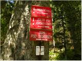 2
2 3
3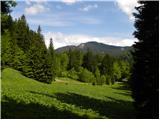 4
4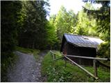 5
5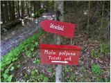 6
6 7
7 8
8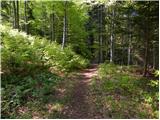 9
9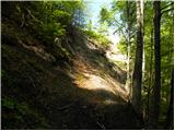 10
10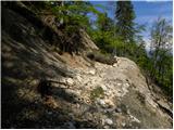 11
11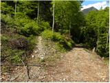 12
12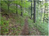 13
13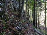 14
14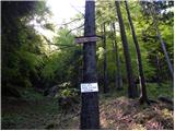 15
15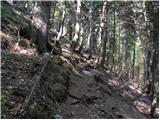 16
16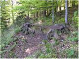 17
17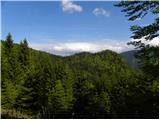 18
18 19
19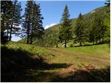 20
20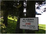 21
21 22
22 23
23 24
24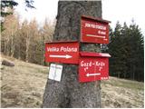 25
25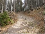 26
26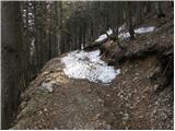 27
27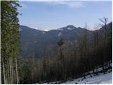 28
28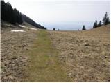 29
29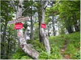 30
30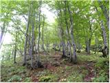 31
31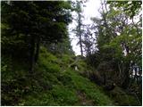 32
32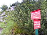 33
33 34
34 35
35 36
36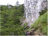 37
37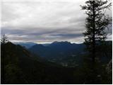 38
38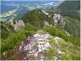 39
39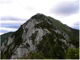 40
40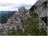 41
41 42
42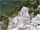 43
43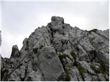 44
44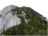 45
45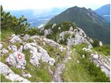 46
46 47
47 48
48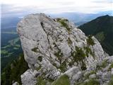 49
49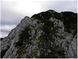 50
50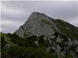 51
51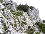 52
52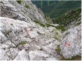 53
53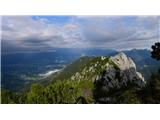 54
54 55
55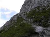 56
56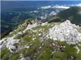 57
57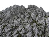 58
58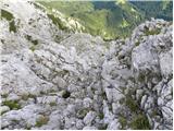 59
59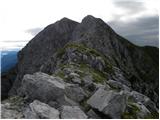 60
60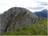 61
61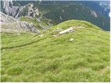 62
62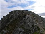 63
63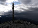 64
64
Discussion about the trip Dom pod Storžičem - Storžič (via Psica)
|
| Potohodnik9. 07. 2013 |
Is the rock crumbly and dangerous to fall on your head if someone is above you? Is self-belaying with a set necessary?
|
|
|
|
| jax9. 07. 2013 |
The danger of falling rocks exists of course, but it is not very high - basically it's a ridge trail, so usually no crowding. The via ferrata set is completely unnecessary in my opinion, on Psica there's only one cable, and a couple after the trail joins Zrel, but nothing problematic.
Sorry, no question marks, I'm abroad.
|
|
|
|
| Potohodnik13. 10. 2013 |
At the beginning the path rises steeply, then descends a bit, then gradually ascends to Mala Poljana. To there we walk about 1h, maybe a bit less. From Mala to Velika Poljana about 15 min. Then we look for the path along the ridge to the summit. We go up and down several times until we reach the steep descent by the wire cable. Then we continue along the ridge, where we go down and up several times. The path is poorly secured. Then we reach a small wall where we have to climb a bit, next to it there is also a wire cable. Then to the summit another about 1/2h. The views are wonderful.
|
|
|
|
| alyas3. 07. 2016 |
Hiked yesterday, well marked and signposted, the path is also easy to follow, very scenic, the ridge over Psico is of course not for beginners, but nowhere are there any really difficult spots, really recommend.
From Storžič we descended via Škarjeve peči and made a nice circular half-day trip.
|
|
|
|
| garmont3. 07. 2016 |
For me the nicest marked approach to Storžič. 
|
|
|
|
| Prefrigan28. 06. 2017 |
Up the gully and back via Psica - has anyone checked this in practice?
|
|
|
|
| franca28. 06. 2017 |
Yes. Psica "downhill" is no harder than uphill, in both directions you climb up and down.
|
|
|
|
| vitan21. 06. 2026 17:08:34 |
|
|
|
|
| mapi6021. 06. 2026 22:11:08 |
Depends on why Vitan.... is closed or if fallen trees on the forest path represent a danger?
I think not. They just lengthen the path a bit for you and that's all. I was there 3 weeks ago, so I know what it looks like. Otherwise the path is wonderful, exemplarily and flawlessly secured and it would be a shame not to enjoy its beauty. It will remain closed until the volunteers of the responsible PD saw and remove the fallen trees, which is a big question if it will ever happen. Unfortunately more and more paths remain permanently closed, which is of course responsible and wise on the part of PZS.
|
|
|
|
| asdf21. 06. 2026 22:20:11 |
mapi60, I agree that due to this damaged part of the path no one will be in danger. As for remediation, it would probably be enough to just mark the bypass and cut the vegetation on it where it is in the way.
|
|
|
|
| plaNinaPirsMajcen21. 06. 2026 22:32:42 |
Yes, we asked the predecessors if the fallen trees pose a danger. They said no, that finding a passage takes a few minutes more and that's it. The path in the ridge part is not damaged anywhere, the cables are also fine. That's why we went. But I think the path will unfortunately remain closed for (too) long, as is the practice with many closed paths.
And yes, asdf, thanks for the comment, the bypass could easily be done below, about 10 m below the official path. Probably the hikers themselves will soon walk it anyway.
|
|
|
|
| vitan22. 06. 2026 10:06:00 |
Mapi, first to answer your question: definitely! Many a tree does not just lie on the ground and can be just before falling and giving a false sense of safety. If such a tree falls and injures a hiker, who is then responsible? Due to such and similar cases, they are now meeting at GRS because it is high time to regulate the system of responsibility for mountain visitors in Slovenia. I do not claim that a person cannot bypass such a path and find some safe passage, but let them do it on their own responsibility, not publish it like this on social media, as if everything is ok, you can come. I speak from experience as I witnessed it when we had a work action on the old path from Suhadolnik towards Kokrsko sedlo, how people walked under us across Taško, while trees and rocks were flying directly above them. We arranged the path already before the new year, but I still had to bite my tongue not to write about it, because God forbid someone would get injured before the path was officially opened. In the meantime, it was still winter, the foresters also had to do their part... Secondly, I cannot understand that you are so impatient. With such a choice and quantity of paths and mountains as we have here... I mean, is it really necessary to go like a bull with head through the wall? I also agree that in many places it could be sped up, but on the other hand, I do not blame the volunteers who are trying, because if someone doesn't like something, let them take the tool themselves and join the markers, instead of just commenting from the comfort of home, and doing nothing in this direction to improve something. That's why we are where we are! Today it is obviously more important to look good in your video posts, pictures on social networks and likes that you get, than the path itself that you have walked.
|
|
|
|
| Hammond22. 06. 2026 13:26:24 |
Vitan, what you say unfortunately holds true. That instead of reaching for the phone someone would reach for tools doesn't occur to anyone. With similar ignorance most also step over trash - not my problem. We are sinking into tourism and sensationalism, whose representatives look at volunteers who enable this as I don't know what kind of miracle - and march on.
|
|
|
|
| bbugari122. 06. 2026 21:47:38 |
1. Open paths.
2. Closed paths, passage possible at your own risk.
3. Closed paths, passage not possible.
|
|
|
|
| ljubitelj gora24. 06. 2026 12:35:58 |
For maintaining paths only trained trail markers can work. One cannot just go and cut in someone else's forest. And one cannot help because you are not trained for that. I would help others but they do not allow it, you must not because we have become limited by legal nonsense. If the path is closed it is closed. But anyone can go at their own risk, spruce trees once on the ground will not move anymore except beech trees. I have already seen beech trees several times how some storm pushes them down to the valley.
|
|
|
|
| mapi605. 07. 2026 23:22:23 |
Ok, Vitan, I mostly agree with what has been written, although it is written more generally. Specifically in this case, regarding the fallen trees, the spruces were so firmly on the ground that they could not be more so, let alone one rolling down into the valley. Of course, a tree can be leaning on the branches of another tree and when they give way, it falls back to the ground again, but here all the trees were on the ground. Still, something interests me... are you sure that absolutely everyone checks the list of closed paths before heading into the mountains, especially foreigners, of whom there are many in our mountains? I don't think so, although it would be necessary. The path over Rudijevo vertikalo is closed, but on the path from Ledin there is no sign or notice that the path is closed, at least last year when I passed there, there wasn't one. So I saw quite a few people coming along this one when I went over Jezersko sedlo to Veliko babo. I think such notices would be necessary at the very beginning of the path, like for example for Žrelo in KSA. Likewise over Psico, nowhere any sign that the path is closed.
As for the responsibility of hikers, that is a chapter of its own. But I think that irresponsibility is not so much on the side of Slovenians, we know that our mountains are not just for flies. From the side of foreign hikers, in many years I have experienced, often a downright bizarre attitude regarding equipment and information about the path they were on. As if they have the belief that because Slovenia is small, all our peaks are easily accessible. In this direction, something would need to be done, at larger starting points signs with warnings that certain paths can only be taken with appropriate equipment and similar. I believe though that today voluntary work is no longer a value as it used to be, unfortunately.
|
|
|
|
| vitan6. 07. 2026 13:34:38 |
It's true, a lot could be improved, but it seems to me that there are fewer and fewer heartfelt and enthusiastic people who would be willing to do something. Unfortunately, regarding information, we live in strange digital times, when it is expected that you get all information online, so nowadays it is very important to check the condition at home before you even set off anywhere.
|
|
|
|
| Hammond23. 07. 2026 09:03:51 |
I'm not saying that the trees in question are to blame, but considering the path closure, there would not have been a fatal victim. Is that enough now or would more be needed?
|
|
|
|
| asdf23. 07. 2026 11:24:19 |
If it's not the fault of fallen trees, then I really don't understand why you're dragging this tragedy into this debate. It's a bit dirty to exploit it to try to prove your point.
Otherwise, about this death we only know that it was in the area of Storžič and that it wasn't a criminal act or an accident (at least as far as I was able to find in the media). So how can you be so sure that it wouldn't have happened if the path closure had been observed?
|
|
|
|
| Hammond23. 07. 2026 14:08:16 |
Because promotion is not done (only) for closed paths.
No one can be sure. However, there are fewer repeaters and thus a lower probability of complications. It has been seen and heard countless times how beautiful pictures and videos have led inexperienced people into trouble (or even death).
|
|
|
|
| mapi6018. 09. 2026 12:09:08 |
It's a bit hard to understand these double standards Hammond... you crucify some for posting about a closed path and almost claim that it's their fault for the fatal incident on Storžič, but I haven't noticed that you also crucified the owner of the post in July this year, when a guided group of children went on the closed Rudijeva vertikala 😵💫
Do I need to make a comparison between fallen spruces on the path or children on Rudijeva vertikala???
I don't think so!
|
|
|
|
| Hammond18. 09. 2026 14:13:24 |
I haven't encountered this case, but both are wrong.
|
|
|
|
| mapi6018. 09. 2026 16:59:36 |
Maybe, or they just deliberately overlooked it.
|
|
|
|
| Hammond18. 09. 2026 17:52:06 |
Of course, we are all up to date with everything every day. But for the chosen ones, even that is not enough and we deliberately overlook something else. Just like maybe someone overlooked this sarcasm.
|
|
|
|
| Tomco18. 09. 2026 22:29:41 |
The path over Psica is the most beautiful of all paths to Storžič.
|
|
|
|
| anica.zu19. 09. 2026 21:12:02 |
Tomco, I think so too. However, it is true that this path is not for everyone.
|
|
|
|
| asdf19. 09. 2026 21:36:33 |
I prefer through Žrelo though. It also has a nice ridge part, but besides that it also has an ascent through Žrelo, so it's more diverse. In addition, on this one through Psico that initial part to the ridge drags on quite a bit, while you reach Žrelo in 20 minutes.
|
|
|
To post a comment you must log in:
If you do not yet have a username, you must first
register.