Dom Pristava v Javorniškem Rovtu - Ptičji vrh
Starting point: Dom Pristava v Javorniškem Rovtu (975 m)
| Latitude/Longitude: | 46,45400°N 14,09210°E |
| |
Walking time: 1 h 45 min
Difficulty: easy unmarked way
Elevation gain: 575 m
Elevation difference along the route: 575 m
Map: Karavanke - osrednji del 1:50.000
Recommended equipment (summer):
Recommended equipment (winter): ice axe, crampons
Views: 8.781
 | 1 person like this post |
Access to starting point:
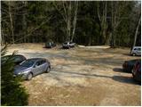
From the Ljubljana - Jesenice motorway, we take the Lipce exit and continue on the road towards Jesenice. When we reach the traffic-light intersection where we join the old road, we continue right towards Žirovnica. We follow this road only briefly, as at the next somewhat larger intersection (traffic light) we continue left towards Javorniški Rovt. The road then goes through an underpass (railway) and then turns left (right Koroška Bela). We follow the road that begins to ascend steeply higher up towards Javorniški Rovt. We then follow the mentioned road to the parking lot near the mountain hut.
Route description:
From the parking lot we walk to the mountain hut, then continue the ascent on a path that is initially less visible, which ascends on the left side of the marshy pond. Further on, the nicely visible and wide path brings us after 5 minutes of walking to the road, where there is also a junction.
We continue right towards Golica (left Javorniški Rovt, straight Španov vrh and Jelenkamen) and continue the ascent on the road, which first leads us past a larger pond, then turns right and brings us out of the forest. When we step out of the forest, a view opens towards Struška, Medji dol and part of Belščica. The road, which continues to ascend moderately, returns higher up into the forest and crosses a larger ravine, after which we soon arrive at a marked junction.
Here we leave the road that turns left and continues towards Križovec and continue straight on the less used road. From the junction we walk on the road for only two more minutes, then the markings direct us left onto a cart track that begins to ascend more steeply through the forest. After a few minutes of ascent the path levels out and leads us out of the forest onto the meadows of Pusti Rovt, where we also join the road from Križovec. Here we continue straight on the gentle road, on which we quickly arrive at the nearby shepherd's hut.
From the shepherd's hut we continue on the road, which in the upper part of Pusti Rovt turns right into the forest. A little further on we come to a marked junction, where we continue slightly right (left Golica) on a moderately steep path that a few meters higher crosses a relatively new road leading to Belska planina - Svečice. We only cross the mentioned road and continue the ascent on the marked path, which soon passes from the forest onto scenic slopes below Sedlo Kočna. We continue the ascent past a small hunting hut, after which we soon arrive at a watering place for animals. Only a short ascent follows and the path brings us to Sedlo Kočna, from which a beautiful view opens towards the Austrian side.
At the saddle we continue left (right Struška) and continue the path for a short time on the marked path towards Golica. After a shorter gentle ascent the marked path moves slightly left from the ridge, but we leave it right at this spot and continue the ascent on a less visible trail that continues along the border ridge. The path ahead ascends somewhat more for a short time, then levels out slightly and continues in a moderate ascent. We then follow this path, from which ever more beautiful views open, all the way to the grassy summit.
Starting point - Pusti Rovt 1:00, Pusti Rovt - turn-off for Struška 0:10, turn-off for Struška - Sedlo Kočna 0:20, Sedlo Kočna - Ptičji vrh 0:15.

Photos:
 1
1 2
2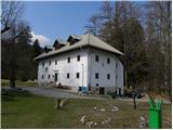 3
3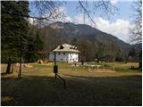 4
4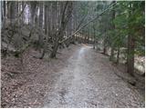 5
5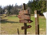 6
6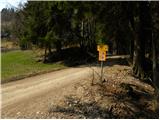 7
7 8
8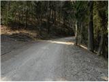 9
9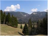 10
10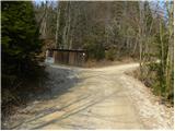 11
11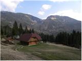 12
12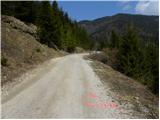 13
13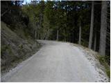 14
14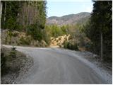 15
15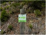 16
16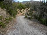 17
17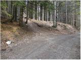 18
18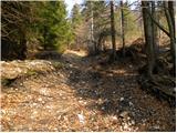 19
19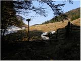 20
20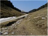 21
21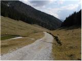 22
22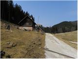 23
23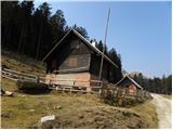 24
24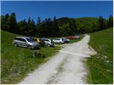 25
25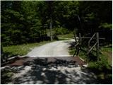 26
26 27
27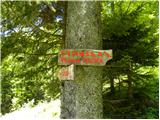 28
28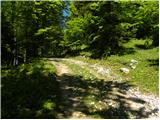 29
29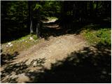 30
30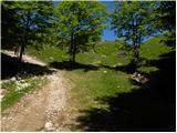 31
31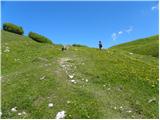 32
32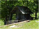 33
33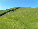 34
34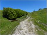 35
35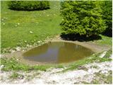 36
36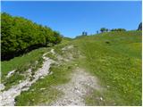 37
37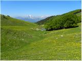 38
38 39
39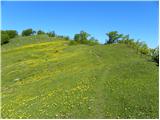 40
40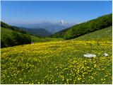 41
41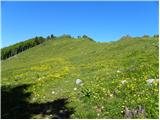 42
42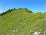 43
43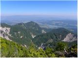 44
44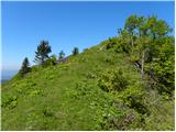 45
45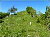 46
46 47
47
Discussion about the trip Dom Pristava v Javorniškem Rovtu - Ptičji vrh
|
| tango26. 12. 2018 |
Nice circular tour. First to Ptičji vrh, then along the upper path to Belska planina and back to Pusti rovt. Ptičji vrh is really a wonderful viewpoint, as you don't even know in which direction the view is nicer.
Conditions excellent, just the road from Javornik to the cart track junction at/into Pusti rovt is very icy in places and caution is needed.
|
|
|
To post a comment you must log in:
If you do not yet have a username, you must first
register.