Dom v Dragi - Koča na Prevalu (by road)
Starting point: Dom v Dragi (689 m)
| Latitude/Longitude: | 46,39500°N 14,21830°E |
| |
Route name: by road
Walking time: 2 h 15 min
Difficulty: easy unmarked way
Elevation gain: 622 m
Elevation difference along the route: 700 m
Map: Karavanke - osrednji del 1:50.000
Recommended equipment (summer):
Recommended equipment (winter):
Views: 19.308
 | 3 people like this post |
Access to starting point:
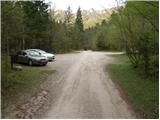
From the highway Ljubljana - Jesenice we take the exit Radovljica (from the Gorenjska side exit Lesce) and follow the road ahead in the direction of Begunje. At the end of the village Begunje we turn left towards Dom v Dragi (right Tržič). The asphalt road then brings us to the parking lot near Dom v Dragi. We park a little further ahead, as parking in front of Dom v Dragi is allowed only for guests.
Route description:
From the parking lot, we continue on the road, which past a bee house brings us to a junction in a few minutes of walking. We continue left on the road (right Preval-a over Luknja), which starts to ascend through the gorge. Further ahead, the road passes into a dense forest, where it then ascends for quite some time. Higher up, we reach an unmarked junction, where we continue on the right "main" road. The still ascending road higher passes out of the forest onto the edge of the Planinca mountain pasture. We ascend along the road a little further to a junction located only a few meters before the hut on the Planinca mountain pasture.
At the junction, we turn sharply right onto the road towards the Preval-a mountain pasture (straight ahead Poljška planina and Roblekov dom). The road, which then crosses the slopes of Begunjščica towards the east, first ascends slightly to moderately, then flattens out. A little further on, a path to Roblekov dom (over Roža) branches off sharply to the left, while we continue on the road, which gradually starts to descend. We follow this occasionally quite panoramic road to the shepherd's hut on the Preval-a mountain pasture.

Photos:
 1
1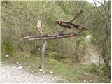 2
2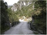 3
3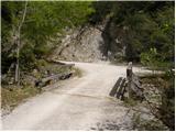 4
4 5
5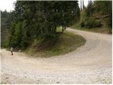 6
6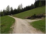 7
7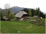 8
8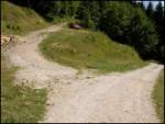 9
9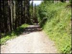 10
10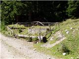 11
11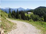 12
12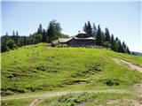 13
13
Discussion about the trip Dom v Dragi - Koča na Prevalu (by road)
To post a comment you must log in:
If you do not yet have a username, you must first
register.