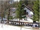
Dom v Dragi - Planina Planinca
Starting point: Dom v Dragi (689 m)
| Latitude/Longitude: | 46,39500°N 14,21830°E |
| |
Walking time: 1 h 15 min
Difficulty: easy marked way
Elevation gain: 447 m
Elevation difference along the route: 450 m
Map: Karavanke - osrednji del 1:50.000
Recommended equipment (summer):
Recommended equipment (winter):
Views: 21.783
 | 1 person like this post |
Access to starting point:
From the highway Ljubljana - Jesenice we take the exit Radovljica (from the Gorenjska side exit Lesce) and follow the road ahead in the direction of Begunje. At the end of the village Begunje we turn left towards the Dom v Dragi (right Tržič). The asphalt road then brings us to the parking lot near the Dom v Dragi. We park a little further, as parking in front of the Dom v Dragi is allowed only for guests.
Route description:
From the parking lot, we continue on the road which, past a bee house, brings us to a crossing in a few minutes of walking. We continue left on the road (right Preval-a over Luknja), which starts ascending through a scenic gorge. Further on, we ascend on the road for quite some time, then the blazes direct us left onto a footpath which starts to ascend steeply. Higher up, the steepness eases a little and the marked path crosses a forest road 3 times (2 different roads). The path, which mostly runs through the forest, brings us higher to the lower part of the mountain pasture Planinca. Here the blazes direct us right (ascent straight across the mountain pasture is forbidden) onto a transverse path, which in a few steps of further walking brings us to the road that we follow to the left.
Already after a few steps of walking on the road we come to a junction, where we continue straight (sharply right to Planina Preval-a). Here a footpath branches off to the left, which brings us to the cottage on Planina Planinca.

Photos:
 1
1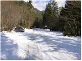 2
2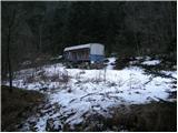 3
3 4
4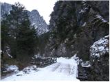 5
5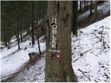 6
6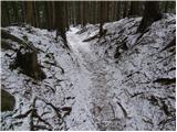 7
7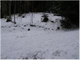 8
8 9
9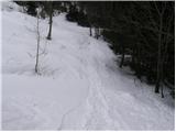 10
10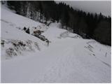 11
11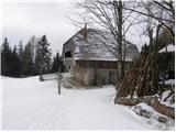 12
12
Discussion about the trip Dom v Dragi - Planina Planinca
To post a comment you must log in:
If you do not yet have a username, you must first
register.