Dom v Dragi - Roblekov dom na Begunjščici
Starting point: Dom v Dragi (689 m)
| Latitude/Longitude: | 46,39500°N 14,21830°E |
| |
Walking time: 2 h 50 min
Difficulty: easy marked way
Elevation gain: 968 m
Elevation difference along the route: 968 m
Map: Karavanke - osrednji del 1:50.000
Recommended equipment (summer):
Recommended equipment (winter): ice axe, crampons
Views: 111.546
 | 2 people like this post |
Access to starting point:
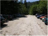
From the Ljubljana–Jesenice highway, we take the Brezje, Radovljica or Lesce exit, then continue driving towards Begunje na Gorenjskem. When we arrive in Begunje, we drive through the centre of the settlement; at the crossroads, we follow the signs for Grad Kamen castle and Dom v Dragi mountain hut. On the other side of the settlement, the main road turns right towards Tržič, while we continue straight onto a narrower road that quickly takes us into the Draga Valley. We drive on asphalt for a short time longer, then the asphalt ends and the road brings us to the parking lot in front of the Dom v Dragi mountain hut. Since parking in front of the hut is permitted only for guests, we continue right, then after about 100 metres of further driving, we park on one of the two larger gravel parking areas.
Route description:
From the parking lot, we continue along the road past the bee house, which in a few minutes of walking brings us to a junction, where we continue left on the road (right Preval-a over Luknja and Begunjščica over Preval-o), which begins to ascend through a scenic gorge. Further on, we ascend along the road for some time, then the markers direct us left onto a footpath, which begins to ascend steeply. Higher up, the steepness eases somewhat and the marked path crosses a forest road three times (2 different roads). The path, which mostly runs through the forest, then brings us higher to the lower part of the Planinca mountain pasture. Here the markers direct us right (ascent straight across the pasture is forbidden) onto a traversing path, which in a few steps of further walking brings us to the road, which we follow left.
Already after some 10 steps of walking along the road, we reach a junction, where we continue straight (sharply right to Preval-a pasture). Here a short path branches off to the left, leading to the hut on Planinca pasture, while we continue straight along the road all the way to Tomčeva koča na Poljški planini, which we reach after 15 minutes of further walking.
From Tomčeva koča, we continue right following the signs for Roblekov dom and continue the ascent along the path, which enters the forest. The path through the forest ascends moderately and soon brings us to the spot where several logs intended for heating Roblekov dom are stacked. If we feel like it and have enough strength, we can carry a log to the hut (they will be very grateful).
Higher up, the forest on the path becomes sparser, and the path steeper. From the wide and well-made path, which after rain is quite muddy, we occasionally get nice views. The path then turns slightly left and brings us to the spot where the path from Preval-a pasture joins from the right.
We continue on the left path, which after a further 10 minutes of traversing ascent brings us to the mountain hut.

Photos:
 1
1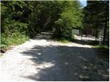 2
2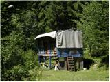 3
3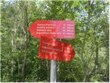 4
4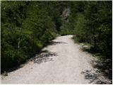 5
5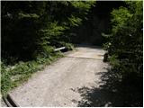 6
6 7
7 8
8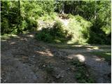 9
9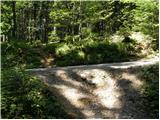 10
10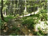 11
11 12
12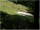 13
13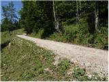 14
14 15
15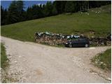 16
16 17
17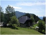 18
18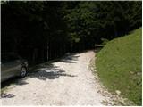 19
19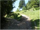 20
20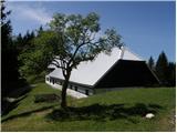 21
21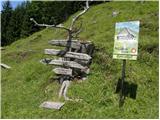 22
22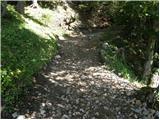 23
23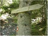 24
24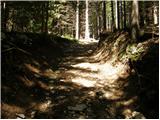 25
25 26
26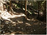 27
27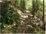 28
28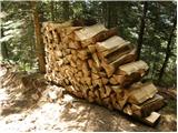 29
29 30
30 31
31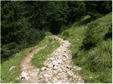 32
32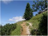 33
33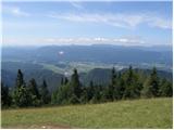 34
34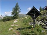 35
35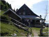 36
36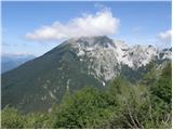 37
37
Discussion about the trip Dom v Dragi - Roblekov dom na Begunjščici
|
| ciklama25. 01. 2013 |
I'm wondering if the hut at Roblek is open on weekends?
|
|
|
|
| slamca25. 01. 2013 |
OSNP - hut open Saturdays, Sundays and holidays - copied from PZS hut page... so just one foot in front of the other 
|
|
|
|
| Pohodnica5626. 01. 2013 |
In good weather the hut is always open. One of my favorite huts
|
|
|
|
| Bojan_A17. 02. 2013 |
Today on training from Draga to Roblek. I expected it to be icy, but it wasn't. Snow on Roblek 1 m. From Planinica meadow one can sledge. Lots of people.
|
|
|
|
| JutranjaZarja2. 08. 2013 |
The path is excellent, passable even in hot summer days, since most of the time you walk through the forest. But it's quite long and strenuous.. but one can survive it 
|
|
|
|
| Vitaja27. 06. 2018 |
Nice path, but not particularly scenic. Excellent coffee in the hut on Planica pasture, where the lady served us fresh pastry. At the top wonderful view of Lake Bled and Stol.
|
|
|
|
| gumpy4. 02. 2021 |
The road below and most of the path due to thaw during the day and frost at night mostly icy. Without crampons I do not recommend the hike to Roblek in these conditions.
The sun was hiding today.
|
|
|
|
| Taja623. 02. 2022 15:56:08 |
Hello, on Saturday 26.2. I would like to head to Roblek, but on Friday it will rain all day in the mountains, probably snow. How safe is it to go on such a path the next day and by which route? Thanks, regards
|
|
|
|
| Majdag23. 02. 2022 17:39:50 |
Roblek is most beautiful in snow, a winter fairy tale.
On foot, you can probably reach it via the road too, even though it's closed. The paths through the forest will soon be trodden down. Just in case, pack those microspikes in your backpack, and good luck..
|
|
|
|
| jprim4. 02. 2024 18:00:09 |
Thanks for your nice descriptions regarding the photos and text.
Best regards!
|
|
|
To post a comment you must log in:
If you do not yet have a username, you must first
register.