Dom v Dragi - Roblekov dom na Begunjščici (via Preval)
Starting point: Dom v Dragi (689 m)
| Latitude/Longitude: | 46,39500°N 14,21830°E |
| |
Route name: via Preval
Walking time: 3 h
Difficulty: partly demanding marked way
Elevation gain: 968 m
Elevation difference along the route: 1000 m
Map: Karavanke - osrednji del 1:50.000
Recommended equipment (summer):
Recommended equipment (winter): ice axe, crampons
Views: 41.991
 | 3 people like this post |
Access to starting point:
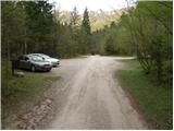
From the highway Ljubljana - Jesenice we go to the exit Radovljica (from Gorenjska side exit Lesce) and follow the road ahead in the direction of Begunje. At the end of the village Begunje we turn left towards the mountain hut Dom v Dragi (right Tržič). The asphalt road then brings us to the parking lot near the mountain hut Dom v Dragi. We park a little further, as parking in front of the hut Dom v Dragi is allowed only for guests.
Route description:
From the parking lot, we continue on the road which, past a bee house, in a few minutes of walking brings us to a junction, where we continue right in the direction of the mountain pasture Preval over Luknja (left mountain pasture Planinca, Poljška planina and Roblekov dom). The path ahead crosses the stream and then for some time ascends gently on the bottom of the valley.
Further, the valley narrows and the path in a moderate ascent brings us to a narrow gully, through which with the help of fixed safety gear we ascend steeply upwards.
A short secured part technically isn't particularly demanding, but it is exposed to falling stones.
Higher, the path brings us out of the gully, where it then continues along the stream for some time. Next follows an ascent on a shorter ladder (undemanding), and then the path passes into the forest, where it continues until we reach a worse road.
We follow the mentioned road only a few steps, and then the blazes direct us right onto a marked footpath which continues on and beside the cart track. Higher, the cart track finally turns into a footpath which heads a little more to the right and starts to ascend steeper and steeper. We follow this relatively steep path in the last part all the way to the mountain pasture Preval-e, which we reach after a few minutes of additional walking.
From Preval we continue on a slightly ascending road in the direction of Roblekov dom and Poljška planina. After approximately 15 minutes of easy walking on the macadam road we will notice on the right side thereof a trough with water and above it mountain signposts for Roblekov dom (over Roža). We head onto this path, which ascends through a strip of forest and brings us after a few minutes to the unvegetated southern slopes of Begunjščica. The path ahead ascends transversely towards the west, meanwhile crossing a few steep gullies. The path is even secured with pegs at some places, so that in snowless conditions it does not present major difficulties. After approximately half an hour of walking from the place where we left the road, we come to a pleasant bench which is located directly beside the spring (source) named Roža. The moderately steep path crosses a few more gullies, then levels out and brings us into a short strip of forest, where we join the usual path to Roblekov dom. Here we continue right and follow the path, which ascends moderately, to Roblekov dom on Begunjščica, which we reach after 10 minutes of additional walking.
Starting point - Preval-a 1:30, Preval-a - Roblekov dom 1:30.

Photos:
 1
1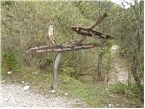 2
2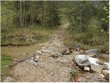 3
3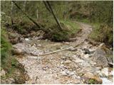 4
4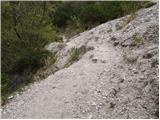 5
5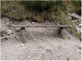 6
6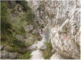 7
7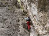 8
8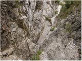 9
9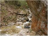 10
10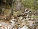 11
11 12
12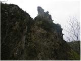 13
13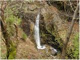 14
14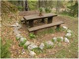 15
15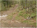 16
16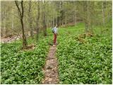 17
17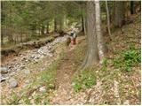 18
18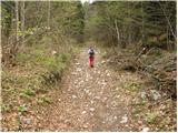 19
19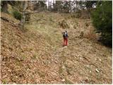 20
20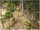 21
21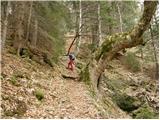 22
22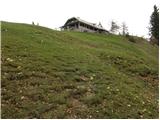 23
23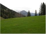 24
24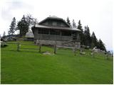 25
25 26
26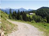 27
27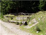 28
28 29
29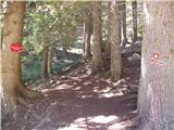 30
30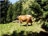 31
31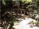 32
32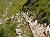 33
33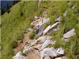 34
34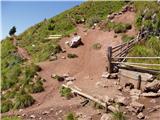 35
35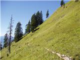 36
36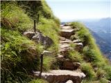 37
37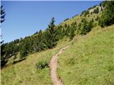 38
38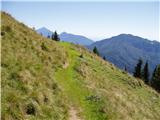 39
39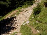 40
40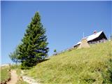 41
41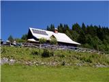 42
42
Discussion about the trip Dom v Dragi - Roblekov dom na Begunjščici (via Preval)
|
| frko13. 06. 2009 |
very detailed path description and well supported with pictures. I'm interested if there is also a circular path from Draga to Roblek and back to Draga. thanks and safe further Franc 
|
|
|
|
| serajko13. 06. 2009 |
if you read the previous description in detail, you see that the path Draga - Prevala - Roblek (over Roža) - Poljška planina - Planinca - Draga is a nice one-day circular path.
regards
|
|
|
|
| Tinca55. 02. 2011 |
The trail is mostly bare, icy in places. Today it was very warm, higher up where there is snow, the snow is sun-exposed.
|
|
|
|
| @rekar6. 02. 2011 |
The hut at Preval is open on weekends
|
|
|
|
| marezt5. 05. 2014 |
Is there still a lot of snow on the path from the pass to Roblek? Can it be done without crampons or ice axe? Best regards Marko
|
|
|
|
| timotej935. 05. 2014 |
The path is passable without problems, there's some snow beside the path, but so little it's not worth mentioning.
|
|
|
To post a comment you must log in:
If you do not yet have a username, you must first
register.