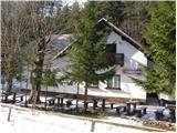
Dom v Dragi - Tomčeva koča na Poljški planini
Starting point: Dom v Dragi (689 m)
| Latitude/Longitude: | 46,39500°N 14,21830°E |
| |
Walking time: 1 h 30 min
Difficulty: easy marked way
Elevation gain: 491 m
Elevation difference along the route: 491 m
Map: Karavanke - osrednji del 1:50.000
Recommended equipment (summer):
Recommended equipment (winter):
Views: 17.947
 | 1 person like this post |
Access to starting point:
From the highway Ljubljana - Jesenice we go to the exit Radovljica (from Gorenjska side exit Lesce) and follow the road ahead in the direction of Begunje. At the end of the village Begunje we turn left towards the Dom v Dragi (right Tržič). The asphalt road then brings us to the parking lot near the Dom v Dragi. We park a little further, as parking in front of the Dom v Dragi is allowed only for guests.
Route description:
From the parking lot, we continue on the road which, past a bee house, brings us to a junction in a few minutes of walking. We continue left on the road (right Preval-a via Luknja), which starts ascending through a scenic gorge. Further on, we ascend on the road for quite some time, then the blazes direct us left onto a footpath, which starts to ascend steeply. Higher up, the steepness eases a little and the marked path crosses a forest road 3 times (2 different roads). The path, which mostly runs through the forest, then brings us higher to the lower part of the mountain pasture Planinca. Here the blazes direct us right (ascent straight across the mountain pasture is forbidden) onto a transverse path, which in a few steps of further walking brings us to the road that we follow to the left.
Already after a few steps of walking on the road we come to a junction, where we continue straight ahead (sharply right to the Preval-a mountain pasture). Here a footpath branches off to the left, which leads to the hut on the Planinca mountain pasture, while we continue straight on the road all the way to the Tomčeva koča on the Poljska planina, which we reach after 15 minutes of further walking.

Photos:
 1
1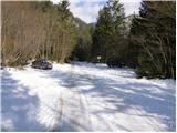 2
2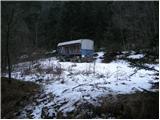 3
3 4
4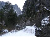 5
5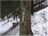 6
6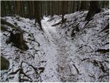 7
7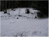 8
8 9
9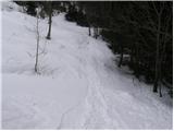 10
10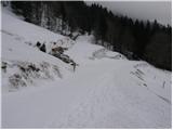 11
11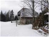 12
12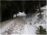 13
13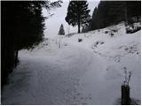 14
14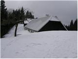 15
15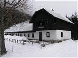 16
16
Discussion about the trip Dom v Dragi - Tomčeva koča na Poljški planini
|
| Gost30. 11. 2007 |
Hi,
I'm interested if this hut is open in winter.
LP!
|
|
|
|
| iztok.maltar2. 12. 2007 |
On weekends it is always open. During the week I'm not sure.
|
|
|
|
| stanko127. 11. 2014 |
Does anyone know if the hut is open on weekends?
|
|
|
|
| Majdag18. 02. 2022 11:51:46 |
Radovljica, municipal news
Complete closure of the forest road Polška planina
Due to emergency bridge repair, the forest road Polška planina will be completely closed from 17.2.2022 to 1.3.2022. No detour...
|
|
|
|
| Lonat30. 03. 2025 19:52:23 |
Hello,
Today on 30.03. We lost a dog leash on the path between Dom v Dragi and Tomčeva koča. If someone found it by chance, please call 041 878 913.
Could someone please provide the phone number of the hut keeper to ask her?
Thanks everyone
Best regards
Polona
|
|
|
To post a comment you must log in:
If you do not yet have a username, you must first
register.