Dom v Iškem Vintgarju - Krim
Starting point: Dom v Iškem Vintgarju (360 m)
| Latitude/Longitude: | 45,91180°N 14,49930°E |
| |
Walking time: 2 h 15 min
Difficulty: easy marked way
Elevation gain: 747 m
Elevation difference along the route: 747 m
Map: Ljubljana - okolica 1:50.000
Recommended equipment (summer):
Recommended equipment (winter): ice axe, crampons
Views: 97.520
 | 4 people like this post |
Access to starting point:
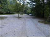
We drive onto the southern Ljubljana bypass and head to the Ig exit. Then at the intersections we follow the direction of Ig. In Ig we continue towards Iška vas (we can also reach here from Podpeči or Škofljica). We then follow the well-signposted road to a large parking lot near the hut Dom v Iškem Vintgarju.
Route description:
From the parking lot, we walk to the mountain hut Dom v Iškem Vintgarju, after that immediately behind the hut we continue right on an ascending cart track in the direction of Krim and Bercet's Partisan hospital in Krvavice. The cart track goes immediately into a dense forest, and by it we notice a notification that we are entering a bear area. Further, we ascend on a marked cart track (the cart track has quite a few forks, so we carefully follow the blazes), which at the altitude of 650 m brings us to the spot where to the left (straight ahead) a marked path branches off towards the Partisan hospital Krvavice (the turn-off is not marked). The path to Krim here turns to the right and flattens a little. Next follows a few minutes of moderate ascent, then the path brings us to a macadam road, which we follow to the right. After a short ascent on the road, the signs for Krim direct us sharply to the left onto a wide cart track, on which in a few minutes of easy walking we step onto expansive grassy slopes. The path ahead brings us to the power line, after which we soon step onto a macadam road.
On the road we step near a smaller intersection, and we continue on the poorer road (direction Krim). Next follows an approximately 15-minute walk on the road, then the signs direct us left onto a steep cart track (here paths from Iška and Strahomer join us). Next follows a traversing ascent on a wide cart track, which higher brings us to a large parking lot or turning area below the summit of Krim. From here we continue past a cross on an increasingly panoramic mountain path, on which in less than 5 minutes of further walking we ascend to the summit.

Photos:
 1
1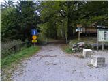 2
2 3
3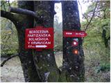 4
4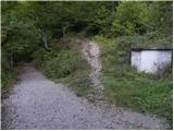 5
5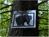 6
6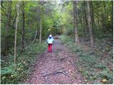 7
7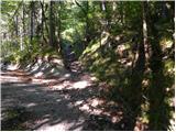 8
8 9
9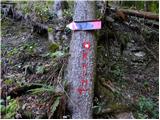 10
10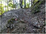 11
11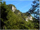 12
12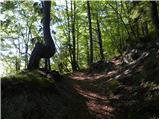 13
13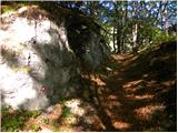 14
14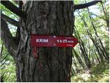 15
15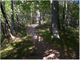 16
16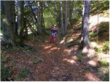 17
17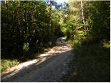 18
18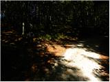 19
19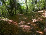 20
20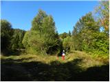 21
21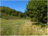 22
22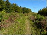 23
23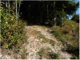 24
24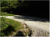 25
25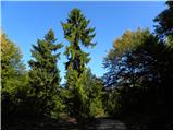 26
26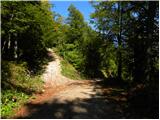 27
27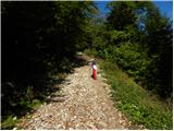 28
28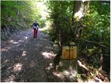 29
29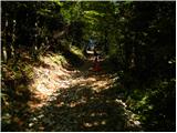 30
30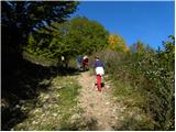 31
31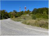 32
32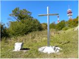 33
33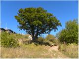 34
34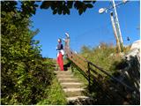 35
35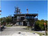 36
36 37
37
Discussion about the trip Dom v Iškem Vintgarju - Krim
|
| gorjanci9. 12. 2013 |
I'm interested how real the bear danger is on this path. Aren't the paths to Krim quite crowded?
|
|
|
|
| aleš4318. 04. 2014 |
Female bears with cubs, sows with piglets, even wolves are around when morels are growing or chestnut time comes...(he he)
|
|
|
|
| majashriba20. 04. 2014 |
Yes, the paths to Krim are indeed quite crowded  On nice weekends, there are so many visitors and cyclists that the poor bears are probably trembling under some log waiting for the crowd to leave On nice weekends, there are so many visitors and cyclists that the poor bears are probably trembling under some log waiting for the crowd to leave 
|
|
|
|
| pemi21. 04. 2014 |
I think this trail is one of the more crowded ones and there's almost no chance of meeting one, but actually I've already seen fresh tracks in the mud but in principle the bear moves away from humans but in principle the bear moves away from humans
|
|
|
|
| zokipoki11. 04. 2015 |
Today I accidentally stumbled upon this trail because I missed the steep variant due to poor signposts, so I ascended this one and descended the steep one, which is tough on the knees.
The described trail is one of the nicer hiking paths... easy, scenic, suitable for everyone... great.
Just watch out for mountain bikers who have already made a descent track on this trail.
Cheers
|
|
|
|
| Mikens23. 06. 2019 |
IMPORTANT!
I ask all hikers to keep their dogs on a leash! (bear area.)
Nice hunting regards.
Klement Mal, LD Tomišelj
|
|
|
|
| anazala12. 12. 2019 |
Tomorrow I'm going to Krim via this path. I hope I really won't encounter any bear. I might freeze if I do. What to do if I see one. Make yourself big, small-start running. There's a lot written on the web. Just a lot of different things, so I don't know what's correct anymore.
|
|
|
|
| turbo12. 12. 2019 |
Bag of gingerbread in hand and loudly: "bear, bear, bear..." 
|
|
|
|
| dragon13. 12. 2019 |
I always have a sandwich with me for this case. I think that if I throw it to him, he'll leave me alone. But I don't know if I should unwrap it first or leave it wrapped. Because if he has to deal with unwrapping, great, I gain a few seconds, why not?
|
|
|
|
| Barentoter13. 12. 2019 |
Go with someone who runs slower than you
|
|
|
|
| ločanka13. 12. 2019 |
This second time for tips she probably won't ask anymore
|
|
|
|
| zokipoki13. 12. 2019 |
Krim is very crowded, although shorter from the hut than from Iška, you need real luck to encounter a bear. I've been to Krim many times and so far I've only heard a cub calling from the forest once. My father-in-law goes up there regularly and has seen it only once. The bear prefers to retreat.
|
|
|
|
| anazala5. 01. 2020 |
haha, sandwich for the bear. maybe. gingerbread for the bear. maybe. no, the bear moves away if it's not too hungry. it's not hungry. it still has plenty of food on the ground. it doesn't sleep because it's not winter. I didn't see it. hunters say it's quite often far in the forest. now motorcycles are roaring at every tree too, so no fear. stick to the marked path and you won't see it. maybe not. I didn't. but it's true I didn't go alone to this hill. 5 women lots of chatter and loud. when you get to the top of the hill there's a nice view. worth it.
|
|
|
|
| Breza918. 09. 2023 10:05:07 |
Yesterday I was lucky to meet a bear on Krim. I spotted him 20 meters ahead on the path. We looked at each other, he seemed peaceful. Then my companion and I turned around and went back where we came from. The bear also turned and continued in the other direction. Then we also chose another route, returned towards Iška instead of towards Vintgar  everything was ok, but we kept quite a safety distance between us. everything was ok, but we kept quite a safety distance between us.
|
|
|
|
| lina1219. 09. 2023 07:31:21 |
Phew, thanks for the comment. I've also gone along the path from Vintgar several times alone But I think I'll prefer to hike from Iška ...
|
|
|
|
| Kafetarca19. 09. 2023 21:17:50 |
Breza9, where exactly on Krim did you meet?
|
|
|
|
| Vrhovka24. 02. 2026 13:16:34 |
Sunday hike to Krim. The path is nicely marked, fresh markings. Only a little snow at the top.
|
|
|
To post a comment you must log in:
If you do not yet have a username, you must first
register.