Dom v Kamniški Bistrici - Brana
Starting point: Dom v Kamniški Bistrici (601 m)
| Latitude/Longitude: | 46,32710°N 14,58930°E |
| |
Walking time: 5 h
Difficulty: difficult marked way
Elevation gain: 1652 m
Elevation difference along the route: 1652 m
Map: Kamniške in Savinjske Alpe 1:50.000
Recommended equipment (summer): helmet
Recommended equipment (winter): helmet, ice axe, crampons
Views: 69.716
 | 2 people like this post |
Access to starting point:
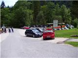
We drive to Kamnik and follow the road ahead towards the valley Kamniška Bistrica, where we park on a large parking lot near the mountain hut Dom v Kamniški Bistrici.
Route description:
From the parking lot in front of the mountain hut Dom v Kamniški Bistrici we continue on the initially still asphalted road, which after a short ascent quickly brings us into the forest. After a few minutes of walking the signposts for Kamniško sedlo direct us to the right onto a steep footpath, which a little higher brings us to an interesting passage below overhanging cliffs. The still steep path then brings us to the bottom station of the cargo cableway, where we step onto the road. We continue left and then already after a few steps sharply right. The relatively steep forest path brings us higher to a cart track, which we follow a few dozen meters to the right, then the blazes direct us to the left, where after a steep initial ascent the steepness decreases. Further in a gentle diagonal ascent we cross relatively steep slopes, after which a path from the higher starting point (Jermanca) joins us from the left. The well-marked and relatively steep path, which ascends through the forest for some time longer, brings us higher to a pleasant spring (in dry periods it dries up). From the spring a short ascent follows and the path brings us to the known resting place Pri Pastirjih, where an emergency bivouac stands.
We continue straight on the marked path, which then quickly passes from the forest onto a vast panoramic meadow. Behind the meadow the path goes into a belt of dwarf pines, where it starts to ascend more steeply again. The path, which continues on an increasingly panoramic sunny slope, brings us after a good hour of walking from Pri Pastirjih to the mountain hut on Kamniško sedlo.
From the hut on Kamniško sedlo we continue left in the direction of Brana on the path which over panoramic meadows brings us to a junction, where we continue slightly left (right downhill Okrešelj). The path, which further ascends on an increasingly rocky slope, quickly brings us to the scree, which is dangerous for slipping in snow. We cross the scree in a gentle diagonal ascent, then the path brings us to the next junction, where we continue left (right Turska gora).
The path then starts to ascend somewhat more steeply and for some time still crosses the slopes towards the west. The path then turns left and becomes somewhat more demanding. Further we ascend on the rocky slope towards the ridge and from the path a nice view also towards Turska gora, Skuta and Grintovec starts to open up. The path then turns even more to the left and crosses steep slopes towards the southeast. On this section a steel cable helps us at some points. A somewhat steeper ascent follows through a narrower gully where some easy climbing is also needed. At the top of the gully the path turns right and a short ascent to the less steep summit slope follows.
We continue left and the nice panoramic and undemanding path brings us in a few minutes to the vast summit.
Dom v Kamniški Bistrici - Pri Pastirjih 2:30, Pri Pastirjih - Kamniška koča 1:15, Kamniška koča - Brana 1:15.

Photos:
 1
1 2
2 3
3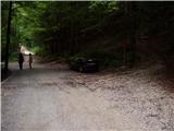 4
4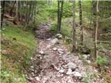 5
5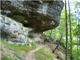 6
6 7
7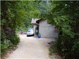 8
8 9
9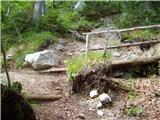 10
10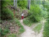 11
11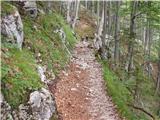 12
12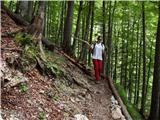 13
13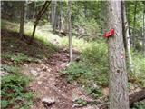 14
14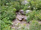 15
15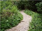 16
16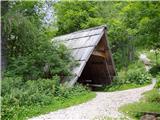 17
17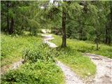 18
18 19
19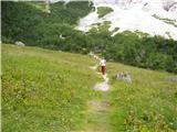 20
20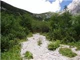 21
21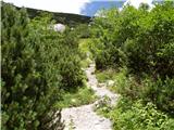 22
22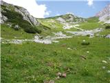 23
23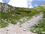 24
24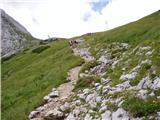 25
25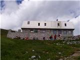 26
26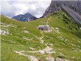 27
27 28
28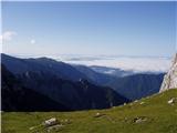 29
29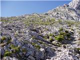 30
30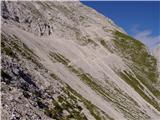 31
31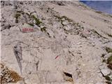 32
32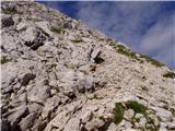 33
33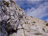 34
34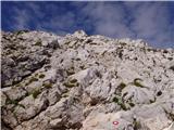 35
35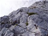 36
36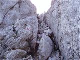 37
37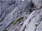 38
38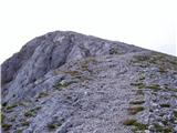 39
39 40
40
Discussion about the trip Dom v Kamniški Bistrici - Brana
|
| andrej76711. 09. 2008 |
Regarding the markings to Brana, it would really be appropriate to have more markings on the ascent path - especially in the lower part many hikers end up quite a bit lower than the actual path ...
|
|
|
|
| and1217. 04. 2009 |
I'm interested in the conditions on Brana at this time of year. On Sunday we plan to climb it and wonder if the path is trodden or not?
|
|
|
|
| rant17. 04. 2009 |
The path is trodden only to Kamniško sedlo.
Further to Brana I advise against due to thawing and avalanches.
|
|
|
|
| gasperv26. 11. 2011 |
hiked the path today. From the hut at the saddle to the dam we encounter some snow patches, which can however be bypassed.
|
|
|
|
| Edi227. 12. 2011 |
Has anyone maybe been to Brana these days?
|
|
|
|
| Marky28. 12. 2011 |
I wanted to go to Brana last week myself but was advised against it, because it is very avalanche-prone and not really the best for winter ascents.
As a warning and advice 
|
|
|
|
| Edi228. 12. 2011 |
Marky thanks, we've changed our plans.
|
|
|
|
| ih_hihi14. 06. 2013 |
Can you hike the Kamniška Bistrica - Kamniško sedlo path with a dog? I was at Kamniško sedlo some time ago.
|
|
|
|
| Zgembo10. 05. 2015 |
I was on this tour today, there's some snow at a few spots, crampons not needed, below the summit itself there's quite a bit of snow, there I recommend climbing straight up the rocks to the roof. Here are some pics
https://www.youtube.com/watch?v=LFeuYOwFAwc
|
|
|
|
| nikolego9. 09. 2015 |
Hey. Does anyone go to Brana on Saturday or Sunday? For a long time conquering this peak has been my wish but I can't convince anyone. I'm interested if one can get lost on the trail from Kamniška Bistrica. Mountaineering experience reduced to hiking experience.
|
|
|
|
| shorty_9910. 09. 2015 |
I went to Brana 14 days ago to watch the sunrise, and I can say it's very hard to get lost.
|
|
|
|
| Jigga3. 01. 2017 |
Caution, at the top without ice axe and crampons not possible, unless you go around. Went with colleague 30.12.
|
|
|
|
| marko77716. 06. 2019 |
I was at Brana yesterday, there is still snow in two places, but it can be bypassed, so I didn't need winter gear, safe steps to all
|
|
|
|
| Golobova20002. 07. 2019 |
Last time I went to Kamniško sedlo and many people on the path from Brana had helmets. Is it really necessary or is it safe to go up purely as an amateur? is it safe to go up purely as an amateur?
|
|
|
|
| coffee2. 07. 2019 |
I wouldn't wear it on a normal ascent.
However, if you go when there are many people on the path, it increases the chance of dislodging rocks. Additionally, the helmet protects your head in possible falls. But you have to assess yourself based on your abilities if the path's difficulty for you means a high risk of falling.
|
|
|
|
| postopač2. 07. 2019 |
The helmet is needed because of irresponsible people who descend off-path thinking they are tough guys. Was up there on Saturday and there were quite a few such idiots. Otherwise, as coffee wrote, not needed for a normal ascent, and safe steps to all.
|
|
|
|
| MiAn2. 07. 2019 |
Even for a regular ascent it's needed, if you have at least a little self-respect!
|
|
|
|
| novinec20193. 07. 2019 |
@Golobova2000; if the recommended gear is a helmet it's already good to have it for all the reasons mentioned above
|
|
|
To post a comment you must log in:
If you do not yet have a username, you must first
register.