Dom v Kamniški Bistrici - Planjava (via Repov kot)
Starting point: Dom v Kamniški Bistrici (601 m)
| Latitude/Longitude: | 46,32710°N 14,58930°E |
| |
Route name: via Repov kot
Walking time: 5 h 45 min
Difficulty: difficult pathless terrain
Elevation gain: 1791 m
Elevation difference along the route: 1791 m
Map: Kamniške in Savinjske Alpe 1:50.000
Recommended equipment (summer): helmet
Recommended equipment (winter): helmet, ice axe, crampons
Views: 60.685
 | 1 person like this post |
Access to starting point:
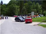
We drive to Kamnik and follow the road ahead towards the Kamniška Bistrica valley, where we park on a large parking lot near the mountain hut Dom v Kamniški Bistrici.
Route description:
From the parking lot in front of the mountain hut Dom v Kamniški Bistrici we continue on the initially still asphalted road, which after a short ascent quickly brings us into the forest. After a few minutes of walking the mountain signs for Kamniško sedlo direct us to the right onto a steep footpath, which a little higher brings us to an interesting passage below overhanging cliffs. The still steep path then brings us to the bottom station of a cargo cableway, where we step on the road. We continue left and then already after a few steps sharply right. The relatively steep forest path brings us higher to a cart track, which we follow a few tens of meters to the right, then the blazes direct us to the left, where after a steep initial ascent the steepness eases. Further in a gentle diagonal ascent we cross relatively steep slopes, after which from the left the path from the higher starting point (Jermanca) joins us. A few more minutes of walking follow and the path brings us to the junction V Klinu. The marked path towards Kamniško sedlo here turns left upwards (by the path there are also signposts), and we continue slightly right on an unmarked path. At the beginning of this path is a large caption »Pot ne vodi na K. sedlo«.
Further, the path starts to ascend a little more steeply and runs through the forest on the left side of the valley. A few times from the path right downwards a narrow footpath branches off, but we all the time walk on the better beaten footpath, which all the time runs on the left side of the valley. Later, when the path brings us out of the forest, we will notice a waterfall when there is enough water in the stream on the right. The path then crosses a slightly exposed slope to the right, aided by some pegs. Here we will on the right side in the stream bed notice a few pools. We continue left and we again start ascending through the forest and dwarf pines. When we come out of the forest the path brings us to a junction, where we continue right on a narrow footpath through dwarf pines. Near the junction on the left side there is a viharnik; if we were to continue left the path after a few meters brings us to a panoramic ridge.
Out of the dwarf pines the path leads us over a short scree and then crosses rocky slabs. The path still runs on the left side of the valley and in the last part turns slightly to the right. Here the path becomes a little steeper and some easy climbing is needed (1st degree). The path on this part is also a little less visible, aided by some cairns. At the last ascent towards Srebrno sedlo the path avoids the steepness on the right side.
On Srebrno sedlo where we join the marked path we continue left. Next follows traversing of slopes towards the west, which we do in a moderate ascent. Next we come to the next junction, where we continue right towards the summit of Planjava (left Kamniško sedlo). From the increasingly panoramic path the green meadows finally end, replaced by gray rock. A little below the summit paths from Klemenča jama and Kamniško sedlo also join us. Only a shorter ascent on the summit slope of the mountain follows.

Along the route: Srebrno sedlo (2115m)
Photos:
 1
1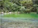 2
2 3
3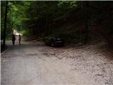 4
4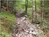 5
5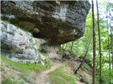 6
6 7
7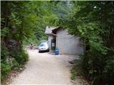 8
8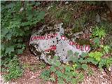 9
9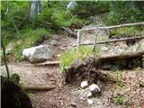 10
10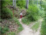 11
11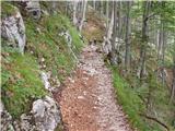 12
12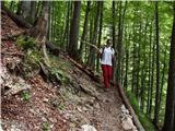 13
13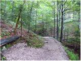 14
14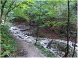 15
15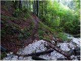 16
16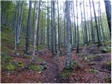 17
17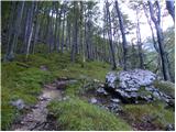 18
18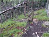 19
19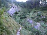 20
20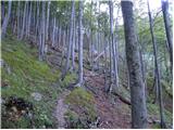 21
21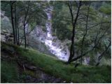 22
22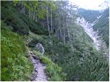 23
23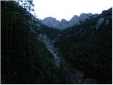 24
24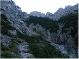 25
25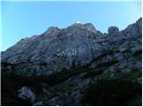 26
26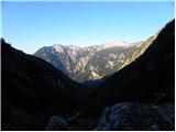 27
27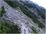 28
28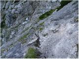 29
29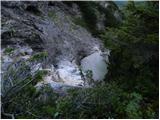 30
30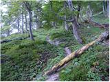 31
31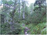 32
32 33
33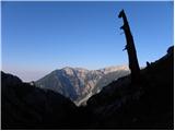 34
34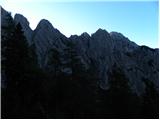 35
35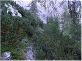 36
36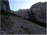 37
37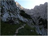 38
38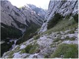 39
39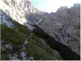 40
40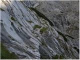 41
41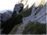 42
42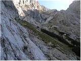 43
43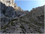 44
44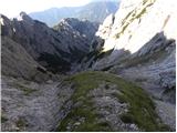 45
45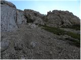 46
46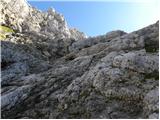 47
47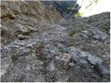 48
48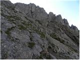 49
49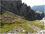 50
50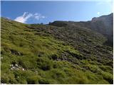 51
51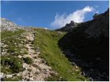 52
52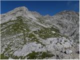 53
53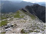 54
54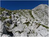 55
55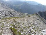 56
56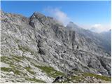 57
57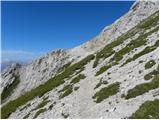 58
58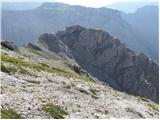 59
59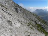 60
60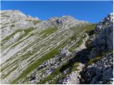 61
61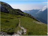 62
62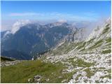 63
63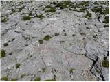 64
64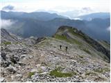 65
65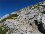 66
66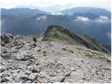 67
67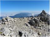 68
68
Discussion about the trip Dom v Kamniški Bistrici - Planjava (via Repov kot)
|
| dprapr5. 10. 2012 |
The inscription on picture 16 "Path does not lead to K.S." is no longer there or it's covered!
Good thing these pictures are posted. So at least I can see where I walked today in fog and rain! From the pools onward I couldn't see a thing!
|
|
|
|
| dprapr5. 10. 2012 |
I would add this. The path towards Kamniško sedlo is actually most interesting in the lower part and there is no need to drive further in this direction for half an hour of walking.
|
|
|
|
| pohodnik3825. 08. 2013 |
Some pictures and impressions from this beautiful solitary path.
PICTURES
|
|
|
|
| fpetel13. 08. 2015 |
How demanding is this trail? Climbing? What about orientation before reaching Srebrno sedlo? Asking because according to Stritar's description, it's a very demanding pathless terrain, but I would go alone without rope. I have experience with easier pathless routes and secured trails in our mountains, but not with very demanding pathless ones.
|
|
|
|
| lepenatka3. 08. 2015 |
Went about a month ago and had no problems. Followed the description above.
No need for rope. Better for ascent than descent. At least for me.
Secure step.
|
|
|
|
| lepenatka3. 08. 2015 |
Went about a month ago and had no problems. Followed the description above.
No need for rope. Better for ascent than descent. At least for me.
Secure step.
|
|
|
|
| ločanka4. 11. 2016 |
This is not the path through Repov kot
|
|
|
|
| tinky4. 11. 2016 |
Forgot to turn right at Klin
|
|
|
|
| trdi11. 06. 2018 |
Why isn't this trail marked, and say the one over Žmavčarje and Gamsov skret? Are there any special reasons for that?
|
|
|
|
| smatjaz11. 06. 2018 |
yes because these are hunting trails and not under the jurisdiction of PZS, which doesn't mean they won't be someday, you never know
|
|
|
|
| NYG11. 06. 2018 |
PZS takes the position that there are enough hiking trails and therefore does not intend to open/mark new ones.
|
|
|
|
| rinoz18. 08. 2018 |
Probably the reason is also that it doesn't make sense to lead people past the Kamniška hut. Today I descended this trail and it is really very difficult, at least for me - so-called advanced beginner. In the upper part below the rock step there is a lot of scree, requiring careful steps.
|
|
|
|
| Victorinox4. 08. 2022 22:07:11 |
Quite unpleasant and not the easiest descent path, and in fog it can be dangerous even orientation-wise.
|
|
|
|
| Rankun27. 06. 2023 08:10:51 |
Re:trdi
the reason why not every hunting trail is marked is also to direct hikers to already marked paths. In the mountains there are animals that just need a square meter of their living space that is not crisscrossed by hiking trails. I don't say anything, I also go on this path sometimes, but since it is not marked, the visits are accordingly fewer. And that's right.
|
|
|
|
| ravnjak14. 10. 2023 18:14:38 |
Someone has sprayed this trail with red and yellow paint at the top, so it has lost all its charm. Someone is playing marker and messing up nature. Pathetic ....
|
|
|
|
| mirank15. 10. 2023 12:34:00 |
Such idiots can be found everywhere. The other day one of the young forest rangers in the Friulian Dolomites told me that the bocciarda is always in his backpack and he marks such messes on the spot. Well, we met one such on the descent from the top of Pramaggiore; he was spraying big time. That the density - according to him correct - could be seen a bit lower. From one spot you could see up to 12 blobs or lines . The saddest thing is that the trail is fully visible and there is no need for such work. . The saddest thing is that the trail is fully visible and there is no need for such work.
|
|
|
To post a comment you must log in:
If you do not yet have a username, you must first
register.