Dom v Lepeni - Bogatin (via Bogatinsko sedlo)
Starting point: Dom v Lepeni (700 m)
| Latitude/Longitude: | 46,30370°N 13,68140°E |
| |
Route name: via Bogatinsko sedlo
Walking time: 4 h 30 min
Difficulty: partly demanding marked way
Elevation gain: 1277 m
Elevation difference along the route: 1320 m
Map: TNP 1:50.000
Recommended equipment (summer): helmet
Recommended equipment (winter): helmet, ice axe, crampons
Views: 9.590
 | 2 people like this post |
Access to starting point:
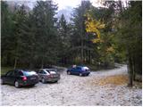
Between Trenta and Bovec, near the village of Soča, a road to Lepena branches off. We follow this fully asphalted road to the parking lot at Dom dr. Klementa Juga in Lepena.
Route description:
From Dom dr. Klementa Juga in Lepena we continue on a wide marked path in the direction of Krn Lakes. A wide and not too steep path splits into two parts after a few minutes of walking. The left one, which is somewhat steeper, is the usual one; the right one, gentler and somewhat longer, is suitable for small children and the elderly. Both paths mostly ascend through the forest to the upper station of the cableway and cross each other several times on the way.
From the upper station of the cargo cableway we continue on the same path, which gently ascends along a wide transport road that quickly brings us to the snow height measurement (every year in April). From here the road starts to descend and, past the turn-off for Velika Baba, quickly brings us to the next junction, where we leave the road and continue to the left downhill on a footpath that brings us to Dom pri Krnskih jezerih in a few minutes (if we continue on the road we bypass the mountain hut).
From the hut we continue straight in the direction of Krn and Krnsko jezero on a gentle path, to which soon joins the path that bypasses the mountain hut. We continue past a shepherd's hut, behind which we reach the next junction, where we continue left in the direction of Komna (straight to Krn and Krnsko jezero). A few 10 steps further, another path from Krn Lakes joins us from the right, but we continue on the gentle path that runs along the edge of a pleasant little valley. The path ahead leads us past the turn-off for the path to Mali Šmohor (1939 m); this one turns right from our path, while we continue on a somewhat steeper path that leads past rare larches and through a belt of dwarf pines. At the beginning of a sort of plateau named Doliči, a marked path to Prehodci and further to the source of the Tolminka branches off to the right. There follows some ascent, then we reach the valley Za Lepočami, where old military barracks from the time between the two world wars stand or stood (today only ruins remain). Here a path from Prehodci or from the source of the Tolminka joins us from the right, but we continue in the direction of Komna. An increasingly scenic path, which for some time further ascends on and along the slopes of Velika Montura (1958 m), continues to lead us along a well-preserved mule track. There follow a few minutes of moderate ascent and the path brings us to Bogatinsko sedlo, where the next marked junction is.
On the saddle we continue right (straight down Komna, left Lanževica) on the path that brings us in a few minutes to the initially indistinct ridge of Bogatin. The path ahead starts to ascend steeply along the very steep and crumbly northwest ridge of Bogatin (danger of slipping and falling rocks). Higher up the ridge narrows somewhat, the path levels out, and in a few 10 steps it brings us to the summit of (Mali) Bogatin.

Photos:
 1
1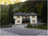 2
2 3
3 4
4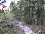 5
5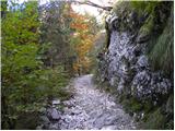 6
6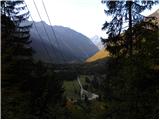 7
7 8
8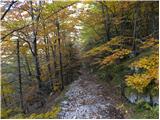 9
9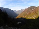 10
10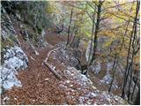 11
11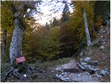 12
12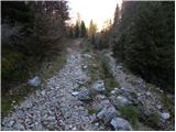 13
13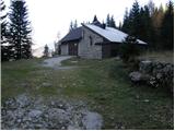 14
14 15
15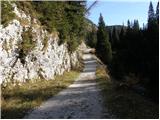 16
16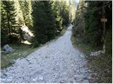 17
17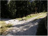 18
18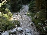 19
19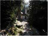 20
20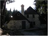 21
21 22
22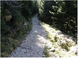 23
23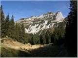 24
24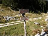 25
25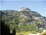 26
26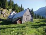 27
27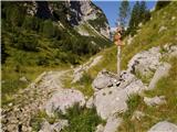 28
28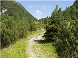 29
29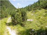 30
30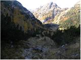 31
31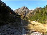 32
32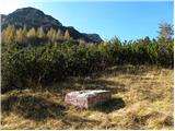 33
33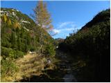 34
34 35
35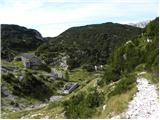 36
36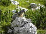 37
37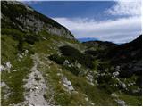 38
38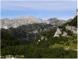 39
39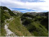 40
40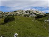 41
41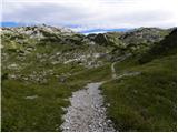 42
42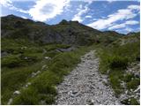 43
43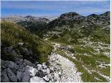 44
44 45
45 46
46 47
47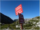 48
48 49
49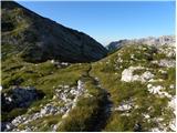 50
50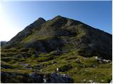 51
51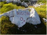 52
52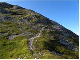 53
53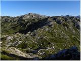 54
54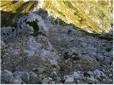 55
55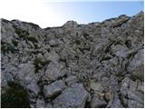 56
56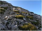 57
57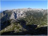 58
58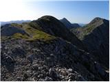 59
59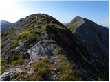 60
60 61
61
Discussion about the trip Dom v Lepeni - Bogatin (via Bogatinsko sedlo)
|
| darinka420. 01. 2020 |
How does it look from Krnsko jezero to Bogatin in the snow?
|
|
|
|
| darinka420. 01. 2020 |
How does it look from Krnsko jezero to Bogatin in the snow?
|
|
|
|
| mirank20. 01. 2020 |
Usually nothing special; only the short summit part is a bit steeper and the difficulty always depends on the conditions.
|
|
|
|
| foxy21. 01. 2020 |
14 days ago the summit part was snowy and hard as stone....despite winter gear I turned back after a few meters and went up the western side
|
|
|
|
| darinka42. 06. 2023 07:02:16 |
Well, yesterday there wasn't much of a crowd. But luckily no rain either. Although it rained in the afternoon all around. Black clouds threatened vainly the whole ascent. After many years in these parts, really nice. The intention was to go to Mahavšček, but we decided for Bogatin. And on the descent to the saddle towards Mahavšček we decided not to go there precisely because of possible rain, which then didn't come.
|
|
|
To post a comment you must log in:
If you do not yet have a username, you must first
register.