Dom v Lepeni - Lanževica (via Bogatinsko sedlo)
Starting point: Dom v Lepeni (700 m)
| Latitude/Longitude: | 46,30370°N 13,68140°E |
| |
Route name: via Bogatinsko sedlo
Walking time: 5 h
Difficulty: easy marked way
Elevation gain: 1303 m
Elevation difference along the route: 1350 m
Map: TNP 1:50.000
Recommended equipment (summer):
Recommended equipment (winter): ice axe, crampons
Views: 5.480
 | 1 person like this post |
Access to starting point:
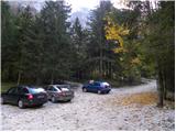
Between Trenta and Bovec, at the village of Soča, a road branches off to Lepena. We follow this fully asphalted road to the parking lot at the Dom dr. Klementa Juga in Lepena.
Route description:
From the Dom dr. Klementa Juga in Lepena we continue on a wide marked path in the direction of the Krn Lakes. A wide and not too steep path splits into two parts after a few minutes of walking. The left one, which is somewhat steeper, is the usual way; the right one, gentler and somewhat longer, is suitable for small children and the elderly. Both paths mostly ascend through the forest to the upper station of the cableway and cross each other several times along the way.
From the upper station of the cargo cableway we continue on the same path, which gently ascends along a wide transport road that quickly brings us to the snow height measurement (every year in April). From here the road starts to descend and past the turn-off for Velika Baba quickly brings us to the next junction, where we leave the road and continue left downhill on a footpath that brings us to the Dom pri Krnskih jezerih in a few minutes (if we continue on the road we bypass the mountain hut).
From the hut we continue straight in the direction of Krn and Krnsko jezero on a gentle path to which the path bypassing the mountain hut soon joins. We continue past a shepherd's hut behind which we reach the next junction, where we continue left in the direction of Komna (straight to Krn and Krnsko jezero). Some 10 steps further a path from the Krn Lakes joins from the right, and we continue on the gentle path that proceeds along the edge of a pleasant little valley. The path ahead leads us past the turn-off for the path to Mali Šmohor (1939 m), which turns right from our path, and we continue on a somewhat steeper path that leads past rare larches and through a belt of dwarf pines. At the beginning of a sort of plain called Doliči a marked path to Prehodci and further to the source of the Tolminka branches off to the right. There follows some ascent, then we reach the valley Za Lepočami, where old military barracks from the time between the two world wars stand or stood (today only ruins remain). Here a path from Prehodci or from the source of the Tolminka joins from the right, and we continue in the direction of Komna. An increasingly scenic path, which for a while further ascends on and along the slopes of Velika Montura (1958 m), continues to lead along a well-preserved mule track. There follow a few minutes of moderate ascent and the path brings us to Bogatinsko sedlo, where the next marked junction is.
This time too we continue on the left path (straight to Koča pod Bogatinom, Dom na Komni, Bohinj..., right to Bogatin, Mahavšček and Tolminski Kuk) in the direction of Lanževica, to which we have about 1 hour of walking left. The path ahead is somewhat more demanding for orientation in fog, as it leads along a wide gentle ridge where it ascends more steeply only occasionally. Further, with fine views on the left side, we bypass the less known Vrh nad Gracijo (1919 m). On the other side of the mentioned peak a path from Koča pod Bogatinom via Lepa Komna joins from the right. From here there follow about 20 minutes of moderate ascent and the path brings us to the 2003 m high summit of Lanževica.

The trip can be extended to the following destinations: Velika Baba
Photos:
 1
1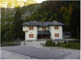 2
2 3
3 4
4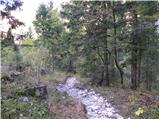 5
5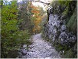 6
6 7
7 8
8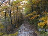 9
9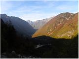 10
10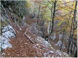 11
11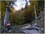 12
12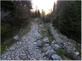 13
13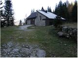 14
14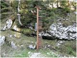 15
15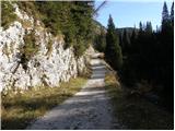 16
16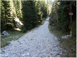 17
17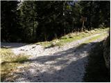 18
18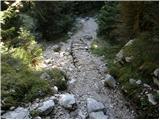 19
19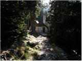 20
20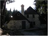 21
21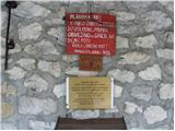 22
22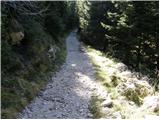 23
23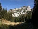 24
24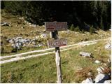 25
25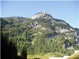 26
26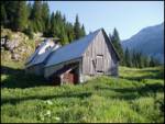 27
27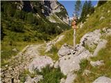 28
28 29
29 30
30 31
31 32
32 33
33 34
34 35
35 36
36 37
37 38
38 39
39 40
40 41
41 42
42 43
43 44
44 45
45 46
46 47
47 48
48 49
49 50
50 51
51 52
52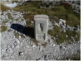 53
53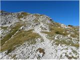 54
54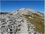 55
55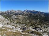 56
56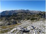 57
57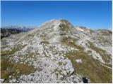 58
58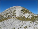 59
59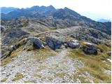 60
60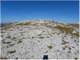 61
61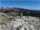 62
62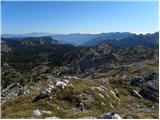 63
63
Discussion about the trip Dom v Lepeni - Lanževica (via Bogatinsko sedlo)
|
| Zgembo30. 04. 2017 |
Maybe someone knows where to get the stamp?
|
|
|
|
| redbull1. 05. 2017 |
Good that you bother to add this stamp mess to all described paths
|
|
|
|
| BT881. 05. 2017 |
Yeah go make it if it isn't there you weren't up anyway and we'll all have it. Kinda rhymes  this one works this one works
|
|
|
|
| mirank1. 05. 2017 |
Looks like you're looking for the starting point stamp...
|
|
|
|
| Zgembo1. 05. 2017 |
No, I want to collect stamps for as many two-thousanders as possible, and for Lanževica they wrote it has a stamp but there's none at the top. Probably in some hut, on Komna they don't have it, maybe in another hut.
|
|
|
|
| Smetar1. 05. 2017 |
Maybe they have it in the hut under Bogatin, although I don't remember any stamp. If you don't find it make a selfie at the top
|
|
|
|
| BT881. 05. 2017 |
Yeah a photo counts what about all other 2000+ without stamps. I think there are more without than with-
|
|
|
|
| Zgembo3. 05. 2017 |
Of course, out of 352 two-thousanders about 80 have a stamp, and even those are mostly at huts 
|
|
|
To post a comment you must log in:
If you do not yet have a username, you must first
register.