Dom v Lepeni - Velika Baba
Starting point: Dom v Lepeni (700 m)
| Latitude/Longitude: | 46,30370°N 13,68140°E |
| |
Walking time: 4 h
Difficulty: easy marked way
Elevation gain: 1316 m
Elevation difference along the route: 1340 m
Map: Julijske Alpe - Zahodni del
Recommended equipment (summer): helmet
Recommended equipment (winter): helmet, ice axe, crampons
Views: 66.952
 | 6 people like this post |
Access to starting point:
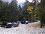
Between Trenta and Bovec, in the village of Soča, a road to Lepena branches off. We follow this fully asphalted road to the parking lot at the Dom dr. Klementa Juga in Lepena.
Route description:
From the Dom dr. Klementa Juga in Lepena we continue on a wide marked path in the direction of the Krn Lakes. The wide and not too steep path splits into two parts after a few minutes of walking. The left one, which is somewhat steeper, is the usual one; the right, gentler and somewhat longer one is suitable for small children and the elderly. Both paths mostly ascend through the forest to the upper station of the cableway and cross each other several times along the way. From the upper station of the cargo cableway we continue on the same path, which gently ascends along the wide transport road that quickly brings us to the snow height measurement (every year in April).
The path ahead starts to descend and after a few steps brings us to a poorly visible junction. We turn left onto a poorly visible footpath that gently descends across a small meadow. The path turn-off is marked (direction Velika Baba).
If we continue straight ahead, the path brings us to the Dom pri Krnskih jezerih (10 min).
The path to Velika Baba brings us after that meadow into a short stretch of forest, after which the path from the Dom pri Krnskih jezerih joins us. The path ahead gently ascends through tall grass and after a few minutes brings us to the slopes below Velika Baba. The path ahead barely noticeably ascends to the left, then makes a turn to the right. Ahead we ascend transversely across the scree in a moderate ascent. On this section beautiful views open up towards Krn. This is followed by a few minutes of steep ascent among dwarf pines to the point where the path brings us below the steep walls of Velika Baba. The path below the wall is nicely routed across the scree, which is partly already overgrown with grass. The path ahead brings us into a small valley between Velika Baba on the left and Velika Montura on the right. On this section the path brings us to a smaller orientation loop.
The path brings us to a junction of marked and unmarked paths.
We turn left in the direction of Velika Baba, a few steps downhill. The path then ascends across a partly grassy and partly rocky slope overgrown with dwarf pines. The path, which in the final section becomes somewhat steeper, quickly brings us with ever better views to the summit of this panoramic mountain.

Photos:
 1
1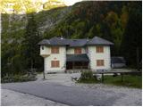 2
2 3
3 4
4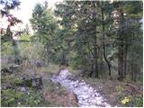 5
5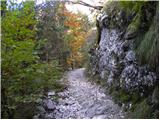 6
6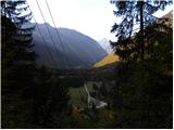 7
7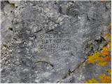 8
8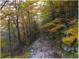 9
9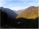 10
10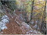 11
11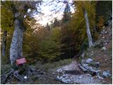 12
12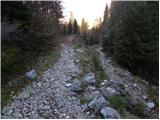 13
13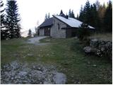 14
14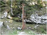 15
15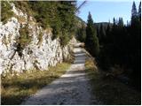 16
16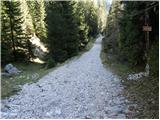 17
17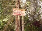 18
18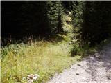 19
19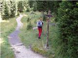 20
20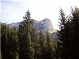 21
21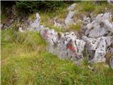 22
22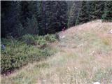 23
23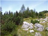 24
24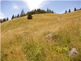 25
25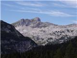 26
26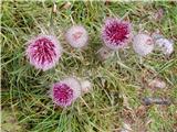 27
27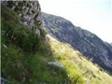 28
28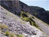 29
29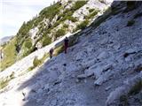 30
30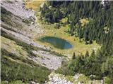 31
31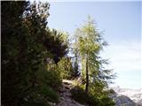 32
32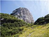 33
33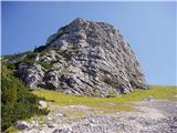 34
34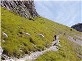 35
35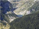 36
36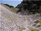 37
37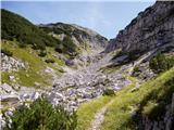 38
38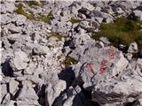 39
39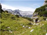 40
40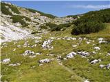 41
41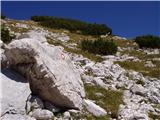 42
42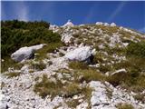 43
43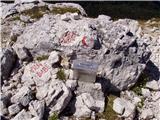 44
44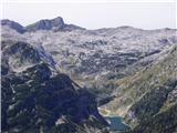 45
45
Discussion about the trip Dom v Lepeni - Velika Baba
|
| odi193m23. 11. 2008 |
I really liked the mountain.
|
|
|
|
| spotonbody24. 06. 2010 |
We climbed this beautiful mountain on 17.06.2010. The path was completely dry, very nice and carefully marked, without precipices, suitable also for the youngest hikers. The summit offers a wonderful view of Krn Lake and its surrounding mountains and on the other side towards the valley of Triglav Lakes. Very nice, less crowded mountain, which I warmly recommend to everyone!
|
|
|
|
| barbarar13. 07. 2010 |
We went to Baba on Sunday end of June and from the junction at the saddle, despite usual traffic to Krnsko jezero, we met no one up or down. Very nice hike and nice views. Heard whistling - marmot? But didn't see it.
|
|
|
|
| dcloud5721. 08. 2010 |
We went to Baba last week. Wonderful trip. On the way up we didn't meet any hikers, on the way down a few.
|
|
|
|
| velkavrh23. 07. 2011 |
I plan to go to Baba next week on Tuesday, as the weather is clearing up. I should go from Savica, over Komna and Bogatinsko sedlo to the lakes. How to get from the lakes to Baba. Do I have to go towards Lepena, since the trail is only described from there. If I understood correctly, the junction to Baba is ten minutes above the hut. If there's no other trail, that's fine too. If there's no other marked trail, I'll take this one, as it's my first time to Baba and I don't like getting lost on unmarked trails or pathless terrain. I regularly manage to turn a premiere tour into one with an hour's extension. Since I'll be returning in the afternoon, I really wouldn't want to lengthen the tour. Thanks! Best regards.
|
|
|
|
| IgorZlodej23. 07. 2011 |
If you're coming from the Komna direction, then the easiest is to turn right at Vratce (Bogatinsko sedlo) on the marked trail to Vrh Gracije and onwards to Lanževica. From there, go on an unmarked path (possibly pathless) to Velika Baba, which isn't far and you can see it all the time in front of you, so you can't miss it. From Baba then down the marked trail to the hut at Krnsko jezero, return via Planina Duplje and behind Lepoče (barracks) back to Bogatinsko sedlo and to Savica, for one day it will be quite long, I suggest overnighting in one of the huts.
|
|
|
|
| velkavrh24. 07. 2011 |
Igor Zlodej, many thanks for the suggested path. I'll try to go along it and at the same time do Lanževica, which I planned to do as a standalone tour. I know this path from Krnska jezera because I've already gone it twice. The last time even through Peske to Krn, then to koča pri Krnska jezera and back to Savica. A 14-hour tour. In the dark from koča on Komna. I haven't done such long tours yet. This year I already had a 12-hour tour around the valley of Triglav Lakes around all the peaks around, so long tours are no problem for me. In fact, I like them the most.
Your tours excite me. Best regards.
|
|
|
|
| Rudi bevc20. 05. 2013 |
On Sunday I’m organizing a trip to Velika Baba so I’m curious about the current conditions on this path?
|
|
|
|
| IgorZlodej20. 05. 2013 |
Current conditions won’t be of much use, if you look at the forecast, Sunday will be quite snowy in those parts, so the paths too.
|
|
|
|
| Rudi bevc21. 05. 2013 |
Igor, many thanks. I was thinking the same, but I needed confirmation. Best hiking regards.
|
|
|
|
| ljubitelj gora14. 10. 2013 |
On a Sunday I decided to visit Velika Baba from Lepena, up to the summit I met no one except 3 chamois watching me. Below the summit there was about 5-10cm. From the summit I continued along the easy ridge to Lanževica and descended from there to Krnsko jezero. There I met 2 hikers who quickly went ahead and saw three more in the distance. Peace, solitude, autumn colors, worth visiting these areas. More photos here: https://picasaweb.google.com/114400986607884783562/LepenaVelikaBabaLanzevicaKrnskoJezero
|
|
|
|
| 1261aleks14. 10. 2013 |
I'm interested in the walking time V. Baba-Lanževica (path condition) Lanževica - v. Montura (time and path condition, is descent better via Bogatinsko sedlo or via Predoline?); another question: walking time and path condition from Lanževica - Oslove škrbine (lepa komna) - pl. za skalo (down behind bajarjem) - pod zjabci, thanks in advance.
|
|
|
|
| ciklama26. 08. 2014 |
I'm interested what the path from V. Baba to Lanževica is like, if it's trodden and easy to follow, or if orientation sense is needed, and how much time I need for this path? Thanks for the answer!
|
|
|
|
| ločanka26. 08. 2014 |
A few years ago I walked this path and have it in very good memory. First descend back along the marked path, which you soon leave and head left through the scree. You reach the saddle between V. Montura and V. Baba and head left again. Follow some kind of pathlet, which later in Predolina somewhat disappears, but with a little orientation the direction to Lanževica is found. In fog however I don't recommend this path, which holds for all pathless terrain anyway.
|
|
|
|
| ciklama2. 09. 2014 |
On Saturday we took this path. From the hut at Krn Lakes we first ascended Velika Baba, descended to the saddle and then climbed V. Montura. Wonderful path and even better views. Lanževica seemed too far to us, and we're not too fond of pathless walking either, so we chose Montura and didn't regret it. How they built paths a hundred years ago that are still usable today - crazy! The next day we climbed another solitary peak, Smohor. Here too the path follows an old mule track and is still full of war remnants. Not to mention the colorful carpets of alpine flowers! This is a hike for the soul! Crowds were swarming on Krn, but on these peaks we were completely, completely alone!
|
|
|
|
| adry1. 06. 2015 |
On Saturday 30.5. on Velika Baba, path below overgrown with brushwood, after screes and turnoff to V.Baba dry, nice solitary tour, met only three chamois. Hut at KJ open, new keeper, friendly. Weather very pleasant warm, at noon fog started on the summit.
|
|
|
|
| sebaseba1. 10. 2015 |
We were at the top today. No snow, but there was lots of mud, fog and wind. The path is well marked.
|
|
|
|
| mornar7. 12. 2016 |
What are the conditions for the path to Velika Baba from Lepena, is there any snow on the path? Thanks for the info.
|
|
|
|
| masker27. 08. 2017 |
Yes, indeed. All hikers rush to Krn, but (at least for me) the ascent to Velika Baba is much more pleasant. No excessive crowds, occasionally you meet rare hikers who also want peaceful wandering in the mountains. So I was yesterday at the summit of Velika Baba. It was really nice. I enjoyed the beautiful clear sunny weather and of course admired the panoramic view from the top. I agree with CIKLAM that this is a hike for the soul. Mountain greetings to all!
|
|
|
|
| tomo_kugy30. 08. 2017 |
Visited yesterday with daughter and since we chatted on the way, we got into the mentioned orientation loop I would suggest one sign for the right turn-off. Otherwise very scenic mountain with easy access. Recommend to all who want over 2000 m and for some reason don't want or can't do airy passages or climbing. And they'll learn peace too, because the mountain really has little visitors . .
|
|
|
|
| Enka30. 08. 2017 |
But the junction is nicely marked, on the rock with large letters it says VELIKA BABA and the arrow points left.
|
|
|
|
| garmont30. 08. 2017 |
Not only on the rock.
Both junctions for Baba are also marked with direction signs.
But it doesn't go further...
|
|
|
|
| tomo_kugy30. 08. 2017 |
The junctions marked with direction signs are not problematic, but the one mentioned in the description as an orientation loop we did miss. The rock on which the direction arrow and inscription are is already set back to the left from the path, that's why I also wrote that the arrow for the junction could be on the right side of the path, because the wrong path going straight is much more obvious than the right one. I believe I'm not the first to go wrong, otherwise it probably wouldn't be mentioned in the description itself. Anyway, it was a nice day, 45 minutes of pathless terrain didn't kill us either. Have a nice day.
|
|
|
|
| mornar24. 06. 2018 |
I would like information about the path from Velika Baba to Lepoče past Montura. I'm interested in traceability and passability. Best regards.
|
|
|
|
| Enka24. 06. 2018 |
We went under Montura last year. Sometimes it's a path, sometimes pathless, then you glimpse the path again, then it's gone again... You can hardly get lost, as the direction is clear. Basically, you're looking for the easiest passages, without special difficulties.
|
|
|
|
| Kanjanez20. 07. 2019 |
I also missed the junction (picture 39) and went a bit around Therefore attention really isn't superfluous.
|
|
|
|
| Tolminc26. 05. 2020 |
Hello, I'm interested if someone has been to Velika Baba recently. What are the conditions, is there still any snow on the path? Thanks and safe steps
|
|
|
|
| lubadar15. 05. 2022 18:42:20 |
Velika Baba never disappoints, snow on the path is no obstacle, path passable without winter gear.
|
|
|
|
| bo_zl17. 10. 2022 21:20:29 |
Yesterday up, this Baba is a splendid viewpoint.
|
|
|
|
| inferno6664. 08. 2024 14:29:21 |
Yesterday at the summit. The path is newly marked and easy to follow. On the way back, we joined the path from Dom na Komni to Krnsko jezero via pathless terrain. Except for the first few meters, it is later nicely marked with cairns. From where we branched off for Velika Baba to the junction with the Komna highway, we didn't meet anyone. The views are balm for the soul.
|
|
|
|
| tadej123423. 09. 2024 19:43:20 |
no stamp at the summit
|
|
|
|
| miri24. 09. 2024 16:11:16 |
@tadej1234, with such views as it offers you, I don't miss it at all.
|
|
|
|
| Primozz_944. 06. 2025 13:03:47 |
I'm planning to go on Sunday with my wife from Lepena and I'm wondering if anyone has been recently and if there are any snow patches left anywhere?
Best, Primož
|
|
|
|
| mirank4. 06. 2025 13:28:52 |
Primož, I don't know why you're asking under commented trips and not under current conditions, where it belongs, and there I can send you a photo taken from the top of Krn. It's quite far away, but according to the photo, there's no snow left anywhere there anymore.
LP
|
|
|
|
| Primozz_945. 06. 2025 07:15:13 |
@mirank
Sorry I didn't post in conditions, I found Velika Baba here first, thanks for the info, so it should be fine without problems.
Best, Primož
|
|
|
|
| glorija8. 06. 2025 15:33:27 |
I'm wondering how long it takes from the saddle to V. Baba to V.
monture? Thanks for the answer. LP
|
|
|
|
| Evjuna8. 06. 2025 21:18:56 |
If memory serves me right, less than three quarters of an hour.
|
|
|
|
| glorija15. 06. 2025 15:17:00 |
Heartfelt thanks Evjuna. Happy and safe steps everywhere.🐞🍀🥾
|
|
|
|
| brett5. 08. 2025 13:57:07 |
I'm interested if the route is feasible: Lepena - Velika Baba - Lanževica - Bogatin - Krn. jezero (past Bog. sedla and Za Lepočami) - Lepena? Any peculiarities on the path?
We'd go this Saturday; one day, fitness is no issue.
Thanks!
|
|
|
|
| Enka5. 08. 2025 16:19:04 |
The path between V. Baba and Lanževica is not marked, but shown on some apps and usually followable. No other issues. Nice loop.
|
|
|
|
| Evjuna5. 08. 2025 22:18:32 |
Best to bypass the scree under Velika Baba towards Predolina more to the right. One day will surely suffice for you.
|
|
|
|
| brett6. 08. 2025 08:03:15 |
Thanks for the useful tips.
How much does this loop amount to in distance and elevation gain? Just out of curiosity
I'd say roughly cca 22km and 1700m elevation gain.
|
|
|
|
| Enka6. 08. 2025 10:49:31 |
You estimated quite well, including the visit to Krnsko jezero it's about 1 km less, the elevations hold true.
|
|
|
To post a comment you must log in:
If you do not yet have a username, you must first
register.