Dorfarje - Archangel Gabriel (Planica)
Starting point: Dorfarje (380 m)
| Latitude/Longitude: | 46,19750°N 14,31730°E |
| |
Walking time: 2 h
Difficulty: easy unmarked way
Elevation gain: 444 m
Elevation difference along the route: 500 m
Map: Škofjeloško in Cerkljansko hribovje 1:50.000
Recommended equipment (summer):
Recommended equipment (winter): crampons
Views: 1.443
 | 1 person like this post |
Access to starting point:
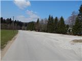
A) From Ljubljana, we drive to Medvode, and from there we continue driving towards Škofja Loka. When we get to Škofja Loka, we don't drive into the center, but we continue "straight" in the direction of Kranj. In the settlement Dorfarje we notice signs for Crngrob, which point us to the left, on the road which further leads through the mentioned village. First, we drive past the furniture salon Prevc, then past the turn-off towards the farm pri Brojanu, and further also past the tree nurseries Cegnar and Zakotnik, and then the quite narrow road which runs through the village widens a little. After the village follows a short descent and the route brings us to a larger parking lot, which is situated by the shooting range of the Slovenian army.
B) First, we drive to Kranj, and from there we continue driving towards Škofja Loka. Before we get to Škofja Loka, in the settlement Dorfarje we continue right in the direction of the settlement Crngrob. First, we drive past the furniture salon Prevc, then past the turn-off towards the farm pri Brojanu, and further also past the tree nurseries Cegnar and Zakotnik, and then the quite narrow road which runs through the village widens a little. After the village follows a short descent and the route brings us to a larger parking lot, which is situated by the shooting range of the Slovenian army.
C) From Žirov, Cerknega or Železnikov we drive to Škofja Loka, and from there we continue in the direction of Kranj. In the settlement Dorfarje we notice signs for Crngrob, which point us to the left, on the road which further leads through the mentioned village. First, we drive past the furniture salon Prevc, then past the turn-off towards the farm pri Brojanu, and further also past the tree nurseries Cegnar and Zakotnik, and then the quite narrow road which runs through the village widens a little. After the village follows a short descent and the route brings us to a larger parking lot, which is situated by the shooting range of the Slovenian army.
Route description:
From the parking lot, we return on the road back to Dorfarje, and there at two successive crossroads we continue left. Behind the last house, the asphalt ends, and we continue on a cart track which leads us past the hayrack. Further, we walk for a short time across a larger meadow, and then the already entirely grassy cart track turns left and descends a little. After a short descent, we approach the bed of the stream, which we then cross with the help of a wooden footbridge. On the other side of the footbridge we continue along the stream for some time, and then a beaten but unmarked path starts to ascend gently. After a few minutes, we reach a cart track, which we follow to the left, walking along it to the place where it crosses a smaller streamlet. Immediately after the streamlet we go slightly left onto a beaten path, which again starts to ascend gently. Higher up the path enters the forest and a little further joins the next cart track, along which we ascend moderately for some 10 steps, then it levels out and brings us to the ridge and a little further to a junction. From the junction we continue on the right cart track, and from it after some 10 steps slightly left onto a steep footpath, which continues along the forested ridge. After a few minutes of steep ascent we reach the indistinct summit of Pošpoh (626 m), from which a view opens towards Šmarjetna gora through the treetops.
Follows a gentle descent, then the path widens into a cart track. A little further, at a smaller junction we continue slightly left, then for some time we ascend across. Further the path leads us also past the NOB memorial park, and behind it in a few minutes we arrive at the turning area of the nearby road. We continue on the road, which temporarily descends a little, then brings us out of the forest, where it leads past a beehive stand and a hunting observation post. Follows a short walk and we join the marked path from Crngrob.
We continue straight ahead on the road, which becomes asphalted and which brings us past a bench and a water trough to a somewhat larger crossroads, where we continue left in the direction of Planica (here to the right and straight from the path we will notice the NOB marker). The path ahead leads us along the asphalt road, on which we quickly arrive at the settlement Planica, where at the first houses we continue sharply right in the direction of the church on Planica. At the nearby marker (cross) we leave the road and continue on a pleasant path, which starts to ascend moderately. The path continues through the forest, only on the section where the path leads past a weekend house does a nice view open up temporarily, reaching to Polhograjsko hribovje and Lubnik. Higher up the path brings us to an indistinct ridge, along which in one or two more minutes of walking we arrive at the church of St. Archangel Gabriel on Planica.
Description and pictures refer to the condition in 2015 (March).

Photos:
 1
1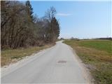 2
2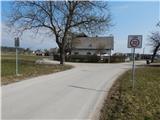 3
3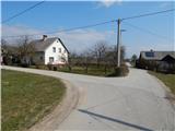 4
4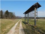 5
5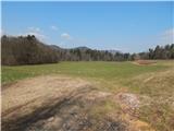 6
6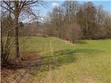 7
7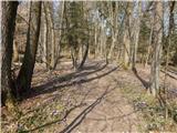 8
8 9
9 10
10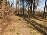 11
11 12
12 13
13 14
14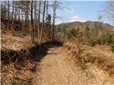 15
15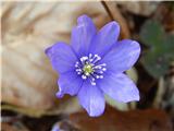 16
16 17
17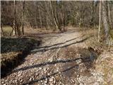 18
18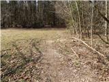 19
19 20
20 21
21 22
22 23
23 24
24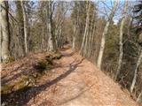 25
25 26
26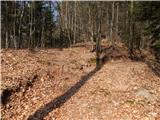 27
27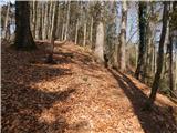 28
28 29
29 30
30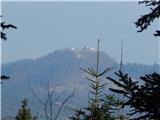 31
31 32
32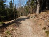 33
33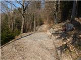 34
34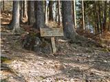 35
35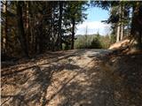 36
36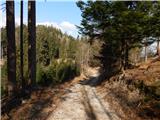 37
37 38
38 39
39 40
40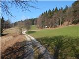 41
41 42
42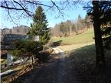 43
43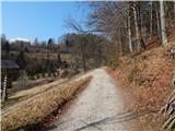 44
44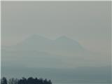 45
45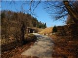 46
46 47
47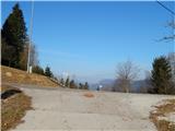 48
48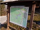 49
49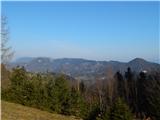 50
50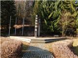 51
51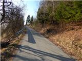 52
52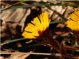 53
53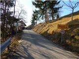 54
54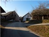 55
55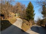 56
56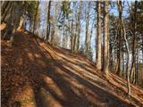 57
57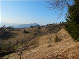 58
58 59
59 60
60 61
61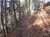 62
62 63
63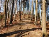 64
64 65
65 66
66
Discussion about the trip Dorfarje - Archangel Gabriel (Planica)
To post a comment you must log in:
If you do not yet have a username, you must first
register.