Dösner Alm - Dösner Hütte
Starting point: Dösner Alm (1448 m)
| Latitude/Longitude: | 46,97980°N 13,20790°E |
| |
Walking time: 2 h 15 min
Difficulty: easy marked way
Elevation gain: 528 m
Elevation difference along the route: 528 m
Map:
Recommended equipment (summer):
Recommended equipment (winter):
Views: 3.328
 | 1 person like this post |
Access to starting point:
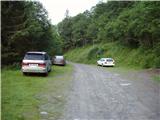
From Spittal we drive towards Lienz, but only to the settlement Möllbrücke. In the mentioned settlement we notice signs for Mallnitz and the alpine road to Großglockner. We follow this road to the settlement Obervellach, where signs for Mallnitz direct us to the right. Behind the village, the road starts ascending steeper and after a few kilometers of ascent brings us to the alpine town Mallnitz. Only a little before the railway station in the mentioned settlement the road branches off to the right in the direction of the mountain pasture Dösner Alm. The steep and narrow road brings us higher to a poorly marked crossroad, where we continue on the lower macadam road. Further we cross a grazing fence and only a little further we come to the parking lot, where we park.
Route description:
From the parking lot, we continue on a macadam road which after a few dozen steps brings us to the trail junction. We continue left on a wide cart track which after a short ascent brings us to the mountain pasture Dösner Alm.
On the mountain pasture, we return to the road which further barely noticeably ascends along the edge of the mountain pasture upwards. Further ahead the road ascends a little more steeply and brings us to the hut Konradhütte (1600m).
Only a few steps ahead on the left side of the road, we notice a smaller pond, which in high waters rises right to the edge of the road. At the end of the pond the road changes into a pleasant footpath which then in a moderate ascent leads along the stream upwards. After a half-hour ascent from the hut Konradhütte we slowly emerge from the forest onto more and more panoramic slopes. The path which then becomes increasingly steep suddenly flattens and brings us to nice high-alpine pastures at the hut Dösner Hütte (1976m).

Photos:
 1
1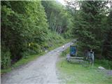 2
2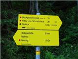 3
3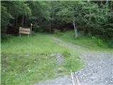 4
4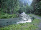 5
5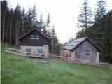 6
6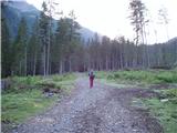 7
7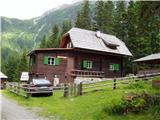 8
8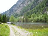 9
9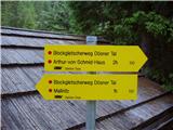 10
10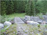 11
11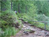 12
12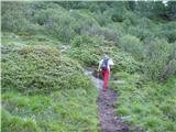 13
13 14
14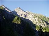 15
15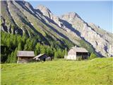 16
16
Discussion about the trip Dösner Alm - Dösner Hütte
To post a comment you must log in:
If you do not yet have a username, you must first
register.