Dösner Alm - Säuleck (Klettersteig)
Starting point: Dösner Alm (1448 m)
| Latitude/Longitude: | 46,97980°N 13,20790°E |
| |
Route name: Klettersteig
Walking time: 6 h 30 min
Difficulty: extremely difficult marked way
Via ferrata: D/E
Elevation gain: 1638 m
Elevation difference along the route: 1650 m
Map:
Recommended equipment (summer): helmet, self belay set
Recommended equipment (winter): helmet, self belay set, ice axe, crampons
Views: 7.358
 | 2 people like this post |
Access to starting point:
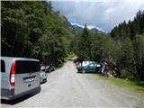
From Ljubljana through the Karawanks Tunnel to Spittal. Further we drive towards Lienz, but only to the settlement Möllbrücke. In the mentioned settlement we notice signs for Mallnitz and the alpine road to Großglockner. We follow this road to the settlement Obervellach, where signs for Mallnitz direct us to the right. Behind the village, the road starts to ascend more steeply and after a few kilometers of ascent brings us to the alpine town Mallnitz. Just a little before the railway station in the mentioned place a road branches off to the right in the direction of the mountain pasture Dösner Alm. The steep and narrow road brings us higher to a poorly marked junction, where we continue on the lower macadam road. Further we cross a pasture fence and only a little further we come to the parking lot, where we park.
Route description:
From the parking lot, we continue on a macadam road which after a few dozen steps brings us to a path junction. We continue left on a wide cart track which after a short ascent brings us to the mountain pasture Dösner Alm.
On the mountain pasture, we return to the road which further barely noticeably ascends along the edge of the mountain pasture upwards. Further the road ascends a little more steeply and brings us to the hut Konradhütte (1600 m).
Only a few steps further on the left side of the road we notice a smaller lake, which in high waters rises right to the edge of the road. At the end of the lake the road changes into a pleasant footpath which then in a moderate ascent leads along the stream upwards. After a half-hour ascent from the hut Konradhütte we slowly pass from the forest to increasingly panoramic slopes. The path, which was then becoming steeper and steeper, suddenly flattens and brings us to beautiful high-alpine pastures at the hut Dösner Hütte (1976 m).
A gentle ascent follows across the pasture to a somewhat steeper section, where we can hear the roaring of the rushing stream. After a further 15 minutes the steepness eases and the path brings us to a high-alpine cirque, where several streams converge. Further we cross the stream over a bridge and then ascend one level higher on an increasingly steep path. Throughout the ascent we are accompanied by the roaring of the stream Dösenbach. When the path flattens we cross the stream again and the path brings us to the alpine hut Arthur Von Schmid Haus, which is located by the lake Dösner See.
From the hut we continue left in the direction of Säuleck on the path which already after a few dozen steps starts to ascend steeply. After 15 minutes of steep ascent the steepness eases and the path turns right. Further we ascend parallel to the lake, which we occasionally see to the right below us. After a further few minutes of ascent through high-alpine terrain full of granite slabs we reach a marked junction.
At the junction we continue left towards the climbing path (Klettersteig-Säuleck), straight ahead leads the easier path to Säuleck. From the junction we first walk on rock slabs, then follows a shorter ascent over scree which brings us below the wall where the entrance to the climbing section of the path is.
At the beginning the climbing path turns right and ascends diagonally across smooth slabs. The path here is not overly steep yet, but since there are not many footholds on the path some arm strength is still needed (difficulty D and C/D). The path then becomes easier for a short time. Here the path is not secured and first crosses the slope to the left then follows a shorter ascent which brings us before the more demanding section of the path. On this section the path first ascends almost vertically (D/E), then turns slightly to the right and still ascends quite steeply along the steel cable. A demanding vertical ascent follows (D/E). Since the path is secured only with a steel cable considerable arm strength is needed. After the vertical section we ascend somewhat more steeply once more, then the path becomes somewhat less steep (B). Such a path then brings us to the logbook box where there is also a suitable spot for a rest.
From the logbook box the path again ascends very steeply several times along the steel cable (C/D and D). A short descent follows and then a short vertical ascent (D/E). In the continuation the path becomes a shade less demanding and brings us to the ridge from which a view opens towards the peaks Ankogel and Hochalmspitze.
The path in the continuation runs along the secured ridge the whole time and ascends and descends steeply several times. The ascents and descents are mostly very short and therefore somewhat less demanding than those in the first part of the secured path. Along the panoramic ridge we then soon reach the summit.
We descend along the easier path which runs across the gentler southern slopes of the mountain.
The described path is extremely demanding and is suitable only for experienced mountaineers with sufficient arm strength. The use of a helmet and self-belaying is mandatory, the use of climbing gloves is also highly recommended.

Photos:
 1
1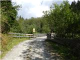 2
2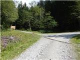 3
3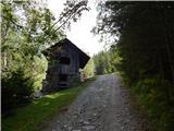 4
4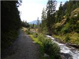 5
5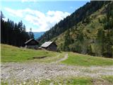 6
6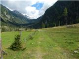 7
7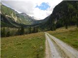 8
8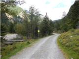 9
9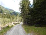 10
10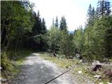 11
11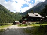 12
12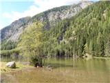 13
13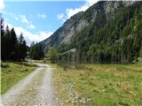 14
14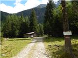 15
15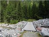 16
16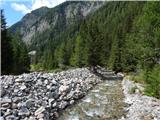 17
17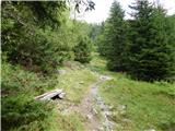 18
18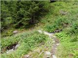 19
19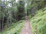 20
20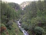 21
21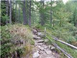 22
22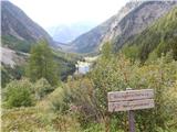 23
23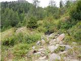 24
24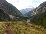 25
25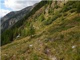 26
26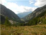 27
27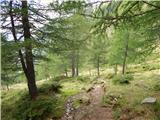 28
28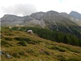 29
29 30
30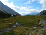 31
31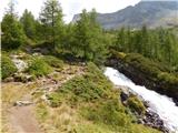 32
32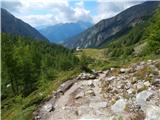 33
33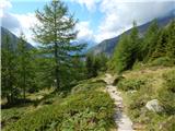 34
34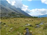 35
35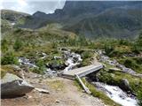 36
36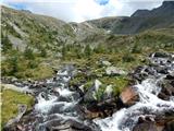 37
37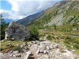 38
38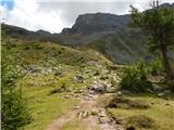 39
39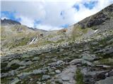 40
40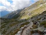 41
41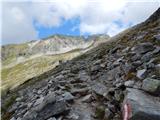 42
42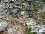 43
43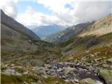 44
44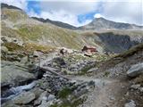 45
45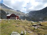 46
46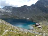 47
47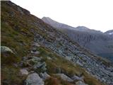 48
48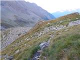 49
49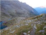 50
50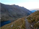 51
51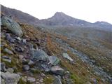 52
52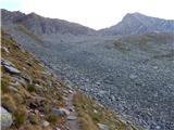 53
53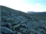 54
54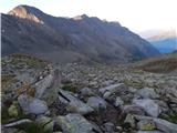 55
55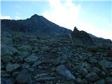 56
56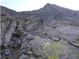 57
57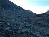 58
58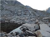 59
59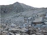 60
60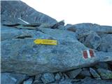 61
61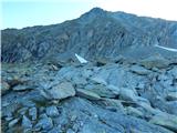 62
62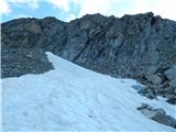 63
63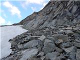 64
64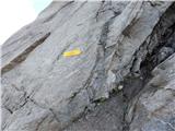 65
65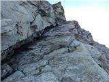 66
66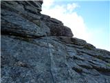 67
67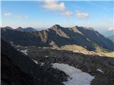 68
68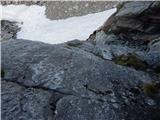 69
69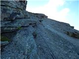 70
70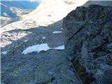 71
71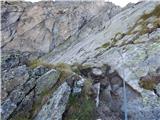 72
72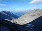 73
73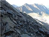 74
74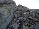 75
75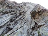 76
76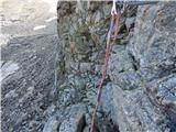 77
77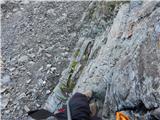 78
78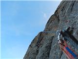 79
79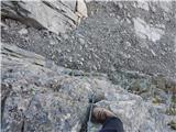 80
80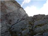 81
81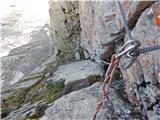 82
82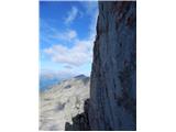 83
83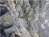 84
84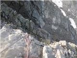 85
85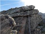 86
86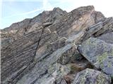 87
87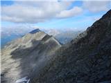 88
88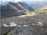 89
89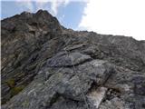 90
90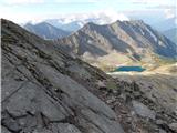 91
91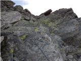 92
92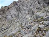 93
93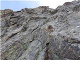 94
94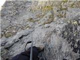 95
95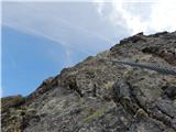 96
96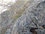 97
97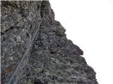 98
98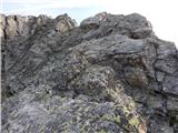 99
99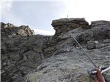 100
100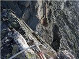 101
101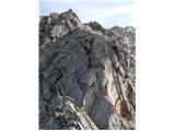 102
102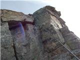 103
103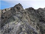 104
104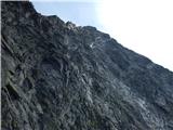 105
105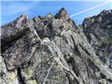 106
106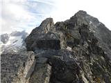 107
107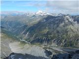 108
108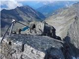 109
109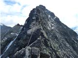 110
110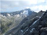 111
111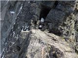 112
112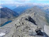 113
113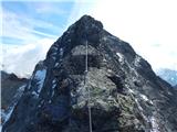 114
114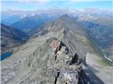 115
115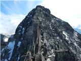 116
116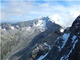 117
117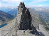 118
118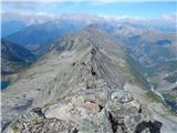 119
119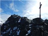 120
120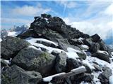 121
121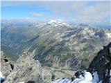 122
122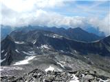 123
123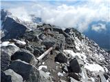 124
124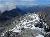 125
125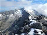 126
126
Discussion about the trip Dösner Alm - Säuleck (Klettersteig)
To post a comment you must log in:
If you do not yet have a username, you must first
register.