Dovje - Frauenkogel/Dovška Baba
Starting point: Dovje (760 m)
| Latitude/Longitude: | 46,46870°N 13,96030°E |
| |
Walking time: 3 h
Difficulty: easy marked way
Elevation gain: 1131 m
Elevation difference along the route: 1131 m
Map: Kranjska Gora 1:30.000
Recommended equipment (summer):
Recommended equipment (winter): ice axe, crampons
Views: 82.777
 | 3 people like this post |
Access to starting point:
We leave the Gorenjska motorway at the Hrušica exit and follow the road ahead in the direction of Kranjska Gora, but only to the village of Dovje at Mojstrana. Here we turn right (direction Dovje) and the road quickly brings us to the mentioned village from where we continue in the direction of Dovška Baba. The road soon after the village brings us to a crossroad, where we continue on the right road (sharply left Kepa and Borovje). We follow this road for a good 100 meters, after which we cross the bridge over the stream Mlinca, after which on the left side we notice mountain signposts for Dovška Baba. We park on one of the parking lots by the road.
Route description:
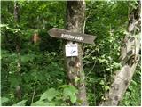
The signposts for Dovška Baba point us to the left on a footpath which starts ascending through the forest. After a few minutes of ascent we step out of the forest onto a somewhat larger clearing, where we also step onto a cart track. We continue the ascent on the cart track which past a smaller cottage brings us to the spot where they are building a new house (holiday cottage).
Here the cart track ends, and we continue behind the house on an initially somewhat poorly visible footpath. The path quickly passes into a dense forest, where with the exception of some smaller panoramic clearings it continues all the way to the abandoned mountain pasture Goreljše.
Here the path turns left, ascends past the cottage and after a short ascent brings us to a cart track which in a moderate ascent we follow towards the east. After a few minutes of panoramic walk across the mountain pasture, the path brings us to the next decaying cottage, behind which we continue left and after a few additional steps we step onto the forest road.
We only cross the mentioned road and continue the ascent on the marked path which returns into the forest. We continue the ascent through pleasant forest which ends on the screes of Bela peč. Over scenic landscape we ascend in a gentle ascent, then the path passes into the forest where it continues all the way to the forest road.
We continue the ascent on the road which after a few steps brings us to the spot where we leave it, as the blazes direct us left onto a steep footpath which further ascends through the forest. Higher the path crosses a grazing fence and a short panoramic slope, then returns into the forest where we reach a smaller unmarked junction. We continue left on the marked path (straight to the spring Studenček Starka 1 minute) which steeply ascends again, then turns slightly to the right, after a few minutes of further walking bringing us to the lower edge of the mountain pasture Dovška Rožca. Here the path turns left and after a few minutes of ascent over blooming meadows brings us to the shepherd's hut on the mountain pasture Dovška Rožca.
From the mountain pasture we continue straight upwards towards the northeast on a well-visible but poorly marked path which starts ascending on the increasingly panoramic slope of Dovška Baba. A pleasant path which ascends along the edge of a panoramic side ridge higher flattens and turns slightly to the right, where we step onto the main ridge of the Karavanks. Here ahead of us we spot the not very compact summit of Dovška Baba which we reach after less than 5 minutes of further walking.

Photos:
 1
1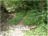 2
2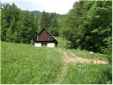 3
3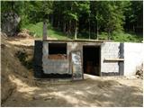 4
4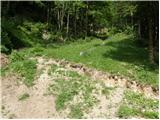 5
5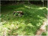 6
6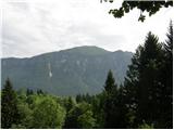 7
7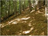 8
8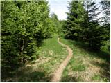 9
9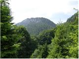 10
10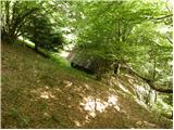 11
11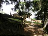 12
12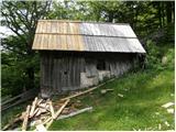 13
13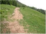 14
14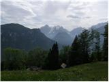 15
15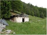 16
16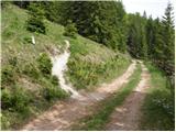 17
17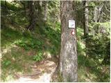 18
18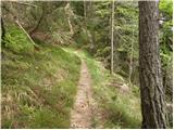 19
19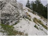 20
20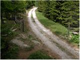 21
21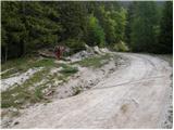 22
22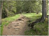 23
23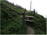 24
24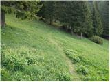 25
25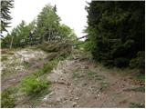 26
26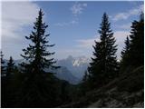 27
27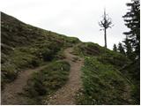 28
28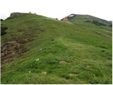 29
29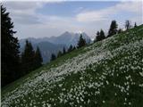 30
30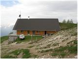 31
31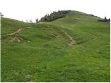 32
32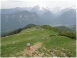 33
33 34
34 35
35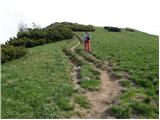 36
36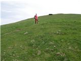 37
37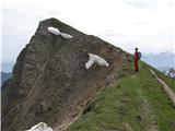 38
38 39
39
Discussion about the trip Dovje - Frauenkogel/Dovška Baba
|
| kr neki21. 01. 2011 |
Does anyone know what the conditions on this trail are like?
Thanks
|
|
|
|
| zvončnica5. 05. 2011 |
Hi!
Can anyone tell me something about Dovška Baba, I'd kindly ask, has anyone been up there recently, is any hut open? Thanks, best regards
|
|
|
|
| grinhorn5. 05. 2011 |
@zvončica
Hey, I was up there for Easter from Ravan at the ramp. The path is nice and snow is only left on the shady side, meaning on this path you see it only from afar. From the shepherd hut on planina Dovška Rožca onwards there is beautiful view all the way and you go on grass to the top. For the hut though I think it wasn't open yet then 
|
|
|
|
| rs75610. 09. 2011 |
On Friday 9.9.11 visited Dovška Baba from Dovje. Nice weather, solitude, except cattle on pasture no one, chat with shepherd, to the top and back to valley. Nice.
|
|
|
|
| Ajda_Zitnik10. 09. 2012 |
I walked the path on Saturday, 8.9.2012.
Path steep, given the ground I'd say it can be slippery and dangerous in wet weather.
I'd change the path description only that much - that hut is now already built that weekend.
There is no hut like a mountain hut along the path, on planina Dovška rožca there is a shepherd's hut where at least this year you could refresh with sour milk and drink something. But the shepherds said they would drive the cows to the valley on Sunday, i.e. yesterday 9.8.2012, so they are no longer up there now.
|
|
|
|
| Janiel741. 05. 2013 |
Nice little path, higher up very scenic. There's actually no snow anymore.
|
|
|
|
| andrejp30. 04. 2015 |
yesterday up there, fantastic views, back at the cabin right towards Kepa, then lower down the path to Dovje branches off to the left (right Kepa) and brings you to the starting point. Beautiful circular tour
|
|
|
|
| B22. 05. 2015 |
Can someone tell me how long from Dovška Baba to the top of Kepa and from Dovška Baba to the hut on Golica. Thanks for the info!
|
|
|
|
| Gost2. 05. 2015 |
From the Dovška Rožca pasture to Kepa it's about two to two and a half hours, to the other side to Golica about three hours. It depends a lot on how fast you walk.
|
|
|
|
| B23. 05. 2015 |
So, Dovška Baba is somehow "time-wise" in the middle of the Golica - Kepa path. Many thanks for the answer!
|
|
|
|
| Beorn27. 03. 2016 |
Today I walked this trip in nice weather. About halfway the snow line starts, the snow was already quite spring-like and sinking a lot. To the hut practically in a t-shirt  from the hut onwards it started to blow. Pleasant tour. from the hut onwards it started to blow. Pleasant tour.
|
|
|
|
| zajko17. 12. 2016 |
Today from Dovje to Baba and also to Koprivnjak on the Austrian side. Very nice sunny, no snow and wonderful views. Total ascent 1250m in 6 hours of walking.
|
|
|
|
| Minaja25. 07. 2017 |
Mountaineering friends, hello!
If someone is perhaps visiting Dovška Baba in the near future, please let me know (privately). I would have one request. Thanks in advance.
I wish you safe steps. 
|
|
|
|
| LidijaJesih17. 09. 2017 |
Paths change, the huts in pictures 3 and 16 are no longer there, the one in picture 4 has grown into a nice weekend house.
|
|
|
|
| misace24. 03. 2018 |
Yesterday quickly after work to see what comes from Planica  Dovška slope, tonight better wait under Baba too From first planina gaiters, few degrees to Belih peči break through to mogul highway. There along edge of piled snow as much as possible. On clearing direct to ridge. No excessive sinking. For summit sit a bit more. Dovška slope, tonight better wait under Baba too From first planina gaiters, few degrees to Belih peči break through to mogul highway. There along edge of piled snow as much as possible. On clearing direct to ridge. No excessive sinking. For summit sit a bit more.
|
|
|
|
| dekichan2. 05. 2018 |
Dry all the way to the top. Today was a great day for hiking, but rather bad for views.
|
|
|
|
| Mrki27. 12. 2018 |
The path description and photos need to be updated with the current state:
- the shack in photo 3 is no longer there,
- the building in photo 4 has been extended for some years,
- the collapsing hut in photo 16 is no longer there; a new building is under construction at that location.
Nature, however, has remained as it was.
|
|
|
To post a comment you must log in:
If you do not yet have a username, you must first
register.