Dragomer - Liparjev grič (on cart track)
Starting point: Dragomer (297 m)
| Latitude/Longitude: | 46,01810°N 14,38680°E |
| |
Route name: on cart track
Walking time: 20 min
Difficulty: easy unmarked way
Elevation gain: 77 m
Elevation difference along the route: 77 m
Map: Ljubljana - okolica 1:50.000
Recommended equipment (summer):
Recommended equipment (winter):
Views: 299
 | 2 people like this post |
Access to starting point:
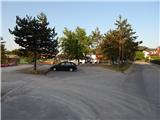
From the Ljubljana - Koper motorway, take the Dragomer exit, then continue driving on the parallel old road towards Vrhnika. Soon at the traffic-light-controlled intersection, turn right towards the center of Dragomer. Immediately after leaving the main road, a marked path branches off to the right, initially a road towards Debelem hrib. Park somewhere in Dragomer, best near the sports field.
Route description:
The path first leads us along an asphalt road, from which a nice view of Dragomer opens up. The asphalt soon ends, and the road enters the forest. We continue past a bench, where a marked path branches off, but we go straight past a few houses, the road gets asphalt again. Soon we watch for a junction, where we turn right and immediately reach another junction, continue straight or right, both paths lead to the destination. The cart track enters the forest, makes a sharp bend and climbs for some time to the next intersection, where the other path variant joins. We continue slightly right onto the path that leads to a meadow. We follow it to the forest and then turn left onto pathless terrain and in a few steps we are on the grassy summit of Liparjev grič.
Description and photos (except the first) refer to the conditions in September 2022.
Photos:
 1
1 2
2 3
3 4
4 5
5 6
6 7
7 8
8 9
9 10
10 11
11 12
12 13
13 14
14 15
15 16
16 17
17
Discussion about the trip Dragomer - Liparjev grič (on cart track)
To post a comment you must log in:
If you do not yet have a username, you must first
register.