Dragonja (Križišče) - Sveti Duh (Sveti Peter) (northwest path)
Starting point: Dragonja (Križišče) (34 m)
| Latitude/Longitude: | 45,45430°N 13,66210°E |
| |
Route name: northwest path
Walking time: 1 h 15 min
Difficulty: easy marked way
Elevation gain: 219 m
Elevation difference along the route: 250 m
Map:
Recommended equipment (summer):
Recommended equipment (winter):
Views: 4.694
 | 2 people like this post |
Access to starting point:
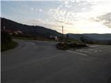
First, we drive to Koper, and from there we continue driving in the direction of Pulj / Pula through the border crossing Dragonja. A few hundred meters before the national border, at the traffic-light crossroads we continue left (straight border crossing Dragonja, right Sečovlje) in the direction of Dragonja. Further on, we drive through Dragonja, and then at the next crossroads we continue slightly left in the direction of the villages Sveti Peter and Nova vas. From the mentioned crossroads, we drive on the main road a few hundred meters more, and then we arrive at a sort of triangular crossroads, where to the left a road branches off towards Sveti Peter, straight ahead the road continues through the valley of Dragonja, and on the right we notice a bus stop. At the mentioned crossroads begins the described footpath towards Sveti Peter or the church of the Holy Spirit. At the starting point, there are no arranged parking spots.
Route description:
From the bus stop, we continue in the direction of Sveti Peter and Nova vas on an ascending asphalt road. After a few hundred meters, at the first left bend to the right branches off the southeastern path, and we continue on the asphalt road, which past the sign that marks the end of the settlement Dragonja brings us also to the right bend. Approximately a minute ahead from the bend, across the road there is a smaller already asphalted passage, at which a marked footpath branches off to the left (the branch-off is not specifically marked), which a little higher, at the stop sign, returns to the asphalt road. We reach the road at the right bend, and we already leave it in the middle of the bend, as the blazes lead us left onto a side macadam road, which further on crosses the slopes. The gentle road after a few minutes turns into a cart track, and at a few smaller junctions we carefully follow the quite frequent blazes. Past a few hunting observatories the path gradually passes into a denser forest, where it still continues without major changes in elevation. There follow a few smaller junctions, then the path leads us past two streams, which in the dry period dry up, but in the time after abundant rainfall they are quite picturesque and full of beautiful rapids. After crossing the second stream the path becomes somewhat steeper and from the forest passes into a belt of shrubbery, so that occasionally some views open up on the other side of the Drnica valley, where we can observe the village Korte. Higher we reach olive groves, past which a partly stony cart track leads us. Above the grove a nice view opens up on the nearby and distant hills, and the path at the direction sign, which otherwise marks the direction of descent, directs us left onto a wider cart track. After rain the quite muddy cart track leads us steeply upwards for a few minutes, then turns right and past a smaller pond brings us to the asphalt road and consequently to the "first" houses in the village Sveti Peter. During the ascent through the village we will also come to one of the sights of the place - Tonine hiše (Tonina hiša was mostly built in the 18th and 19th century, today it is part of the ethnological collection in Sv. Petru).
At the crossroads above the mentioned house we continue left, then past a few more houses, including the Vojvoda farm where we can buy homemade olive oil and the Kulturni dom Sveti Peter, we walk to the crossroads at the well.
At the well we continue right (if at the well we go straight and then after a few meters right we can also reach the church of sv. Petra from the 18th century) in the direction of the villages Krkavče and Dragonja. The path further leads us along a somewhat narrower asphalt road, from which soon to the left branches off the already mentioned marked footpath. From the mentioned junction onwards there are no more blazes, but orientation is not difficult, as we constantly follow the ascending asphalt road, which quickly brings us to the cemetery church Sv. Duha on a 253-meter-high hill, from which a nice view opens up, which on good visibility reaches all the way from the sea to the Alps.
Description and pictures refer to the condition in the year 2014 (November).

Photos:
 1
1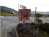 2
2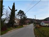 3
3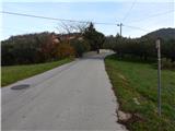 4
4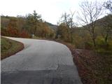 5
5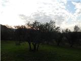 6
6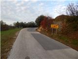 7
7 8
8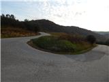 9
9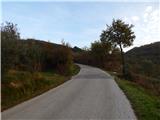 10
10 11
11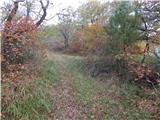 12
12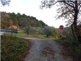 13
13 14
14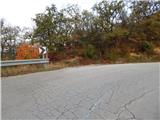 15
15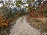 16
16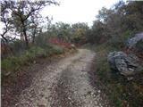 17
17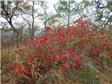 18
18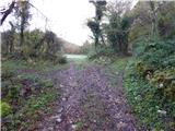 19
19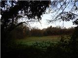 20
20 21
21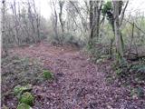 22
22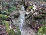 23
23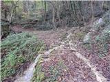 24
24 25
25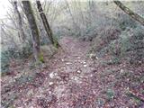 26
26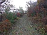 27
27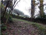 28
28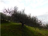 29
29 30
30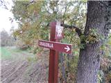 31
31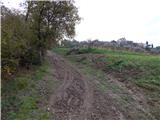 32
32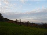 33
33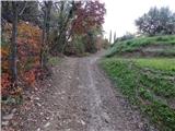 34
34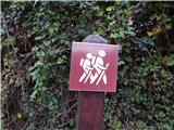 35
35 36
36 37
37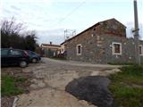 38
38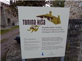 39
39 40
40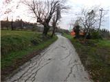 41
41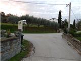 42
42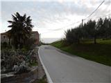 43
43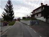 44
44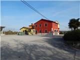 45
45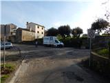 46
46 47
47 48
48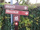 49
49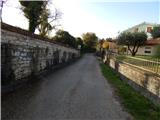 50
50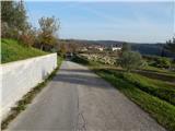 51
51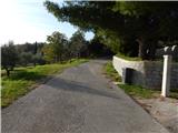 52
52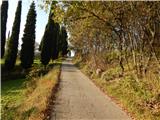 53
53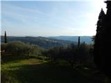 54
54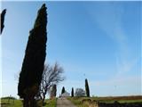 55
55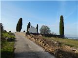 56
56 57
57
Discussion about the trip Dragonja (Križišče) - Sveti Duh (Sveti Peter) (northwest path)
To post a comment you must log in:
If you do not yet have a username, you must first
register.