Dravograd (na Meži) - Skala (above Dravograd)
Starting point: Dravograd (na Meži) (363 m)
| Latitude/Longitude: | 46,58530°N 15,02640°E |
| |
Walking time: 25 min
Difficulty: easy marked way
Elevation gain: 162 m
Elevation difference along the route: 162 m
Map: Koroška 1:50.000
Recommended equipment (summer):
Recommended equipment (winter): ice axe, crampons
Views: 2.260
 | 1 person like this post |
Access to starting point:
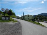
A) From Slovenj Gradec or Ravne na Koroškem we drive to Dravograd, and then still before we cross the river Drava we continue right (we turn right at the first right junction). Next follows crossing the railway track, and then we are already at the beginning of the described path at the Agricultural and Forestry Cooperative Koroška (Kmetijsko gozdarska zadruga Koroška). At the starting point, there are no organised parking spots for hikers.
B) From Maribor we drive to Dravograd, where we continue left towards Slovenj Gradec and Ravne na Koroškem. After the bridge over the river Drava we continue on the second street to the left. Next follows crossing the railway track, and then we are already at the beginning of the described path at the Agricultural and Forestry Cooperative Koroška (Kmetijsko gozdarska zadruga Koroška). At the starting point, there are no organised parking spots for hikers.
Route description:
On the other side of the railway track we go right, then in front of the Agricultural and Forestry Cooperative Koroška left onto the ascending asphalt road. On the asphalt road we continue to the nearby right hairpin turn, from where we continue straight in the direction of the marked path (near the junction there are a few parking options). Next follows an ascent on the macadam road to the nearby house, behind which the road changes into a cart track, on which we continue the ascent through the forest. For a few minutes we ascend on the cart track, then we arrive at the area affected by the windstorm. Here we go from the cart track right onto the nicely maintained path, which ascends over the slope with nice views, and the slope is slowly becoming overgrown. The exemplarily repaired path makes a few hairpin turns, then ascends diagonally to the vantage point Skala, where there is a registration box and from where a beautiful view opens up in the direction of Dravograd.
The description and pictures refer to the condition in 2019 (May).

Photos:
 1
1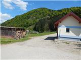 2
2 3
3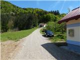 4
4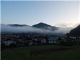 5
5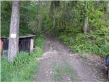 6
6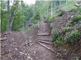 7
7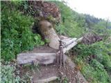 8
8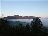 9
9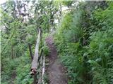 10
10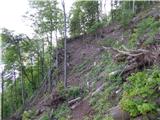 11
11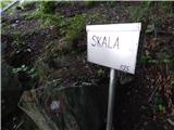 12
12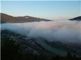 13
13
Discussion about the trip Dravograd (na Meži) - Skala (above Dravograd)
To post a comment you must log in:
If you do not yet have a username, you must first
register.