Dražgoše (Na Pečeh) - Planina Kališnik
Starting point: Dražgoše (Na Pečeh) (816 m)
| Latitude/Longitude: | 46,25210°N 14,17710°E |
| |
Walking time: 1 h 5 min
Difficulty: easy marked way
Elevation gain: 364 m
Elevation difference along the route: 395 m
Map: Škofjeloško in Cerkljansko hribovje 1:50.000
Recommended equipment (summer):
Recommended equipment (winter): ice axe, crampons
Views: 987
 | 1 person like this post |
Access to starting point:
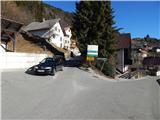
A) We drive to Železniki, and then we continue driving towards Dražgoše. Through Dražgoše we follow the main road to the part of the village named Na Pečeh, where we notice signs for Bičkovo skalo. At the mentioned crossroad, the described path begins. Nearby there are no designated parking spaces.
B) We drive to Kranj, and then we follow the signs for Besnica (the turn-off from the old road Ljubljana - Kranj is before the bridge over the Sava River, or after the bridge if coming from the direction of Kranj). Further on, we drive through Spodnja and Zgornja Besnica and Njivica. A little further ahead, we arrive in Nemilje; after the mentioned settlement, the road begins to ascend more steeply. When we arrive in Podblica, we follow the main road; above Podblica, we reach the main road Kropa - Dražgoše, which we follow to the left (if the bend is too sharp, there is an arranged turning area some 10 meters to the right). Further on, we drive past the church of St. Jedert, and then we already arrive in Dražgoše, where we first reach a crossroad where the road to Sv. Križ branches off to the left. Here we continue on the main road, and then we arrive in the center of Dražgoše, where in the area named Na Pečeh we notice signs for Bičkovo skalo (the signs are from the opposite direction of the road), where the described path begins. Nearby there are no designated parking spaces.
C) We drive to Kropa, and then we continue driving towards Dražgoše and Železniki. When we arrive in Dražgoše, in the center of Dražgoše, in the area named Na Pečeh we notice signs for Bičkovo skalo (the signs are from the opposite direction of the road), where the described path begins. Nearby there are no designated parking spaces.
Route description:
From the starting point, we continue on a side road in the direction of Bičkove skale and Dražgoške gore. At first we walk on a steep asphalt road towards the hamlet Jelenšče, then we continue left on the road in the direction of house numbers Dražgoše 43, 68 and 70. With nice views, we ascend along the still asphalt road to the edge of the forest, where from the road a path branches off to the right, leading towards Dražgoška gora, mountain pasture Kališnik and Vodiški planini (the turn-off is not marked). After a short ascent, at the junction we continue right (the trail blaze shows the direction straight ahead), then we ascend across a panoramic hayfield. When a little further we reach a wider path, we continue left (right returns us to the asphalt road, but we reach it higher than our starting point), then we ascend diagonally towards the left along it for quite some time. A little further ahead we reach a cart track, which we just cross and continue in the direction of mountain pasture Kališnik and Vodic (left Dražgoška gora 5 minutes, right Jelenšče), along a path that ascends somewhat more steeply, and a little further reaches the edge of the Jelovica plateau, where it levels out and shortly after joins a cart track (here we join the path that leads past the Dražgoška gora viewpoint), which we follow slightly to the right. The cart track soon brings us to a forest road, where there is a marked junction.
The left road continues towards Partizanski vrh, right continues the marked path towards Vodiška planina, and via the road we can also return to Dražgoše; we continue slightly left on the footpath towards mountain pasture Kališnik. From the point where we leave the road, we begin to descend gently through the forest, lower down the path levels out, then quickly brings us to the abandoned mountain pasture.
The description and pictures refer to the condition in 2018 (January).

Photos:
 1
1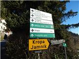 2
2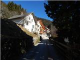 3
3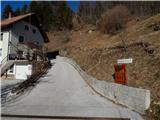 4
4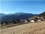 5
5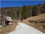 6
6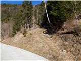 7
7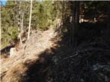 8
8 9
9 10
10 11
11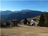 12
12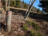 13
13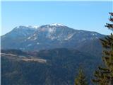 14
14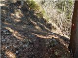 15
15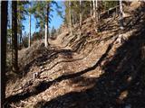 16
16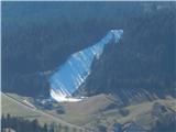 17
17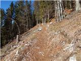 18
18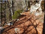 19
19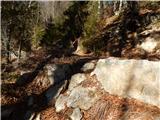 20
20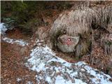 21
21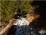 22
22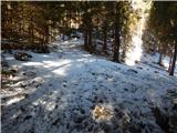 23
23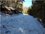 24
24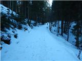 25
25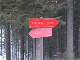 26
26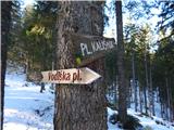 27
27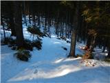 28
28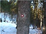 29
29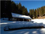 30
30
Discussion about the trip Dražgoše (Na Pečeh) - Planina Kališnik
To post a comment you must log in:
If you do not yet have a username, you must first
register.