Drežnica - Krn (south way)
Starting point: Drežnica (553 m)
| Latitude/Longitude: | 46,25550°N 13,61700°E |
| |
Route name: south way
Walking time: 4 h 45 min
Difficulty: easy marked way
Elevation gain: 1691 m
Elevation difference along the route: 1691 m
Map: Julijske Alpe - zahodni del 1:50.000
Recommended equipment (summer):
Recommended equipment (winter): ice axe, crampons
Views: 47.607
 | 2 people like this post |
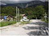
Access to starting point:
From Tolmin or Bovec we drive to Kobarid, from there we follow the road in the direction of Drežnica (the turn-off is from the Kobarid bypass). We continue across the bridge over the Soča River and immediately after the bridge we turn left in the direction of Drežnica. We then follow this mostly ascending road to the center of Drežnica, where we turn right and drive on to the primary school, which is the starting point of our path.
Route description:
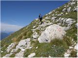
From the parking lot, we head past the chapel and primary school on the marked path to Krn. Further on, the path leads us through the forest and then along the pasture to the Triglav National Park sign. Here, the path along the road also joins us (road from Drežnica), but we continue on the marked path, which a little higher crosses the Ročica stream, after which we arrive at the marked junction, where we continue right in the direction of the easier path to Krn (left bivouac and very demanding path to Krn).
The path ahead runs through the forest and is well marked all the way. Higher up, an unmarked path from Podbrdo joins from the right, but here we continue left and then gradually begin ascending in zigzags. For some time we ascend relatively steeply, then we arrive at a small clearing where a hunting hut stands.
From the hunting hut onward, the path begins to ascend below the slopes of Kožljak (1587 m) and soon turns slightly to the left. Higher up, the path takes us out of the forest and fine views open up toward Drežnica and Krasji vrh (1773 m). Further on, the path crosses fairly steep slopes for a while, then turns slightly to the right and joins the path from the Kuhinja pasture.
Here we continue left toward Krn and proceed with the ascent along the old military mule track, which zigzags up along an indistinct ridge. This very scenic path continues along the edge of the expansive grassy slopes of Krn, gradually approaching Gomiščkovo zavetišče, which we have seen ahead of us for some time. Higher up, the grassy slope gradually gives way to scree, and the moderately steep path brings us to the aforementioned hut, where the Pot Silva Korena joins from the left.
From the hut, we continue toward Krn, which we reach after about 10 minutes of further walking.

Photos:
 1
1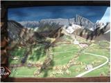 2
2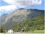 3
3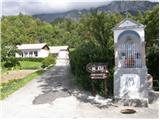 4
4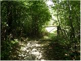 5
5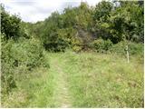 6
6 7
7 8
8 9
9 10
10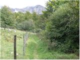 11
11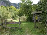 12
12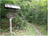 13
13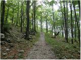 14
14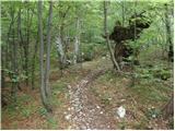 15
15 16
16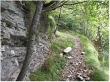 17
17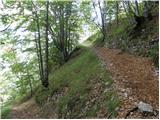 18
18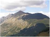 19
19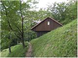 20
20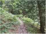 21
21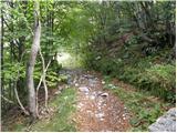 22
22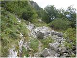 23
23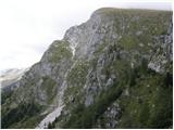 24
24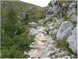 25
25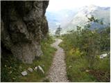 26
26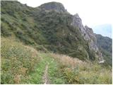 27
27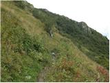 28
28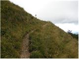 29
29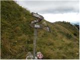 30
30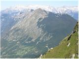 31
31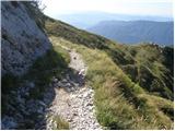 32
32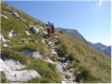 33
33 34
34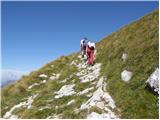 35
3536
 37
37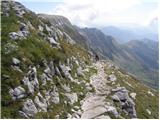 38
38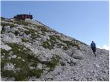 39
39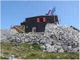 40
40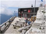 41
41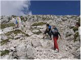 42
42 43
43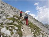 44
44 45
45
Discussion about the trip Drežnica - Krn (south way)
|
| Matjaz_656. 08. 2012 |
some photos from ascent via S. Korena and descent via southern path 
|
|
|
|
| malihodec28. 04. 2013 |
Could someone please tell me what the conditions are like on the trail from Drežnica to Krn - on the southern, easier trail. How much snow is left?
|
|
|
|
| IgorZlodej29. 04. 2013 |
Check the forum - conditions, as everything is described there.
|
|
|
|
| SuzanaM3. 08. 2015 |
To Drežnica from the village Ladra near Kobarid. Trail description: http://www.hribi.net/trenutnerazmere.asp?slo=1&gorovjeid=1&id=666
Lots of shade to the forest edge below Kožljak and endless serpentines for training legs and head. The grassy slopes below Kožljak are well overgrown with summer vegetation and on the steep slopes leave little room for the already narrow path.
|
|
|
|
| darinka431. 05. 2021 22:05:17 |
First time I went on this trail in the ascent direction. Yesterday. The trail isn't short. Shady. Mostly through the forest. I think you rarely meet anyone. Me and Maksij met only a hunter on the descent who had just arrived at the hunting hut. It's well marked. At least I had no problems.
|
|
|
|
| winni4. 06. 2021 14:09:42 |
Me too first time on this path, extremely beautiful path that rises in switchbacks along the old military mule track. I'll gladly repeat it sometime, access to Drežnica is much nicer than to Krn village.
First half of the path runs through the forest, so it's very suitable for those who aren't early risers 
The sign in Drežnica says 4 hours, which is a very realistic duration. Well marked.
|
|
|
To post a comment you must log in:
If you do not yet have a username, you must first
register.