Dvor - Polhograjska Grmada
Starting point: Dvor (345 m)
| Latitude/Longitude: | 46,06590°N 14,34790°E |
| |
Walking time: 1 h 45 min
Difficulty: easy marked way
Elevation gain: 553 m
Elevation difference along the route: 580 m
Map: Ljubljana - okolica 1:50.000
Recommended equipment (summer):
Recommended equipment (winter): ice axe, crampons
Views: 11.350
 | 2 people like this post |
Access to starting point:
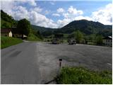
First, we drive to Dobrova near Ljubljana, and then we continue driving in the direction of Polhov Gradec. Just a little after the village of Belica, we will arrive at the village of Dvor, which is the starting point for our tour. The large parking lot at the beginning of the village (viewed from the direction of Ljubljana) is intended for guests of the nearby snack bar (by arrangement with the employees in the snack bar, it is possible to leave the car also on the mentioned parking lot). A few spots for parking are also at the end of the settlement.
Route description:
From the parking lot (at the snack bar) we continue on the main road towards Polhov Gradec, and then a few 10 m before the old Gothic church of St. Peter, by the road we notice a trough with water and next to it mountain signposts for Grmada, which point us to the right on a narrower, but still asphalt road. After a short ascent, the road turns a little towards the left, and right on this spot we look for a footpath which from the road goes sharply to the right (the turn-off is not marked). When we step into the forest, the footpath turns to the left and further ascends diagonally. After a few minutes, we come to a cart track, where we step on the marked path which leads from the previously mentioned church (to here we can also come past the church).
We continue the ascent on the cart track, which higher changes into a steep footpath. The path ahead ascends on a relatively steep ridge, which we higher avoid a little to the left. When we leave the ridge, the path flattens, and it further leads us through a panoramic meadow, by the edge of which we notice a hunting observatory. The path ahead brings us to a gently sloping cart track, to which a little further from the left joins the path from Polhov Gradec (path over Ravnek). We continue on the cart track, which quickly brings us to the hunting cottage, near which there is a marked junction.
From the hunting cottage, we continue slightly right in the direction of Grmada (slightly left Grmada over Mala Grmada), so that we bypass the hunting cottage on its right side. The path ahead in a gentle ascent crosses slopes to the right, then it brings us to a panoramic and quite scenic section, where we cross a few gullies. After a few minutes the steepness of the slopes eases, and we gently ascend towards the right for some time. When after a few minutes we reach one of the side ridges of Grmada, we join the marked path from Belica, where we continue left in the direction of Grmada (straight Katarina and Gonte). There follows a relatively steep ascent, then from the left joins the path over Mala Grmada, a few steps higher from the right also the path from Topol and Gont.
From both junctions we continue on the ascending path, on which in a minute of further walking we arrive at the panoramic summit of Grmada.

The trip can be extended to the following destinations: Tošč
Photos:
 1
1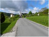 2
2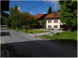 3
3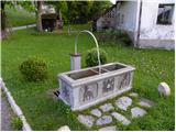 4
4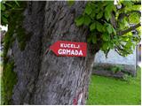 5
5 6
6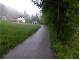 7
7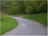 8
8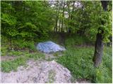 9
9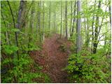 10
10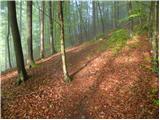 11
11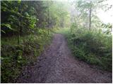 12
12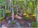 13
13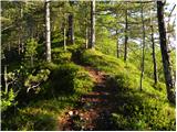 14
14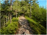 15
15 16
16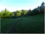 17
17 18
18 19
19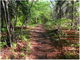 20
20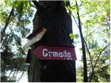 21
21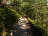 22
22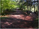 23
23 24
24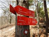 25
25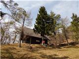 26
26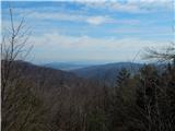 27
27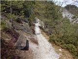 28
28 29
29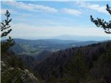 30
30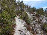 31
31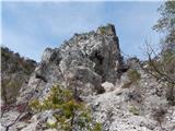 32
32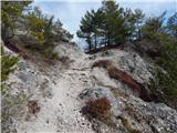 33
33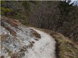 34
34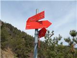 35
35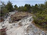 36
36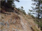 37
37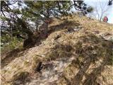 38
38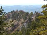 39
39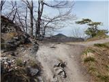 40
40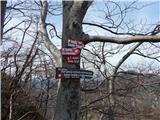 41
41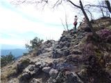 42
42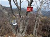 43
43 44
44
Discussion about the trip Dvor - Polhograjska Grmada
|
| orchigu24. 07. 2021 11:48:30 |
Hiked on 20.7.2021, the plan was to go only to Mala grmada. Really wonderful trail, a good part of the trail also through the forest in the shade. I met a gentleman, a mountain guide, on the way, who at the junction at the hunting hut suggested that I take the circular variant first right to Polhograjska Grmada and then back via Mala grmada. That was a super decision, the trail is phenomenal, and since we're so close to Polhograjska Grmada, it's really worth climbing up there for the views that Mala grmada doesn't offer as much. It's a fun circular trail if we return via Mala grmada, definitely recommend.
Edit: at the fountain during my visit, there was no sign directing to the start of the trail, but it's not a problem to find it 
Regarding parking: during the week they allowed me to park at the guesthouse without problem, but the lady said that on weekends it's too much of a problem. That parking at the end of the village is like... a bit of gravel opposite some house, maybe for a couple of cars.
|
|
|
|
| senicaj24. 07. 2021 12:58:54 |
Nice description of the hike to Grmada. If you're attentive, picture 32, you'll notice a natural window on the left side a bit above the trail. I recommend checking it out next time. Besides your trail description, there are many hunting trails that lead to and around the entire Grmada.
|
|
|
To post a comment you must log in:
If you do not yet have a username, you must first
register.