Eisenberg an der Raab - Holzmannkogel (by the border)
Starting point: Eisenberg an der Raab (344 m)
| Latitude/Longitude: | 46,88920°N 16,13591°E |
| |
Route name: by the border
Walking time: 1 h
Difficulty: easy marked way
Elevation gain: 49 m
Elevation difference along the route: 70 m
Map:
Recommended equipment (summer):
Recommended equipment (winter): ice axe, crampons
Views: 104
 | 1 person like this post |
Access to starting point:
Via the border crossing Kuzma we drive into Austria and continue driving towards Jennersdorf. From the roundabout before the entrance to the fast road we take the first exit in the direction of the settlement Sankt Martin an der Raab, in the middle of the mentioned settlement we go right, so that we continue driving on Oberdrosener Landesstraße. After 3.5 km of driving on the mentioned road, we turn left onto the Oberberg road and we start ascending. A little higher we go right (left - settlement Eisenberg) and then after approximately 50 m we park on the parking lot at the information boards.
Route description:
From the starting point, we continue on the asphalt road, by which there are signs for the tripoint / Dreiländereck, and when after a minute of walking we arrive at the edge of the forest we go slightly right on a macadam road, on which we continue through the forest to the guard tower a few minutes distant.
From the tower we continue straight in the direction of the tripoint, where we continue on a worse macadam road which changes into a cart track, and it splits.
We continue on the slightly left path, which on the left side bypasses the nearby beehive (slightly right path which mostly runs on the road) and continues along the state border between Austria and Hungary. Next follows some shorter ascents and descents, and from the left another path from Hungary joins, namely from the settlement Gornji Senik / Felsőszölnök. We continue for some time on the mostly forest path, then we reach the forest road, where we continue straight (left tripoint, right the road leads towards the valley, sharply right we can return to the guard tower).
The path ahead leads us on a macadam road which gently to moderately ascends, a little ahead the road turns somewhat to the right. On the part where the road turns to the right, a marked path branches off to the left which leads to Holzmannkogel, the branch-off itself is not marked and also the path further is not easy to follow, but on the trees there are individual blazes. We follow this pathless marked path to the summit a few minutes distant.
Starting point - guard tower 0:10, guard tower - Holzmannkogel 0:50.
Description and pictures refer to the condition in February 2023.

Photos:
 1
1 2
2 3
3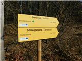 4
4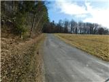 5
5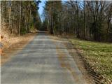 6
6 7
7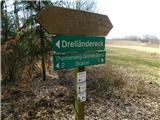 8
8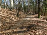 9
9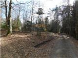 10
10 11
11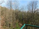 12
12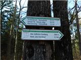 13
13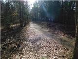 14
14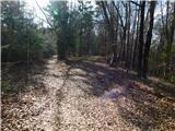 15
15 16
16 17
17 18
18 19
19 20
20 21
21 22
22 23
23 24
24 25
25 26
26 27
27 28
28 29
29 30
30 31
31
Discussion about the trip Eisenberg an der Raab - Holzmannkogel (by the border)
To post a comment you must log in:
If you do not yet have a username, you must first
register.