Starting point: Konec ceste (1000 m)
| Latitude/Longitude: | 46,31180°N 14,74910°E |
| |
Walking time: 1 h
Difficulty: easy marked way
Elevation gain: 425 m
Elevation difference along the route: 425 m
Map: Kamniške in Savinjske Alpe 1:50.000
Recommended equipment (summer):
Recommended equipment (winter):
Views: 42.914
 | 2 people like this post |
Access to starting point:
From Kamnik we drive towards Gornji grad. At the chapel just a few dozen meters before Gornji grad we turn left (direction Sveti Lenart). Further, we drive on the road which goes along the stream upwards. The road then leaves the stream and brings us to a decaying wooden shack, where we continue ahead on the road towards the church. At the crossroad a few meters below the church we go left and we follow the road which makes a sharp right turn to its end, where we park.
From the Štajerska side we first drive to Gornji Grad and follow the road ahead in the direction of Kamnik. Immediately after Gornji Grad we turn right (direction Sveti Lenart). Further, follow the above description.
Route description:
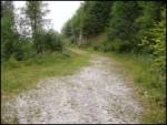
From the end of the road, we cross a torrent and immediately thereafter the path steeply ascends and in zig-zags brings us to an indistinct ridge. The path ahead ascends through the forest quite steeply upwards. After a good 20 minutes of ascent the steepness decreases and the path in a crossing brings us below the saddle Kal. Next follows a shorter ascent on a mostly muddy footpath (exceptions are longer dry periods), which after a good five minutes brings us to the pastures on saddle Kal. Just a few dozen meters to the right there is also a crossing, where we continue left in the direction of Lepenatka (right bivouac 3 minutes and Rogatec 1 hour). The path then starts to ascend slightly on the grassy slopes of Lepenatka. The path soon transitions to a wide indistinct ridge which brings us to the main ridge of Lepenatka in 20 minutes. Here we are again at a crossing. We continue right and in a few steps of easy walking we reach the peak.

The trip can be extended to the following destinations: Rogatec
Photos:
 1
1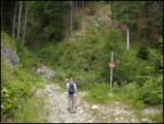 2
2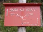 3
3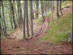 4
4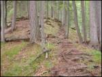 5
5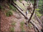 6
6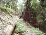 7
7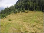 8
8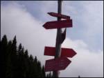 9
9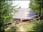 10
10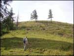 11
11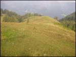 12
12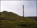 13
13 14
14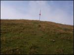 15
15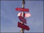 16
16 17
17 18
18
Discussion about the trip Konec ceste - Lepenatka
|
| J.P.10. 03. 2019 |
We left the car a little below the church of St. Lenart. The path through the forest was closed and we reached the Bivouac on Kal via a wide forest road, which is well marked. Walking time is also 1h. Regards, J.P
|
|
|
|
| PUHIPUHI8. 05. 2020 |
Last week we were on Lepenatka. Really wonderful peak.
I have one question though... About 20 min before the church there is a no traffic sign. But we saw everyone driving higher with cars, past the sign. What's with that sign?
Thanks, LP; Petra
|
|
|
|
| jprim9. 05. 2020 |
There is a sign, but everyone decides for themselves. What about all that driving on hiking trails with cross bikes, quads, it destroys hiking trails, nature itself ... What about all that driving on hiking trails with cross bikes, quads, it destroys hiking trails, nature itself ...
Uršlja gora, Čemšeniška planina and I could list more and no one does anything to anyone.
Regards!
|
|
|
|
| potpodnoge5. 06. 2020 |
In case something damages the car, you have no excuse for anyone to compensate the damage. Well, the traffic sign is clear enough, who follows it follows it, who doesn't is just an ordinary driver who blames everything else when something unpleasant happens, only not himself. But it seems most get through fine, no need to expect police or municipal wardens there.
|
|
|
To post a comment you must log in:
If you do not yet have a username, you must first
register.