Konec ceste na Pokljuki - Šmarjetna glava
Starting point: Konec ceste na Pokljuki (1312 m)
| Latitude/Longitude: | 46,33860°N 13,90450°E |
| |
Walking time: 6 h
Difficulty: difficult pathless terrain
Elevation gain: 1046 m
Elevation difference along the route: 1315 m
Map: Triglav 1:25.000
Recommended equipment (summer): helmet
Recommended equipment (winter): helmet, ice axe, crampons
Views: 9.653
 | 1 person like this post |
Access to starting point:a) Leave the Gorenjska motorway at the Lesce exit, then follow signs for Bled and Pokljuka. Continue through Gorje and past the Zatrnik ski slope to Rudno polje on Pokljuka, where there is a large paid parking lot; nearby there is also a military barracks and shooting range. From here continue straight along the gravel road, which shortly brings us to a junction where we continue right (left Uskovnica). Follow this road to the former Za Ribnico parking lot at the end of the road (mountain signs for planina Konjščica nearby).
Parking at the end of the road is now prohibited, so park at Rudno polje instead, which extends the approach by about 40 minutes; it is more suitable to choose the marked path that starts at Rudno polje.
b) From Železniki or Podbrdo drive to Bohinjska Bistrica, then continue towards Bled. Shortly after the Petrol gas station just beyond Bohinjska Bistrica, turn left towards Pokljuka and Jereka. The road climbs steeply at first, then gradually flattens after Koriti and leads to a junction at the bus stop, where continue right towards Pokljuka, Koprivnik, and Jereka (straight to Srednja vas). Immediately after the junction we arrive in Jereka; from the junction in front of the church we continue straight to Pokljuka (left Podjelje). After Jereka the road climbs steeply again, then flattens higher up and continues along the Mrzli potok stream. Upon joining the road from Bled, go left to Rudno polje, where there is a large paid parking lot; nearby military barracks and shooting range. From here continue straight on the gravel road to the junction, continuing right (left Uskovnica), then to the former Za Ribnico parking lot at the end (mountain signs for planina Konjščica nearby).
Parking at the end is now prohibited, so park at Rudno polje, extending the approach by about 40 minutes; better to take the marked path from Rudno polje.
Traffic regime in the Pokljuka and Uskovnica area from 15.6. to 15.10.
Route description:
From the former parking lot at the end of the road, continue on the wide initially ascending cart track towards planina Konjščica. The track enters dense forest immediately, soon flattens, and after a few minutes of easy walking turns into a footpath continuing along the left bank of the Ribnica stream. When the path approaches the stream closely, it turns slightly right and ascends more steeply. Higher up it flattens and leads out of the forest to the lower edge of the vast planina Konjščica. Here the path turns slightly left, crosses the streamlet, and after a few more steps reaches the cheese dairy on planina Konjščica.
From the dairy continue on a pleasant path that in a few minutes of gentle ascent brings us to the upper edge of the pasture. Here the path enters a belt of dwarf pines and shrubs and gradually starts ascending more steeply. In the upper part of the ascent towards Jezerc, the path from Rudno polje joins from the right; we continue straight on the moderately steep path that in a few more minutes brings us to Jezerc, where it flattens and turns left (right branches the path to Srenjski preval).
Follow easy walking to a sign marking the central area of TNP, then the path begins a moderate ascent along a torrent, initially a streamlet. Higher up the path crosses to the right side of the torrent (viewed from ascent direction) and then ascends traversely to Studorski preval, from which a fine view opens to the mountains above Bohinj.
Here a demanding path from Srenjski preval joins from the right; from our path unmarked tracks also branch to Ablanca and Veliki Draški vrh.
From the saddle first descend steeply for a short time, then the path turns right; we then traverse the slopes to the left for longer with some shorter easy ascents and descents. From the slopes of Veliki Draški vrh we gradually reach the slopes of the massive Tosc, continuing amid fine views past the branch to Tosc and a junction where the path from Uskovnica joins from the left.
At all junctions, including where a partly abandoned path over planina Zgornji Tosc joins, continue straight; the path gradually leads to steeper and even precipitous southwest slopes of Tosc, where there was a landslide years ago, so extra caution is needed due to falling rocks. Across the precipitous section runs a quite wide path, so no special difficulties here; when the slope becomes less steep, the path from Stara Fužina or Voje valley joins from the left.
Here continue slightly left towards Velo polje (sharply left Voje, straight Vodnikov dom and Velska dolina via path past Vodnikov dom). The path ahead begins traversing down to the right and quickly reaches an unmarked junction. Continue on the right marked path (left hunters' hut), which soon flattens and continues traversing slopes below Vodnikov dom. After a few minutes it turns slightly left and descends towards Mali and Velo polje. After a short descent the path from Voje valley joins from the left; we continue right and after a few dozen steps reach the shepherds' huts on planina Velo polje.
From the pasture continue slightly right or straight on the path traversing the extensive pasture. On the other side reach stone barriers preventing torrents from burying this beautiful pasture. Just a few meters before the stone barrier the path turns slightly left and ascends into sparse mostly larch forest. The path then turns even more left and leads us via gentle and lightly vegetated grassy slopes to the aforementioned torrent, where the path past Vodnikov dom joins from the right. Ahead the path ascends gently along the torrent for a while, then steeply below the walls of Šmarjetna glava. The steepness soon eases and the increasingly rocky path under walls and screes of surrounding peaks leads to sedlo Dolič, with a marked junction.
Continue straight (left Hribarice, right Dom Planika pod Triglavom) on the path that begins gradual descent and after less than ten minutes reaches Koča na Doliču.
Just before the hut (near heliport) leave the marked path to Koča na Doliču and head right uphill on pathless terrain. Ascend the rocky slope to the ridge from which Šmarjetna glava comes into view. Head to the saddle on the left side of Šmarjetna glava.
From the saddle continue right along the steep ridge marked by a few cairns. The ridge becomes somewhat steeper and short section requires some easy scrambling (UIAA I). Just below the summit where the ridge is steepest, cairns direct to the right side, followed by a short ascent on slightly exposed and scree slope to the top.
Izhodišče - Planina Konjščica 0:30, Planina Konjščica - Klanci 0:40, Klanci - Jezerce 0:05, Jezerce - Studorski preval 0:30, Studorski preval - Planina Zgornji Tosc 0:35, Planina Zgornji Tosc - Na Zagonu 0:20, Na Zagonu - Velo polje 0:20, Velo polje - sedlo Dolič 1:40, sedlo Dolič - Koča na Doliču 0:05, Koča na Doliču - Šmarjetna glava 1:15.

Along the route: Planina Konjščica (1427m), Klanci (1678m), Jezerce (1719m), Izvir pod Studorskim prevalom (1746m),
Studorski preval (1892m), Planina Zgornji Tosc (1849m), Na Zagonu (1819m),
Velo polje (1680m), Velska dolina (1738m), Sedlo Dolič (2165m),
Koča na Doliču (2151m)
Photos:
 1
1 2
2 3
3 4
4 5
5 6
6 7
7 8
8 9
9 10
10 11
11 12
12 13
13 14
14 15
15 16
16 17
17 18
18 19
19 20
20 21
21 22
22 23
23 24
24 25
25 26
26 27
27 28
28 29
29 30
30 31
31 32
32 33
33 34
34 35
35 36
36 37
37 38
38 39
39 40
40 41
41 42
42 43
43 44
44 45
45 46
46 47
47 48
48 49
49 50
50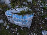 51
51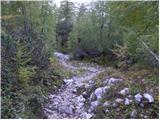 52
52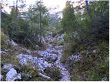 53
53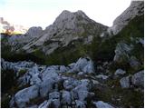 54
54 55
55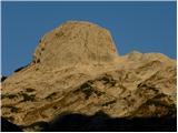 56
56 57
57 58
58 59
59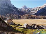 60
60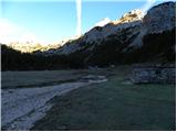 61
61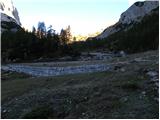 62
62 63
63 64
64 65
65 66
66 67
67 68
68 69
69 70
70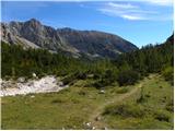 71
71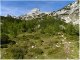 72
72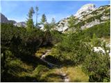 73
73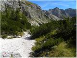 74
74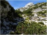 75
75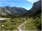 76
76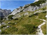 77
77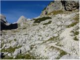 78
78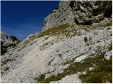 79
79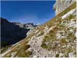 80
80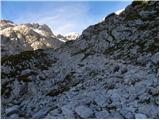 81
81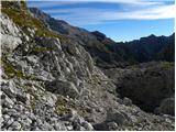 82
82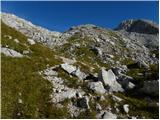 83
83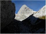 84
84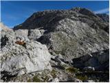 85
85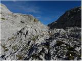 86
86 87
87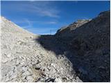 88
88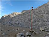 89
89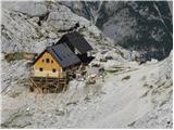 90
90 91
91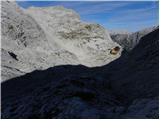 92
92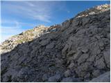 93
93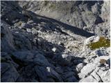 94
94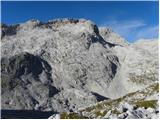 95
95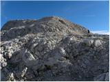 96
96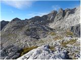 97
97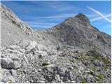 98
98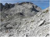 99
99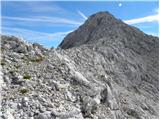 100
100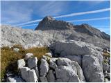 101
101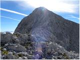 102
102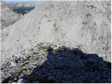 103
103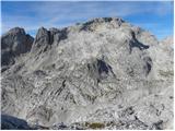 104
104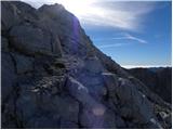 105
105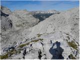 106
106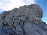 107
107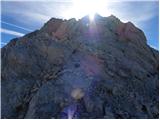 108
108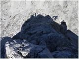 109
109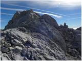 110
110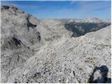 111
111 112
112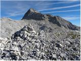 113
113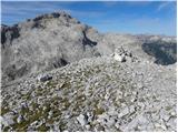 114
114 115
115
Discussion about the trip Konec ceste na Pokljuki - Šmarjetna glava
|
| jprevc13. 11. 2015 |
The heliport mentioned in the route description is not visible from the path. The junction to the unmarked section of the path is right at the fork - picture 89 - specifically it starts about a meter before the rock with the Planika inscription.
|
|
|
|
| ločanka20. 07. 2018 |
Nicely marked, pleasant scrambling below the summit (one of the best for me).
Best to start directly at Dolič saddle, no need to descend towards the hut
Mihelič in his guidebook says that only eccentric lovers of pathless solitude climb it.
Times have changed since then, now such are actually in fashion
|
|
|
|
| saram20. 09. 2020 |
Yesterday we finally made it. We had tried two years ago, but we stopped the ascent just below the summit. It was blowing so hard that we didn't dare go to the top; it was a tough decision but the only right one in those conditions, as the summit waited for us until yesterday. We don't regret returning. The weather was excellent. Alone at the summit. Also on the path from Vodnik hut to Dolič I met only four hikers. Really beautiful solitary peaks, wonderful views.
|
|
|
To post a comment you must log in:
If you do not yet have a username, you must first
register.