Konec ceste na Vogar - Pršivec (via planina Viševnik)
Starting point: Konec ceste na Vogar (1350 m)
| Latitude/Longitude: | 46,29560°N 13,84120°E |
| |
Route name: via planina Viševnik
Walking time: 2 h 20 min
Difficulty: easy marked way
Elevation gain: 411 m
Elevation difference along the route: 570 m
Map: Triglav 1:25.000
Recommended equipment (summer):
Recommended equipment (winter): ice axe, crampons
Views: 20.161
 | 1 person like this post |
Access to starting point:
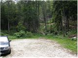
From the Ljubljana - Jesenice motorway take the Lesce exit and follow the road towards Bled and further towards Bohinjska Bistrica. Continue driving towards Lake Bohinj (Ribčev laz), where we reach a junction, continuing right towards Stara Fužina. In Stara Fužina at the junction by the chapel turn sharply left onto the ascending road towards planina Blato, planina Vogar and Voje valley. The road then takes us to the place where they collect toll and parking fee, we follow it further to the next junction, where we continue left (right Voje). Then follow the road to the next junction (we drive for quite some time), continuing straight (sharp right planina Blato). Then follow the road past planina Vogar and drive along it to the parking lot at the end of the road.
From the toll collection point to the starting point it is less than 11 km drive, the last half or slightly less is entirely gravel road.
Route description:
At the parking lot notice the signs for Planina Viševnik, which direct us right onto a wide and initially quite steep tractor track. After a few minutes of steep ascent the track levels out, then continues without major elevation changes further through the forest. When the track turns right, continue straight on the marked footpath, which initially ascends gently for a short time. When the path becomes steeper we will notice a cairn on the left side and next to it a path leading to Pršivec (the path later joins the usual path from Vogar), but we continue straight on the steep mountain path. The path ahead continues steeply ascending through the forest for some time, then levels out temporarily and brings us to Brezno pri Gamsovi glavici (pit cave explored to depth of 817 m). Above the pit cave the path enters an indistinct and in the upper part also steeper valleyette, up which we ascend to a small saddle between Pršivec (1761 m) on the left and Gornji Viševnik (1722 m) on the right. Here the path completely levels out, then continues for some time across the pastures of Gornji Viševnik. On the other side the path returns to the forest and descends to Planina Viševnik in a few minutes, in the middle of which stands Bregarjevo zavetišče.
From the pasture continue on the far left path towards Pršivec (left Črno jezero, slightly left Planina Ovčarija, slightly right Koča na Planini pri Jezeru past Krištofojce, right Koča na Planini pri Jezeru) on the path that first ascends transversely towards the southwest part of planina Viševnik, where the path turns even more left and turns south. Follows some transverse ascent through the forest, then the path levels out and even descends slightly to Majska jama (pit cave explored to depth of 592 m), where we start ascending again, this time on the northern slopes of Pršivec. Follows another approx. 15 minutes ascent through increasingly sparse, mostly larch forest and we arrive at the top of Pršivec, from which a nice view opens to Bohinj and surrounding mountains.
Parking Hebed - Brezno pri gamsovi glavici 0:55, Brezno pri gamsovi glavici - Gornji Viševnik 0:10, Gornji Viševnik - Planina Viševnik 0:15, Planina Viševnik - Majska jama 0:45, Majska jama - Pršivec 0:15.

Along the route: Brezno pri gamsovi glavici (1608m), Gornji Viševnik (1680m),
Planina Viševnik (1625m), Majska jama (1695m)
Photos:
 1
1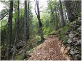 2
2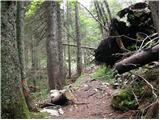 3
3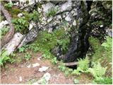 4
4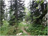 5
5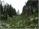 6
6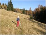 7
7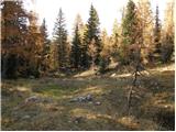 8
8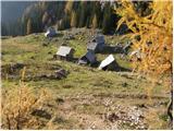 9
9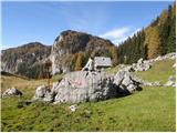 10
10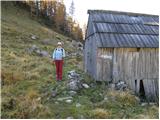 11
11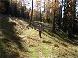 12
12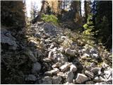 13
13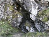 14
14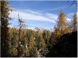 15
15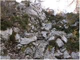 16
16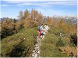 17
17 18
18
Discussion about the trip Konec ceste na Vogar - Pršivec (via planina Viševnik)
To post a comment you must log in:
If you do not yet have a username, you must first
register.