Konec ceste na Vogar - Velika Zelnarica (via Štapce)
Starting point: Konec ceste na Vogar (1350 m)
| Latitude/Longitude: | 46,29560°N 13,84120°E |
| |
Route name: via Štapce
Walking time: 5 h 50 min
Difficulty: partly demanding marked way, easy pathless terrain
Elevation gain: 970 m
Elevation difference along the route: 1250 m
Map: TNP 1:50.000
Recommended equipment (summer):
Recommended equipment (winter): ice axe, crampons
Views: 132
 | 1 person like this post |
Access to starting point:
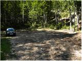
From the Ljubljana - Jesenice highway, we take the Lesce exit and follow the road towards Bled and further towards Bohinjska Bistrica. We continue driving towards Lake Bohinj (Ribčev Laz), where we reach an intersection and continue right in the direction of Stara Fužina. In Stara Fužina, at the intersection by the chapel, we turn sharply left onto the ascending road in the direction of Planina Blato, Planina Vogar, and Voje Valley. The road then leads us to the place where toll and parking fees are collected, and we follow it further to the next intersection, where we continue left (right Voje). We then follow the road to the next intersection (we drive for quite some time), where we continue straight (sharp right Planina Blato). We then follow the road past Planina Vogar and drive along it to the parking lot at the end of the road.
From the place where the toll is collected to the starting point, it is less than 11 km of driving, the last half or slightly less is the road entirely gravel.
Route description:
At the parking lot, we notice signs for Planina Viševnik, which direct us right onto a wide and initially quite steep tractor track. After a few minutes of steep ascent, the track levels out, then continues without major changes in height further through the forest. When the track turns right, we continue straight on the marked footpath, which initially ascends gently for a short time. When the path becomes steeper, we will notice a cairn on the left side and next to it a path leading to Pršivec (the path later joins the usual path from Vogar), but we continue straight on the steep mountain path. The path then ascends steeply through the forest for some time, then temporarily levels out and brings us to the sinkhole at Gamsova glavica (the sinkhole is explored to a depth of 817 m). Above the sinkhole, the path transitions into an indistinct and in the upper part also steeper small valley, through which we ascend to a small pass between Pršivec (1761 m) on the left and Gornji Viševnik (1722 m) on the right. Here the path completely levels out, then continues for some time across the pastures of Gornji Viševnik. On the other side, the path returns to the forest and in a few minutes of descent brings us to Planina Viševnik, in the middle of which stands Bregarjevo zavetišče.
From Planina Viševnik we continue slightly left (sharp left Pršivec, left Črno jezero, slightly right Planina pri Jezeru via Krištofojca, right Planina pri Jezeru) on the path in the direction of Planina Ovčarija and Triglav Lakes. The path first ascends transversely to the left across a steeper slope, then gradually levels out and brings us to a more plateau-like terrain. We continue southwest of Griva (1758 m) for some time without major changes in height. A bit further, exactly at the direction signs, an unmarked trail continues straight towards Planina Dedno polje, but we continue sharp left in the direction of Planina Ovčarija. From the direction signs, the path descends slightly, then turns right and continues for some time along a kind of contour or sinkhole. On the other side of the contour, the path begins to ascend moderately again, then levels out and brings us to the shepherd's huts on Planina Ovčarija.
We continue between the huts on the marked mountain path, which begins to descend moderately. A bit lower, the path leads us past a few more huts, then in a few minutes of further walking brings us to the place where it joins the wider path from Planina Dedno polje. Here we continue left and in a few steps arrive at the next crossroads.
From the split, we follow the signs for the path over Štapce (straight path over Prodi), both leading to Koča pri Triglavskih jezerih, the right one, which we will continue on, also to Mala Tičarica and Zelnarice. We soon leave Planina Ovčarija and the path ascends moderately to steeply through increasingly sparse forest, which higher up is replaced by dwarf pines. After a half-hour ascent, the path levels out and brings us to Štapce, where there is the next marked crossroads.
At Štapce we continue slightly right in the direction of Tičarica and Zelnarica (slightly left Koča pri Triglavskih jezerih) and continue the ascent on the path that first ascends through a belt of dwarf pines, then brings us to a short steep jump, especially dangerous for slipping in wet conditions. Above the jump, the path levels out and transitions to moderately steep grassy slopes, on which in a few minutes of further walking we ascend to a small saddle, where a marked path to Mala Tičarica branches off to the left, to which it is about ten minutes of ascent.
We continue in the direction of Zelnarica on a relatively gentle path, which first traverses the slopes of Mala and then Velika Tičarica. Just a few tens of meters behind the sign "Ne trgaj cvetja!" (sign on the wall), a passage to Velika Tičarica opens to the left, to which it is about 15 minutes of demanding ascent, but we continue straight on the marked path, which north of Velika Tičarica reaches the main ridge.
Behind Velika Tičarica the path transitions to a wide grassy ridge along and on which we then ascend. After a few minutes of easy walking, the path begins to ascend steeply on a partially grassy slope. The steepness quickly eases, and the path brings us to the vast meadows south of the precipitous and overhanging Kopica. We walk across the vast meadows to the foot of the summit slope of Kopica, then when we reach the edge of the wall, the marked path turns right and ascends transversely across a small scree. Behind the scree, the path turns left, then in a transverse ascent begins to ascend steeply. The marked path approaches the ridge at a small indistinct hollow and turns slightly to the right.
At this place, a passage to Kopica opens to the left, to the summit of which it is about five minutes, but we continue on the marked path, which approaches the ridge and turns right. The path then gradually transitions to a very steep and slip-prone slope; after about 30 meters of somewhat exposed part, the slope becomes somewhat less steep. Follows a transverse ascent to the right, the path leads us slightly below the ridge, a bit further we reach the summit slope of Mala Zelnarica. Here the path begins to ascend steeper again and after about 15 minutes of increasingly scenic walking brings us to the summit of Mala Zelnarica, from which an exceptional view opens in the direction of the Valley of Triglav Lakes.
From Mala Zelnarica we continue slightly right, still on the marked path, which begins to descend towards the Vrata pass, leading us over a shorter part where there is increased danger of slipping on the scree along which the path runs due to the considerable steepness. Lower down, the path levels out and turns slightly to the left and soon brings us to the notch or saddle between the two Zelnarice. From here on the marked path towards Vrata we continue only a few tens of meters, but when a nice passage opens on the left side, we leave it and turn left onto easier pathless terrain.
We continue on pathless terrain, or initially still a poorer trail, which in a few minutes of moderate ascent brings us to the somewhat exposed southern ridge of Velika Zelnarica. The path then leads us along or slightly right of the ridge, the trail disappears completely in parts, but we follow the ridge to the summit of Velika Zelnarica about 15 minutes away, from which a beautiful view opens to the surrounding mountains and valleys.
Hebed parking lot - Sinkhole at Gamsova glavica 0:55, Sinkhole at Gamsova glavica - Gornji Viševnik 0:10, Gornji Viševnik - Planina Viševnik 0:15, Planina Viševnik - Planina Ovčarija 0:50, Planina Ovčarija - crossroads at Planina Ovčarija 0:05, crossroads at Planina Ovčarija - Štapce 0:35, Štapce - crossroads below Mala Tičarica 0:25, crossroads below Mala Tičarica - branch for Velika Tičarica 0:20, branch for Velika Tičarica - branch for Kopica 1:00, branch for Kopica - Mala Zelnarica 0:45, Mala Zelnarica - Saddle between Zelnarice 0:15, Saddle between Zelnarice - Velika Zelnarica 0:20.

Along the route: Brezno pri gamsovi glavici (1608m), Gornji Viševnik (1680m),
Planina Viševnik (1625m), Smodlakov brlog (1714m),
Planina Ovčarija (1660m), Štapce (1851m), Razpotje pod Malo Tičarico (2008m), Odcep za Veliko Tičarico (2020m), Odcep za Kopico (2168m),
Mala Zelnarica (2310m), Sedlo med Zelnaricama (2222m)
Photos:
 1
1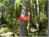 2
2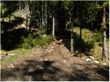 3
3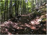 4
4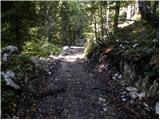 5
5 6
6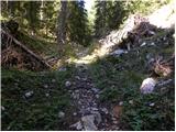 7
7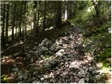 8
8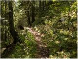 9
9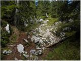 10
10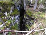 11
11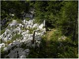 12
12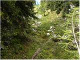 13
13 14
14 15
15 16
16 17
17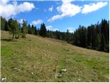 18
18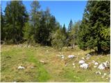 19
19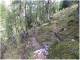 20
20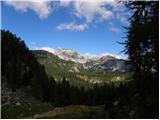 21
21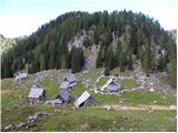 22
22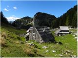 23
23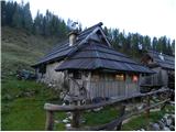 24
24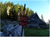 25
25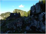 26
26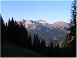 27
27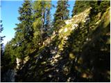 28
28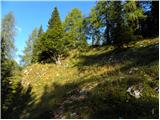 29
29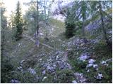 30
30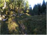 31
31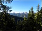 32
32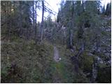 33
33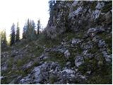 34
34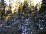 35
35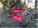 36
36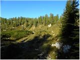 37
37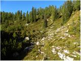 38
38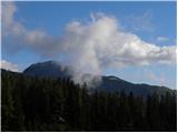 39
39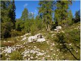 40
40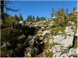 41
41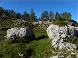 42
42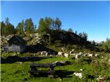 43
43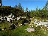 44
44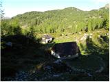 45
45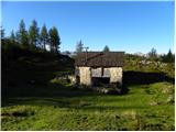 46
46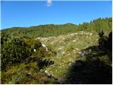 47
47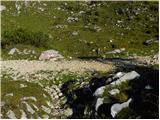 48
48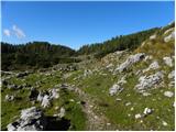 49
49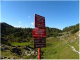 50
50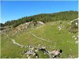 51
51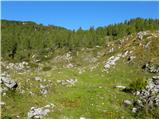 52
52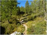 53
53 54
54 55
55 56
56 57
57 58
58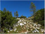 59
59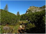 60
60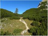 61
61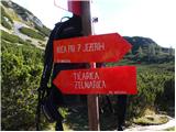 62
62 63
63 64
64 65
65 66
66 67
67 68
68 69
69 70
70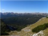 71
71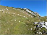 72
72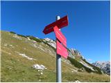 73
73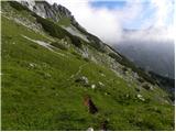 74
74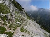 75
75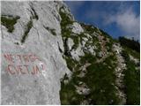 76
76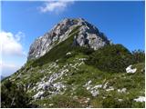 77
77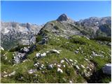 78
78 79
79 80
80 81
81 82
82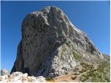 83
83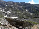 84
84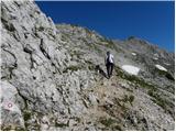 85
85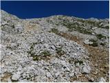 86
86 87
87 88
88 89
89 90
90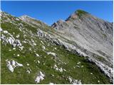 91
91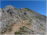 92
92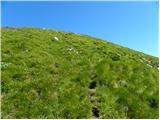 93
93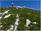 94
94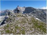 95
95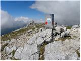 96
96 97
97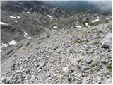 98
98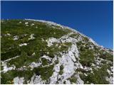 99
99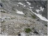 100
100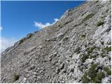 101
101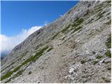 102
102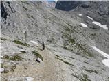 103
103 104
104 105
105 106
106 107
107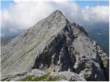 108
108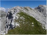 109
109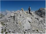 110
110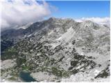 111
111
Discussion about the trip Konec ceste na Vogar - Velika Zelnarica (via Štapce)
To post a comment you must log in:
If you do not yet have a username, you must first
register.