Erjavčev Rovt - Huhnerkogel/Gubno
Starting point: Erjavčev Rovt (1065 m)
| Latitude/Longitude: | 46,47920°N 13,96360°E |
| |
Walking time: 2 h 30 min
Difficulty: easy marked way, easy unmarked way
Elevation gain: 970 m
Elevation difference along the route: 970 m
Map: Kranjska Gora 1:30.000
Recommended equipment (summer):
Recommended equipment (winter): helmet, ice axe, crampons
Views: 11.882
 | 3 people like this post |
Access to starting point:
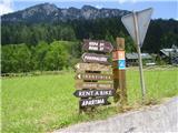
We drive to Dovje and follow the road ahead through the village upwards. Soon after the village we come to a crossroads, where the road to Kepa branches off to the left and to Dovška Baba to the right. Here we take the left road and follow it to the next crossroads, where we continue right and then park at one of the parking lots by the road (near the parking lot is the stream Mlinca).
Route description:
We start by crossing the stream and slightly ascend in the direction of Kepa. After 10 minutes of walking the steep part of the path starts, which runs through the forest and after 20 minutes of good warming up brings us to a nice level path, which after less than 15 minutes brings us to the Brvog hunting cottage and that's when we first see Gubno in all its glory. The path ahead turns right and ascends slightly again along a nice and wide path. After 25 minutes of further walking we come to a path junction, where we turn left (right to sedlo Mlinca and Dovška Baba) in the direction of Kepa. After a few minutes of steep path, which runs through low bushes, we slowly come to grassy slopes (possibility of slipping), which we cross and after an hour of walking with a nice view on the Julian Alps we come below Gubno, which we cross and before the end of the slope we turn sharply right (ahead we continue to Dovška Mala Kepa and Kepa), and along an unmarked trodden path in a few minutes we reach the summit. The summit is marked with a cairn and a border stone.

Along the route: Lovska koča Brvog (1450m)
Photos:
 1
1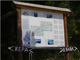 2
2 3
3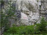 4
4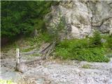 5
5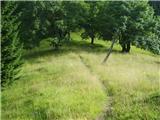 6
6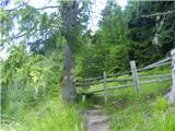 7
7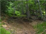 8
8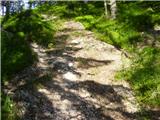 9
9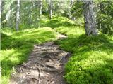 10
10 11
11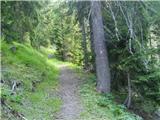 12
12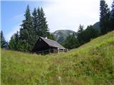 13
13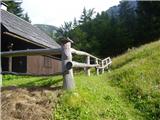 14
14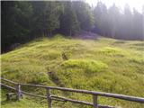 15
15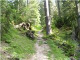 16
16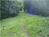 17
17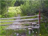 18
18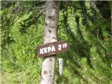 19
19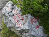 20
20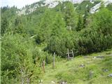 21
21 22
22 23
23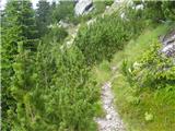 24
24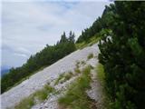 25
25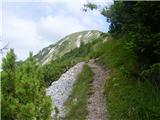 26
26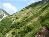 27
27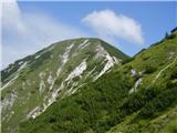 28
28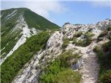 29
29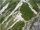 30
30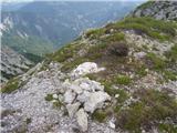 31
31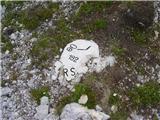 32
32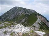 33
33
Discussion about the trip Erjavčev Rovt - Huhnerkogel/Gubno
|
| heinz24. 11. 2009 |
This is one of the most beautiful and quietest paths in the western Karavanke. It's not the easiest, but not demanding. You'll surely meet chamois.
Regarding views in all directions, Gubno doesn't lag much behind its dominant neighbor Kepa.
|
|
|
|
| ben27. 11. 2009 |
Why is this an unmarked trail? Except for the last five minutes before the summit, everything is marked, or am I wrong? 
LP B
|
|
|
|
| heinz28. 11. 2009 |
Probably a similar principle as with path difficulties; if just a part is so difficult that it requires certain technical knowledge and equipment, the entire path is considered difficult, even though the rest is easy, etc..
It is true, however, that the path to Gubno could be named "marked", since it applies almost entirely to it, only the marked turn-off at its end is missing.
So, for those afraid of unmarked paths, let's add that it is mainly (99%) a "NICELY marked path"..
|
|
|
|
| grega_p18. 07. 2011 |
Interesting, varied and at these temperatures quite strenuous path, but definitely not (any longer) peaceful. Yesterday there were crowds of hikers, so it was quite hard to find space for the car down there. Unfortunately, no chamois anywhere but still beautiful and scenic!
|
|
|
To post a comment you must log in:
If you do not yet have a username, you must first
register.