Erjavčev rovt - Huhnerkogel/Gubno
Starting point: Erjavčev rovt (1065 m)
| Latitude/Longitude: | 46,47920°N 13,96360°E |
| |
Walking time: 2 h 35 min
Difficulty: partly demanding marked way, easy unmarked way
Elevation gain: 970 m
Elevation difference along the route: 970 m
Map: Kranjska Gora 1:30.000
Recommended equipment (summer):
Recommended equipment (winter): ice axe, crampons
Views: 18.681
 | 2 people like this post |
Access to starting point:
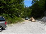
From the Gorenjska motorway, take the Jesenice - West exit and follow the road ahead towards Kranjska Gora. Soon we will notice signs for Dovje, which direct us right onto the ascending road, along which we quickly climb to the upper part of the village. Through the village, follow the road towards Kepa and Dovška Baba, then arrive at a somewhat larger intersection, where continue sharply left towards Kepa. Further on, drive for quite some time along a nicely maintained forest road, then come to the next intersection. Continue slightly right (left Brinje, Rovt Vrse and Požarnica) along the road, which a little further flattens out and then starts descending towards the confluence of Žaklja and Mlince (near the confluence there is also a smaller artificial lake). Park at a suitable spot by the confluence, or a little back at one of the suitable spots along the road.
Route description:
From the confluence head towards the left stream (Žakelj) and cross it immediately. A wide path continues on the right side of the stream; we follow it for only a few metres, then the sign "Kepa" on the pasture fence directs us right onto an ascending footpath, along which in a few minutes we arrive above the hut in Erjavčev rovt.
Continue on the marked path, which passes into the forest and starts ascending steeply. Higher, the path turns slightly right and brings us onto a relatively level cart track, along which we continue the ascent. The path then quickly brings us to a trough with water; behind it, it turns left and brings us out of the forest onto the Brvog pasture, across which we quickly ascend to the nearby hunting hut.
From the hut continue right and continue the ascent on the marked path, which passes into the forest. The path ahead quickly brings us to an indistinct partly grassy ridge, but soon veers right onto somewhat steeper slopes. A pleasant little path higher completely levels out, then brings us across increasingly panoramic slopes to a smaller scree slope, across which leads the marked path. With some caution cross the mentioned slope, then a still relatively gentle path brings us to the Koritec spring, beside which there is a marked junction.
At the junction continue left and in a gentle ascent cross the slopes covered with dwarf pines. Further on, ascend somewhat more steeply a few times, and increasingly beautiful views of the Julian Alps begin to open up. Still in ascent cross steep slopes towards the west, then soon reach the ridge, where the view opens onto the Austrian side. Continue briefly on the relatively narrow ridge, then the path turns left and in ascent crosses steep grassy slopes below the Gubno summit. The path brings us to an indistinct ridge on the south side of the peak, where the view towards Kepa opens. If we want to visit the Gubno peak, then at this spot leave the marked path and head right onto pathless terrain and in a few minutes reach the summit.

Photos:
 1
1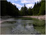 2
2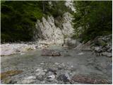 3
3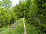 4
4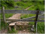 5
5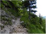 6
6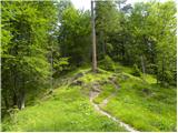 7
7 8
8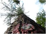 9
9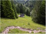 10
10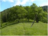 11
11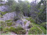 12
12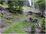 13
13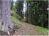 14
14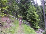 15
15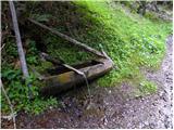 16
16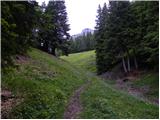 17
17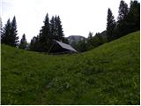 18
18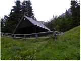 19
19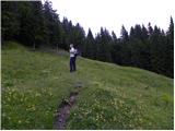 20
20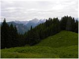 21
21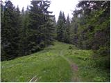 22
22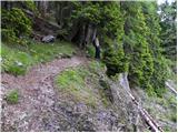 23
23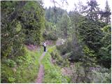 24
24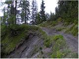 25
25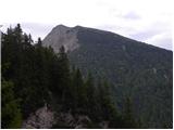 26
26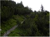 27
27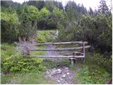 28
28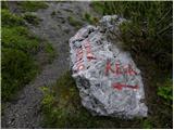 29
29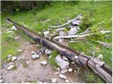 30
30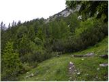 31
31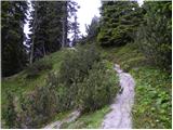 32
32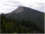 33
33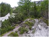 34
34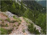 35
35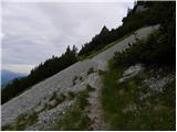 36
36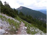 37
37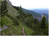 38
38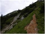 39
39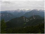 40
40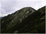 41
41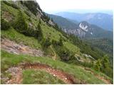 42
42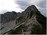 43
43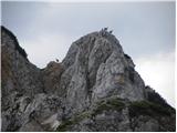 44
44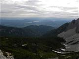 45
45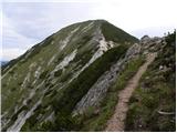 46
46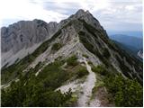 47
47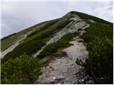 48
48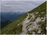 49
49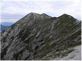 50
50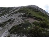 51
51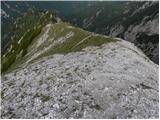 52
52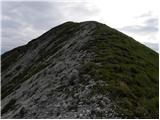 53
53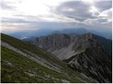 54
54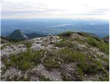 55
55
Discussion about the trip Erjavčev rovt - Huhnerkogel/Gubno
|
| tango21. 07. 2020 |
Today's day was ideal, in the morning a bit cloudy and pleasantly cool, on the way back warmer, so refreshment in the Žakelj stream really came in handy. I recommend!
|
|
|
To post a comment you must log in:
If you do not yet have a username, you must first
register.