Starting point: Fiames (1300 m)
| Latitude/Longitude: | 46,57665°N 12,11613°E |
| |
Walking time: 3 h 45 min
Difficulty: easy pathless terrain, difficult marked way
Elevation gain: 1048 m
Elevation difference along the route: 1100 m
Map: Tabacco 03 1:25.000
Recommended equipment (summer): helmet
Recommended equipment (winter): helmet, ice axe, crampons
Views: 1.446
 | 3 people like this post |
Access to starting point:
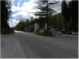
Over the border crossing Rateče we drive to Trbiž / Tarvisio, where we head onto the highway in the direction of Vidma / Udine. We leave the highway at the exit for Tolmezzo and follow the road to the mentioned settlement. From Tolmezzo we continue in the direction of the settlement Ampezzo and the mountain pass Passo della Mauria. The road then starts descending and brings us into the Cadore valley, where we continue right (left Belluno and Cortina d'Ampezzo) in the direction of the settlement Auronzo. After a few additional km of driving, we come to the next larger intersection, where we turn right in the direction of the settlement Misurina (left pass Tre Croci). From here we descend along the road to a larger intersection where we continue left towards Cortina d'Ampezzo (right Austria). A few kilometers before Cortina d'Ampezzo we arrive in the settlement Fiames. At the very beginning of the settlement Fiames (at the sign that marks the settlement) we will notice on the left (eastern) side of the road a smaller parking lot where we park. On the right side of the road there is a hotel and a few more parking lots.
Route description:
From the parking lot, we head onto the marked path through the forest in the direction towards the southeast. After a short ascent, we arrive at a macadam road along which we continue right. We quickly leave the mentioned road and head left upwards following the signs »Ferrovia, Ferrata Strobel«. Here the path gently ascends through the forest and then joins another macadam road (path 208), which is very popular among cyclists. We continue right along the gently sloping macadam road and already after a few meters a path branches off to the left towards the secured climbing path Via Ferrata Strobel. We continue walking along the macadam road all the way to a marked junction where signposts direct us left into the forest on path 218 following the signs »Punta Fiames«.
The path further runs mostly through pine forest towards the south and from the path a view opens up several times on the mountain group Tofana and on the valley of the river Boite. Such a path then brings us to a junction where the path from the settlement Vera joins from the right.
At the junction we continue left and begin to ascend somewhat more steeply. The path then brings us out of the forest into the dwarf pines and increasingly beautiful views of the surrounding peaks begin to open up. When we approach the walls of the peaks the path turns right and crosses the slopes towards the southeast. On the path we also cross some torrent gullies, then soon we arrive at a marked junction.
Right downwards leads path 202 towards the settlement Vera, straight ahead leads path 218, and we head left upwards on path 202 towards the notch Forcella Pomagagnon. The path further ascends over scree beside increasingly sparse dwarf pines and brings us to yet another marked junction.
Right branches off path Terza Cengia (only for experienced), and we continue left upwards and look for the passage that crosses the torrent bed (cairns help us). The path then ascends for a long time over scree upwards and later crosses a few more beds, where some caution is needed when crossing them. From the path, which runs through a wide gully below the precipitous walls of the peak Croda del Pomagagnon, we otherwise have a nice view all the time on the precipitous walls above us and towards the mountain group Sorapiss. The path through the gully runs over scree all the way to the notch Forcella Pomagagnon where a view opens up to the north towards the summit Croda Rossa.
From the notch we first slightly descend to the northern side along the marked path, then after a few hundred meters we leave the marked path and head left onto the unmarked old military path, which leads below the slopes of the peak Pezzories, which we see in front of us all the time from the notch. When we arrive below the slopes of the mentioned peak we will also notice some military ruins along the path. We head to the southern slopes of the mountain, which are partly overgrown with dwarf pines. The track is here quite poorly visible but runs in zigzags along the southern slopes of the mountain. In the lower part the path is already slightly overgrown with dwarf pines but is still quite easily passable. Higher up on the path there are no more dwarf pines and an ascent follows on a relatively steep slope to the summit where a cross stands.

Along the route: Forcella Pomagagnon (2178m)
Photos:
 1
1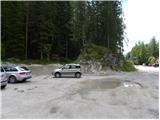 2
2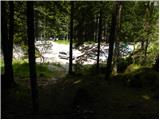 3
3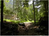 4
4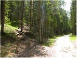 5
5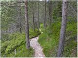 6
6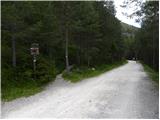 7
7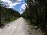 8
8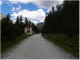 9
9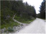 10
10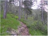 11
11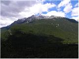 12
12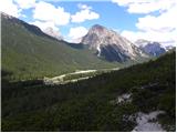 13
13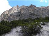 14
14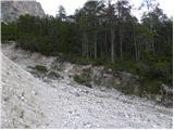 15
15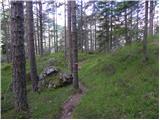 16
16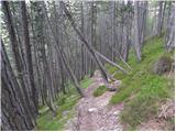 17
17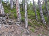 18
18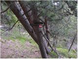 19
19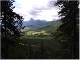 20
20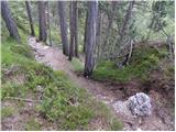 21
21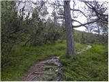 22
22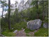 23
23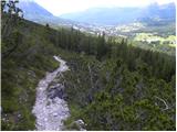 24
24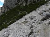 25
25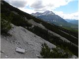 26
26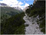 27
27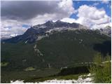 28
28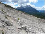 29
29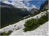 30
30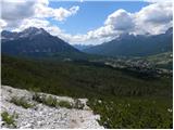 31
31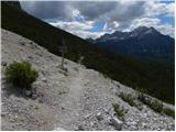 32
32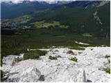 33
33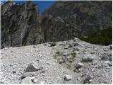 34
34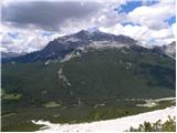 35
35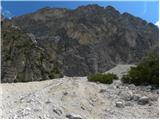 36
36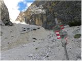 37
37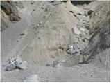 38
38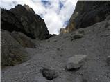 39
39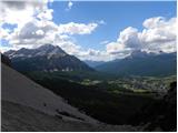 40
40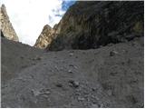 41
41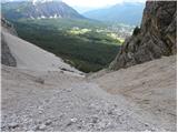 42
42 43
43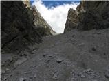 44
44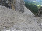 45
45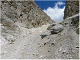 46
46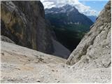 47
47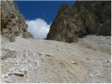 48
48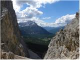 49
49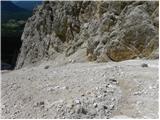 50
50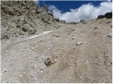 51
51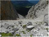 52
52 53
53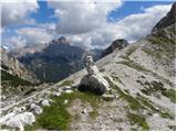 54
54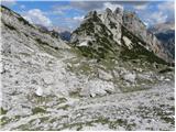 55
55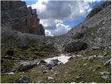 56
56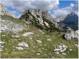 57
57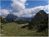 58
58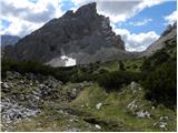 59
59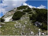 60
60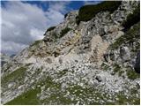 61
61 62
62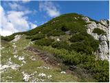 63
63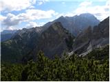 64
64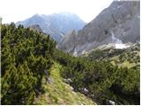 65
65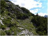 66
66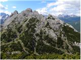 67
67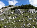 68
68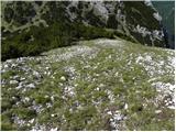 69
69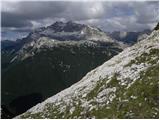 70
70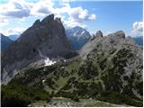 71
71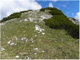 72
72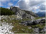 73
73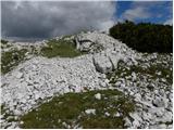 74
74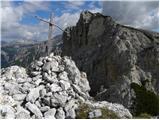 75
75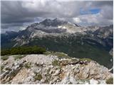 76
76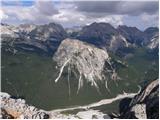 77
77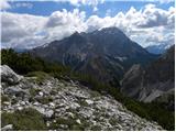 78
78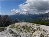 79
79
Discussion about the trip Fiames - Pezzories
To post a comment you must log in:
If you do not yet have a username, you must first
register.