Fiames - Punta Fiames (Via Ferrata Strobel)
Starting point: Fiames (1300 m)
| Latitude/Longitude: | 46,57665°N 12,11613°E |
| |
Route name: Via Ferrata Strobel
Walking time: 3 h
Difficulty: extremely difficult marked way
Via ferrata: C/D
Elevation gain: 940 m
Elevation difference along the route: 940 m
Map: Tabacco 03 1:25.000
Recommended equipment (summer): helmet, self belay set
Recommended equipment (winter): helmet, self belay set, ice axe, crampons
Views: 3.695
 | 3 people like this post |
Access to starting point:
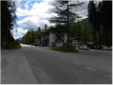
Over the Rateče border crossing we drive to Trbiž / Tarvisio, where we head onto the highway in the direction of Videm / Udine. We leave the highway at the Tolmezzo exit and follow the road to the mentioned settlement. From Tolmezzo we continue in the direction of the settlement Ampezzo and mountain pass Passo della Mauria. The road then starts descending and brings us into the Cadore valley, where we continue right (left Belluno and Cortina d'Ampezzo) in the direction of the settlement Auronzo. After a few additional km of driving, we come to the next bigger crossroad, where we go right in the direction of the settlement Misurina (left mountain pass Tre Croci). From here we descend on the road to a bigger crossroad where we continue left towards Cortina d'Ampezzo (right Austria). A few kilometers before Cortina d'Ampezzo we come to the settlement Fiames. At the very beginning of the settlement Fiames (at the sign which marks the settlement) we will on the left (eastern) side of the road notice a smaller parking lot on which we park. On the right side of the road there is a hotel and a few more parking lots.
Route description:
From the parking lot, we head onto the marked path through the forest in the southeast direction. After a short ascent, we reach a macadam road, on which we continue right. We quickly leave the mentioned road and head left uphill following the signs «Ferrovia, Ferrata Strobel». Here the path gently ascends through the forest and then joins another macadam road (path 208), which is very popular among cyclists. We continue right on the gently sloping macadam road, which we leave after just a few meters, heading left uphill towards the secured path Via Ferrata Strobel.
The path here first runs through the forest and begins to ascend steeply. The forest soon ends and the path turns slightly left, ascending mostly through dwarf pines along the bed of a torrent. Here we ascend towards a wide gully, but when we get very close to the precipitous walls, the path turns right onto the ledge.
At the beginning of the ledge, we will also notice a plaque in the wall indicating that the path is dedicated to the mountain guide Michielli Albino Strobel. The path along the ledge gently ascends and crosses the wall to the right. Here the path is not yet secured, then it turns left and brings us to the first fixed protections. The secured path at the beginning ascends very steeply several times along the steel cable, and some arm strength is also needed. From the path we have increasingly beautiful views of the nearby mountain group Tofana and the valley of the river Boite. Continuing, the path turns slightly left and ascends steeply a few more times along the steel cable. Higher up, the path turns right and brings us to less steep slopes. The path then crosses the slope to the right and soon a view opens towards the mountain group Sorapiss. Here the path becomes more demanding again and ascends vertically with the aid of a few pegs. A less demanding crossing to the left follows, bringing us in front of a relatively long vertical ladder. After the ladder, an ascent on a few pegs follows, then the path becomes a shade less steep and continues ascending along the steel cable for a while. Higher, the path turns right, followed by an ascent on a less steep slope through sparse dwarf pines. Later, the path turns left again and the last somewhat steeper ascent along the steel cable follows. The fixed protections then end and the path brings us to the less steep northern slopes of the mountain, where there is a junction.
We continue right uphill towards the summit, while left leads the path downhill towards the saddle Forcella del Pomagagnon. From the junction, we ascend slightly more on the rocky slope, then soon reach the panoramic summit.
We descend via the path over the saddle Forcella del Pomagagnon. From the saddle, we then descend the gully to the south side and from there back to the starting point. From the saddle Forcella del Pomagagnon, we can also descend via a less steep but somewhat longer path, which descends from the saddle to the north side through the valley Val Pomagagnon.

Photos:
 1
1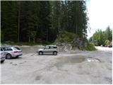 2
2 3
3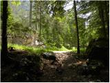 4
4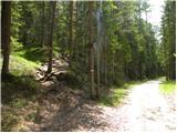 5
5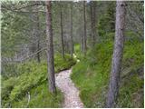 6
6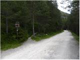 7
7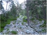 8
8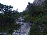 9
9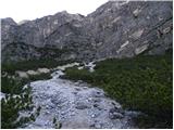 10
10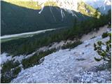 11
11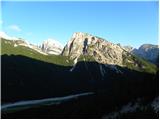 12
12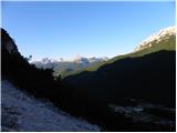 13
13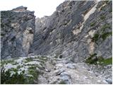 14
14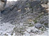 15
15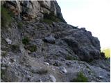 16
16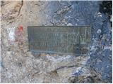 17
17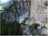 18
18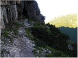 19
19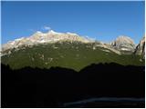 20
20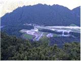 21
21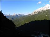 22
22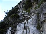 23
23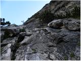 24
24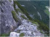 25
25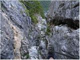 26
26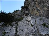 27
27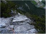 28
28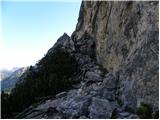 29
29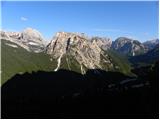 30
30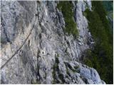 31
31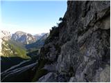 32
32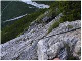 33
33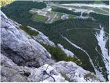 34
34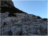 35
35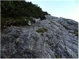 36
36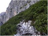 37
37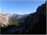 38
38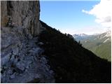 39
39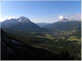 40
40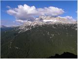 41
41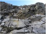 42
42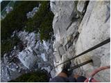 43
43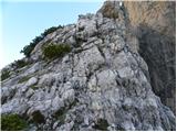 44
44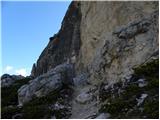 45
45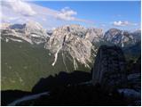 46
46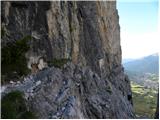 47
47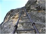 48
48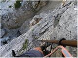 49
49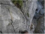 50
50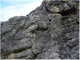 51
51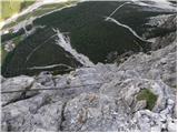 52
52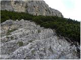 53
53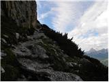 54
54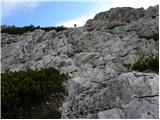 55
55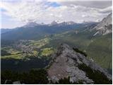 56
56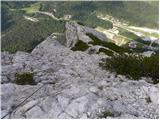 57
57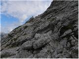 58
58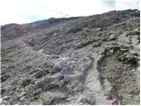 59
59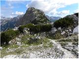 60
60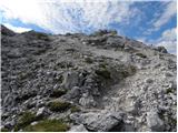 61
61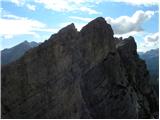 62
62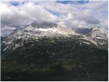 63
63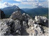 64
64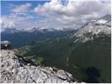 65
65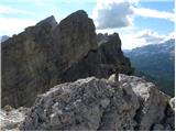 66
66
Discussion about the trip Fiames - Punta Fiames (Via Ferrata Strobel)
|
| janezmatos6. 09. 2020 |
When the ferrata ends and you reach the less steep slopes before the summit, a path branches off to the left immediately, marked with cairns. This is not the right path! The correct path to the Pomagagnon saddle branches off to the left only a few meters below the summit.
|
|
|
|
| Behemot12. 08. 2021 19:19:19 |
The difficulty of the via ferrata is one grade lower and deserves a B/C rating at the hardest sections, as it is rated in all serious guidebooks.
|
|
|
To post a comment you must log in:
If you do not yet have a username, you must first
register.