Franc / Franzbauer - Ferlacher Horn / Grlovec
Starting point: Franc / Franzbauer (1008 m)
| Latitude/Longitude: | 46,47590°N 14,29810°E |
| |
Walking time: 2 h 15 min
Difficulty: easy marked way
Elevation gain: 832 m
Elevation difference along the route: 832 m
Map: Karavanke - osrednji del 1:50.000
Recommended equipment (summer):
Recommended equipment (winter): ice axe, crampons
Views: 7.545
 | 1 person like this post |
Access to starting point:
From the Ljubljana - Jesenice highway, we head to the Ljubelj (Tržič) exit, then continue driving in the direction of Celovec / Klagenfurt. After the Ljubelj tunnel, the road starts descending, and we follow it to the junction where the road towards the settlement Borovlje / Ferlach branches off slightly right and downwards. The road, still descending, quickly brings us to the mentioned settlement, where we soon cross the railway track. Just a little after the track, we join another road, which we follow to the right, driving towards the settlement Sele / Zell - Pfarre. Soon after the village Bajdiše / Waidisch, we leave the main road and continue driving right towards Zgornji Kot / Zell - Oberwinkel. Further, we drive alongside the Ribnica / Ribnitza stream for some time, then soon notice the first signposts for Grlovec / Ferlacher Horn. We can start the path here (this extends the path by approximately 45 minutes), or we can drive a little higher towards the farm Franc / Franzbauer. If we continue driving, we drive through the valley for some time longer, then park at a suitable place about 15 minutes below the farm Franc / Franzbauer.
Route description:
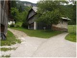
From the starting point, we first walk to the farm Franc, where there is a hamlet of a few houses.
At the end of the small hamlet, signs for Grlovec / Ferlacher Horn direct us left onto a cart track that passes the house with house number 11 and takes us to the spot where the cart track turns right, while the marked path continues straight. The path ahead crosses a shorter clearing or meadow, then passes into the forest through which it gradually starts to ascend more steeply. Higher up, the trail levels out, then brings us to a forest road, which we follow for a few meters to the left; after a few meters, we notice the continuation of the mountain path. For a short time, we continue parallel to the road, then diagonally ascend across the clearing. On the other side of the clearing, we step into the forest, and the path brings us to a marked junction, where we join the path from Dajčpetra / Deutcher Peter.
Here we continue right and once again cross a fairly scenic clearing. Further on, the path leads us through the forest and, past a memorial, gradually brings us to the western ridge of Grlovec (ridge named Velika gora). We continue the ascent along and beside the ridge, from which we occasionally get nice views mainly towards the north. Higher up, the ridge temporarily narrows and continues for a short time along the edge of a mighty precipice (the precipice is only on one side, so there are no major difficulties). The ridge then gradually widens, and the path from the forest brings us to the upper slope of the mountain. This is followed by a short diagonal ascent through a sparse belt of coniferous forest, then, with increasingly beautiful views, we quickly reach the summit, on which stands a larger cross.

Photos:
 1
1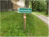 2
2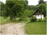 3
3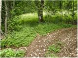 4
4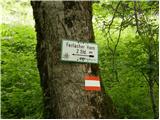 5
5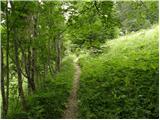 6
6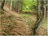 7
7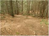 8
8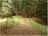 9
9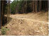 10
10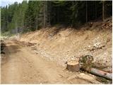 11
11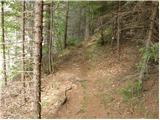 12
12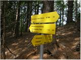 13
13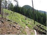 14
14 15
15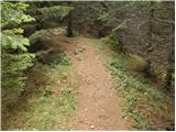 16
16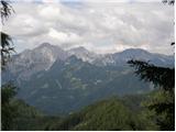 17
17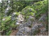 18
18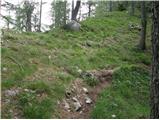 19
19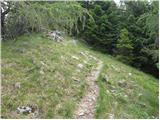 20
20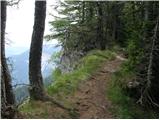 21
21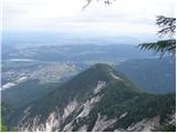 22
22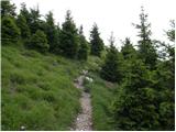 23
23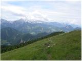 24
24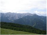 25
25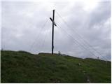 26
26
Discussion about the trip Franc / Franzbauer - Ferlacher Horn / Grlovec
|
| michael6612. 04. 2017 |
Is the road to the Franc farm asphalt?
|
|
|
|
| turbo12. 04. 2017 |
There is asphalt up to Franc, but driving up is officially permitted only to locals. I always left the car below at the intersection, Austrians do the same, there is no parking space in the village anyway, except on someone's yard.
|
|
|
|
| ljubitelj gora7. 10. 2019 |
Yesterday afternoon I drove there, at Ljubelj they check ID cards. The road to the starting point is asphalted. The trail is easy and well marked. The views are magnificent.
|
|
|
To post a comment you must log in:
If you do not yet have a username, you must first
register.