Gabrje - Limbarska gora (footpath)
Starting point: Gabrje (500 m)
| Latitude/Longitude: | 46,14770°N 14,77300°E |
| |
Route name: footpath
Walking time: 45 min
Difficulty: easy marked way
Elevation gain: 273 m
Elevation difference along the route: 273 m
Map: Ljubljana - okolica 1:50.000
Recommended equipment (summer):
Recommended equipment (winter):
Views: 40.154
 | 2 people like this post |
Access to starting point:
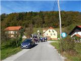
A) From the highway Ljubljana - Maribor, we take the exit Krtina, then continue driving in the direction of Moravče. In Moravče, we continue left in the direction of Limbarska gora and Sveti Mohor; at the next crossroad, where the road branches off to the left towards Sveti Mohor, we continue slightly right in the direction of Limbarska gora. Further on, the road gradually starts ascending, and we drive along it through the settlement Zalog to the settlement Gabrje pod Limbarsko, where the forest ends, and the road flattens, or even descends a little. When we get to a moderate right turn, where on the right side we notice a built chapel, we continue left on the road with speed bumps. A few dozen meters further, we are at the beginning of the described path at the next chapel. There are no arranged parking spaces at the starting point.
B) From the direction of Zasavje, we first drive to Izlake, from there we continue driving towards Moravče. When the road already starts descending towards Moravče, we need to pay attention to the right turn-offs, because we will leave the main road towards Moravče at the turn-off towards the settlement Peče. In Peče at the church, we continue left, then we continue driving through the settlements Zgornje Koseze and Mošenik and arrive at Gabrje pod Limbarsko goro, where at the smaller crossroad opposite the chapel we continue right on the road with speed bumps. A few dozen meters further, we are at the beginning of the described path at the next chapel. There are no arranged parking spaces at the starting point.
Route description:
The beginning of the mountain path is slightly to the left of the chapel, where on a power line pole we notice mountain markers for Limbarska gora, which tell us that we have 45 minutes of walking to the top. After a few steps of walking, the path goes into the forest, through which we ascend for a few minutes, then we already arrive at an asphalt road, which we follow to the right, and we walk along it to the left turn. At the mentioned turn, the marked path continues straight ahead, initially along the nearby fence. The path, which is initially a little overgrown, soon turns left and starts ascending through the forest. Higher up, we step onto a cart track, which continues through the forest for a short time, then starts ascending transversely across a larger hay meadow. When the traverse ends, we arrive at a smaller hamlet (hamlet Globočica), where we continue left on a wide cart track or a bad road. The road higher turns right and a little further flattens at the next hamlet. There follows an easy walk past a few houses, then we continue on a somewhat steeper cart track, which higher changes into an asphalt road, which joins the main asphalt road that leads towards the top of Limbarska gora.
On the mentioned road, we ascend past a few more houses, and then with increasingly beautiful views we quickly ascend to the church of St. Valentine and the inn on Limbarska gora.

Photos:
 1
1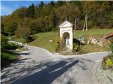 2
2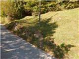 3
3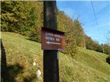 4
4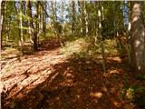 5
5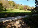 6
6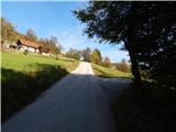 7
7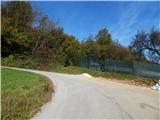 8
8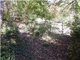 9
9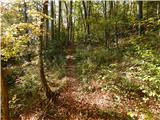 10
10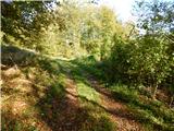 11
11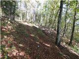 12
12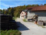 13
13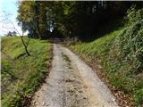 14
14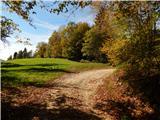 15
15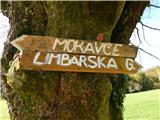 16
16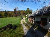 17
17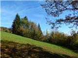 18
18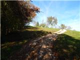 19
19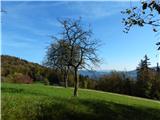 20
20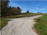 21
21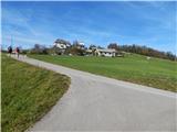 22
22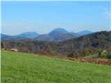 23
23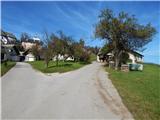 24
24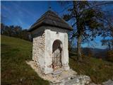 25
25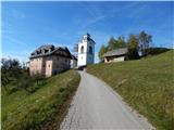 26
26 27
27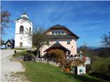 28
28 29
29
Discussion about the trip Gabrje - Limbarska gora (footpath)
|
| kroki29. 01. 2008 |
In clear and washed air we see beautiful Kamnik-Savinja Alps and Julian Alps.
|
|
|
|
| marchy14. 09. 2009 |
Hey, does anyone know the path to Limbarska gora from Trojan, I heard you can get there too? I'd appreciate a short description of the path if anyone knows, thanks in advance.
|
|
|
|
| AndrejN15. 09. 2009 |
From Trojan you head towards Ljubljana on the main road. When you reach the pass where the road starts descending, turn left towards Zavrh. Continue on the road that leads to Dolin. From there over Škal to the village of Borje. There you reach the asphalt road and continue on it towards Golčaj. This road leads to Blagovica, so be careful to leave it at the right time and go onto the gravel road. At Golčaj there is a logbook, a little church and a bench for rest. From Golčaj continue on the path, partly also on the road, to the asphalt road Limbarska-Moravče. At the intersection turn right uphill and after a few minutes you see the church on Limbarska.
The path is marked along its entire length.
Happy hiking!
Andrej
|
|
|
|
| marchy15. 09. 2009 |
OK, thanks Andrej for the explanation, first free weekend I'll head to Limbarska.
|
|
|
|
| al198118. 08. 2010 |
I've been to Limbarska several times already, and I'm tired of the same path :-(
two days ago I wanted to go directly from L. Gora to Moravče... but it's very poorly marked... Does anyone know how to describe from Moravče to the top?
|
|
|
|
| Gorska rožica19. 08. 2010 |
My favorite route is through Serjuče, at the Tuš store you turn left at the intersection, drive or walk approx. 2km, past the school through the village Soteska and turn right over the little bridge, where the village Serjuče is. When the asphalt ends, park somewhere on the farm, the locals are very friendly. The path is fully marked, leads almost all the time through the forest, just a little before the summit you go through the clearing and cross the road, a bit more uphill, the last kilometer unfortunately only on the road. GOOD LUCK!!
|
|
|
|
| Gorska rožica19. 08. 2010 |
Most people go right at the Tuš store, through Zalog, in Gaberje you turn left and at the first junction left through Vodice, turn right through the forest... and it's supposedly also marked.... unfortunately I don't use it,
I always go this direction only by bike.. nice day!!
|
|
|
To post a comment you must log in:
If you do not yet have a username, you must first
register.