Starting point: Gabrovo (500 m)
| Latitude/Longitude: | 46,15870°N 14,29110°E |
| |
Walking time: 1 h 30 min
Difficulty: easy marked way
Elevation gain: 525 m
Elevation difference along the route: 425 m
Map: Škofjeloško in Cerkljanjsko hribovje 1:50.000
Recommended equipment (summer):
Recommended equipment (winter):
Views: 131.739
 | 10 people like this post |
Access to starting point:
First, we drive to Škofja Loka and from there we continue driving in the direction of Gorenje vasi. In the village Podpulfrca (which is located immediately after Škofja Loka) we leave the main road and turn right in the direction of the villages Breznica and Gabrovo (there is also a sign by the road for the mountain hut Koča na Lubniku). We then follow the ascending road to a sharp left bend, where parking is possible, or we drive a little further to the crossroads, where a road sharply branches off to the right towards the village Gabrovo. Here we can park on one of the smaller parking lots near the crossroads (parking in the village Gabrovo is not possible).
Route description:
If we've parked at the bend, we head onto the footpath with signs "Dom na Lubniku". The well-marked path brings us to the village Gabrovo after approximately half an hour of walking from the starting point.
If we drove a little higher, we first walk to the crossroads, where the road to the village Gabrovo branches off. We then follow this slightly ascending road to the mentioned village, where we join the path from the lower starting point.
From the village Gabrovo we continue on the forest road closed to traffic, which slightly ascends along the edge of the forest. After a few minutes of walking on this road, we leave it as the blazes direct us slightly to the right onto a footpath that immediately steeply ascends. After a few steps the steepness eases and the path continues ascending through dense forest. A little higher, the path joins a wide cart track, which we follow to the right. The cart track then takes us past a smaller already overgrown clearing, after which we reach a junction.
We continue left on the gentle and marked cart track, which after a few minutes of further walking turns into a moderately steep footpath. Higher up, the path widens and shortly after joins a wide partly stone-paved cart track that comes from the village Breznica. We continue the ascent on the mentioned cart track, which continues ascending through the forest. A little higher, the path from Podlubnik joins from the right, and we continue on the cart track, which after a few more minutes of walking brings us to the summit of Lubnik.

Photos:
 1
1 2
2 3
3 4
4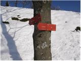 5
5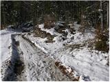 6
6 7
7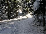 8
8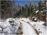 9
9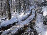 10
10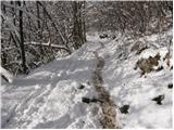 11
11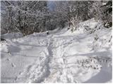 12
12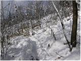 13
13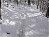 14
14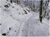 15
15 16
16 17
17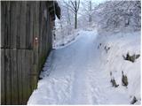 18
18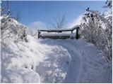 19
19 20
20
Discussion about the trip Gabrovo - Lubnik
|
| Gost2. 10. 2006 |
MT - If we go from the junction for Gabrovo along the road from Podlauferce to the lower station of the freight cableway, we have about 40 minutes of effortless walking on a wide path to the top of Lubnik. The path is well marked and signposted with shortcut options. At the top there is a hut with excellent spoon food (tried: jota, goulash). In fine weather wonderful views over the Ljubljana basin and Poljane valley.
|
|
|
|
| Gost18. 08. 2007 |
You can reach Lubnik from several sides, on foot directly from Škofjeloški grad.
The path is fully marked.
Walking time 1.30h
|
|
|
|
| Gost7. 09. 2007 |
   We recommend the trip, the shortest is from the Naceta farm. In about 40 minutes you climb to 1025 m We recommend the trip, the shortest is from the Naceta farm. In about 40 minutes you climb to 1025 m
|
|
|
|
| Gost4. 01. 2008 |
A 5-year-old child, of course with full animation along the way, made it from the castle to the top of Lubnik without problems... 
|
|
|
|
| Gost9. 02. 2008 |
Yesterday we went to Lubnik with the family along the described path. The description certainly matches. A very nice addition to a sunny day with wonderful views in all directions. I recommend it to families with children. LP Andrej
|
|
|
|
| mihan6. 04. 2008 |
Small correction. At the end of the village Gabrovo (at the sawmill) there is now a sign "no entry for all vehicles", so you can park in front of the village by the road. Even better (also for the residents of Gabrovo) is to park a kilometer or two lower at the bend, where there is plenty of space and no one is disturbed. From there to the top is less than an hour and a half - all well marked.
|
|
|
|
| elpadre6. 12. 2008 |
Hello, I'm interested if there's any snow on Lubnik and how the path from Škofja Loka castle to the top is
lp
|
|
|
|
| viharnik7. 12. 2008 |
Today I was on Tošč, in shady ravines quite muddy, on ridges drier. Morning fog limit at 750m. Snow just a sample, on northern slopes, above 800m.
|
|
|
|
| elpadre7. 12. 2008 |
Some pics from today's Lubnik, weather was OK.
|
|
|
|
| Planinček31. 03. 2009 |
Is there still any snow or ice on the path to Lubnik?
|
|
|
|
| serajko31. 03. 2009 |
Little mountaineer!
I don't know if snow fell these days, but I was on Lubnik two weeks ago and it was dry on the entire path from the bridge at Gabrovo to the hut
lp
|
|
|
|
| Planinček1. 04. 2009 |
Thanks for the reply. I think the weekend will be just right for visiting Lubnik.
|
|
|
|
| Planinček6. 04. 2009 |
I was on Lubnik yesterday. No snow as someone already said, but the path is quite muddy in places.
|
|
|
|
| Bizy6. 04. 2009 |
We were also on Lubnik on Sunday, beautiful weather for the ascent, real summer on the summit, quite a lot of people, back we went along the ridge path (ridge path), super!
|
|
|
|
| stanko115. 01. 2010 |
Does anyone know conditions for Lubnik from Gabrovo?
|
|
|
|
| serajko15. 01. 2010 |
From Gabrovo to summit well trodden. Downhill crampons recommended. Hut closed weekdays until 1.3.2010. Weekends open shelter, if I'm not mistaken it says open until 15:00. Checked 13.1.2010
lp
|
|
|
|
| tanto26. 02. 2010 |
But it's already nicer than from the partisan printing house in Podlubnik (burned) to Lubnik...
|
|
|
|
| serajko26. 02. 2010 |
And yesterday it was already quite muddy in places
|
|
|
|
| ziga.subic13. 03. 2010 |
Today I was on Lubnik, very little snow, not even for gaiters, on the way back the slush that started forming due to the sun was annoying. Otherwise great weather, the hut at the top is open, so I recommend it for a short trip.
|
|
|
|
| podplat.car28. 04. 2010 |
Today my wife and I headed to Lubnik. From the starting point to the top we were quick, the path is dry but there are too many rocks in the forest for our taste. At the top the friendly caretaker served us nicely, we signed the book, stamped the transverse and then took the shortcuts back to the starting point. Nice hike on a beautiful day. LP Tanja and Borut.
|
|
|
|
| pohodnik0123. 07. 2010 |
Easy marked path? It is easy, but regarding marking it should get WORST MARK. Why? From the road into Gabrovo village sign, from Gabrovo village towards Lubnik sign, markings. OK. Then it's the end. In between there are lots of paths, turnoffs, intersections but no markings anywhere. A local we met said all paths lead to Lubnik. True they do, but for someone going up for the first time it's nice to have markings. To Lubnik the markings are again ~100 m before the hut? They could look at the properly marked path to sv. Jošt above Kranj, which is marked and written for any layman.
Best regards
|
|
|
|
| Kriška23. 07. 2010 |
I agree with pohodnik01. I first hiked the trail in the opposite direction - descent from Lubnik towards the settlement of Gabrovo and from there to Škofja Loka or Podlubnik. If it weren't for other hikers who already knew the path (and whom I asked for help), I would have gotten seriously lost at least twice, and even in between I was several times in dilemma where to continue (but luckily chose the right path).
I ascended then via the ridge path, which is well marked.
I think directional signs would be urgently needed at least at trail junctions and intersections.
|
|
|
|
| GITA16. 10. 2010 |
Pohodnik01 and Kriška... I don't know if we're talking about the same path, but we walked up this morning with kids (we were first). Parked "at the bend", from there the path to the hut is perfectly marked, all junctions signed, at the start of the path also a sign asking hikers to stick to the marked path...
|
|
|
|
| capraibex16. 10. 2010 |
Here I agree with Kriška that the path in the direction Gabrovo Lubnik is inadequately marked. The problem is numerous shortcuts, crossings, so I myself missed the path at least twice on descent.
|
|
|
|
| kaveljc16. 10. 2010 |
capraibex ... And when were you last on Lubnik??? Go up again and you'll see! If you miss it now something's wrong! But not with the markings!!!
|
|
|
|
| capraibex17. 10. 2010 |
February 2010, kaveljc you are probably one of those who go up every week unlike us who were there for the first time, best regards.
|
|
|
|
| krištof8. 02. 2011 |
Today I was up there, really super trail and weather
|
|
|
|
| limona29. 02. 2011 |
krištof, is the path snowy, icy (crampons?) Did you go from the castle or from the village Gabrovo? Thanks and best regards!
|
|
|
|
| serajko9. 02. 2011 |
best regards
Yesterday I was on Lubnik from Vešter via Gabrovo. No snow or ice, but mud mud to the village
|
|
|
|
| limona210. 02. 2011 |
thanks, serajko. best regards!
|
|
|
|
| Lucy9. 08. 2011 |
After a long time I visited the hut on Lubnik and was disappointed. I found out that in the meantime the owners of the hut have changed. The previous owners were much friendlier, more accommodating and the service itself was great. The new owners of the hut were so unfriendly that I decided not to go to Lubnik anymore.
|
|
|
|
| Branee9. 08. 2011 |
@ Lucy
Look what nonsense you're writing, you're not going to Lubnik because you don't get along with the hut owners? waw..
Secondly, the previous owner (my neighbor) died, he had cancer, my mom (who has now passed away) eased his last hours.. RIP
|
|
|
|
| Branee9. 08. 2011 |
oh I forgot to write that she is a retired doctor..
|
|
|
|
| dore9. 08. 2011 |
Poor lucy, if it continues like this you'll soon only be able to visit Spar and Mercator.
|
|
|
|
| LijaK27. 03. 2015 |
Hello, if anyone has been up there recently or lives nearby, could they tell me if there's still any snow on Lubnik and if this recent rain has really made it muddy?
|
|
|
|
| GregorC28. 03. 2015 |
I was there last week from Sv. Tomaž. No snow, but it might be a bit muddy, especially since there's a lot of work going on in the forest.
|
|
|
|
| SunBurned22. 09. 2015 |
Today found a plastic phone case 50 m below the summit. Left it up at the Dom.
|
|
|
|
| Kafe Rajsar5. 07. 2017 |
We were on this trail yesterday. Excellent variant for an afternoon workout. Trails are poorly marked in some places.  PD will have to organize a marking action from mark to mark. PD will have to organize a marking action from mark to mark.
|
|
|
|
| ločanka6. 07. 2017 |
I haven't been there yet
|
|
|
|
| ločanka6. 07. 2017 |
I haven't been there yet
|
|
|
|
| anazala31. 08. 2018 |
On Lubnik it's great. You can get there nicely even through snow, deep snow. Friendly staff, good food. Drink prices like elsewhere in huts. Tour suitable for children and elderly. You have sun and shade throughout, so you can rest in the shade if you go in summer. I'm going tomorrow, even though there will be a few drops of rain. A few drops of rain won't spoil my day. If someone doesn't like the staff or service, let them wait outside. The view is nice.
|
|
|
|
| robbrt2. 03. 2019 |
Today I visited Lubnik for the first time . In my opinion, this trail is a suitable choice if it's your first visit to the Škofja Loka "Triglav"  , with a moderate pace you can reach the summit in 1.15h, the view is fantastic, the staff at the hut is friendly. The only thing that bothered me a bit are the somewhat misleading markers in places , with a moderate pace you can reach the summit in 1.15h, the view is fantastic, the staff at the hut is friendly. The only thing that bothered me a bit are the somewhat misleading markers in places
|
|
|
|
| LadyS28. 03. 2019 |
In the hiking booklet Slovenska planinska pot, we randomly chose Lubnik for the first spring hike and the route from the Gabrovo side. A large sign for the mountain hut soon greets you from the Škofja Loka side, from where we drove up. Newly arranged parking lot for buses and cars shortly after on the left. Signs for the Lubnik path satisfactorily marked, markings really a bit tricky. We stopped a few times and really pondered. You can't get lost though, as long as you follow at least the visible markings they lead upwards, some just steeper. Path very nice. Not too demanding even for first-timers. Owner at the hut very friendly. Nicely served tasty food. Fantastic view. Only the WC was broken on our ascent, but no matter, an outhouse in cold wind has its purpose too. Descent confused us a bit due to all the trails, so we took the wrong shortest path down and soon reached the road on the other side of the hill. No problem though, the road walk was still very nice and green. Just a bit longer to the car. Definitely recommend! I'll return.
|
|
|
|
| Majdag7. 06. 2024 20:38:40 |
5.6..Hikers DU Javornik Kor. Bela. We arrived by train. Then by bus to Škofja Loka. Continued past the Museum and the sawmill. Then along paths, there are many, steep and sometimes slippery too. At the top nice, great weather and service too, nice.
https://jelenkamenmajdag.blogspot.com/2024/06/lubnik.html
|
|
|
|
| Gorzo5. 01. 2025 12:56:25 |
The path is fine, a small patch of snow and ice right at the top. So, if you want, you can also fall . Wonderful view.
The hut is closed from 3.1.2025 indefinitely due to water shortage. Probably there was a nice party for New Year and they used up all the water for tea .
|
|
|
To post a comment you must log in:
If you do not yet have a username, you must first
register.