Zapornica (Belca) - Huhnerkogel/Gubno
Starting point: Zapornica (Belca) (1007 m)
| Latitude/Longitude: | 46,50410°N 13,91790°E |
| |
Walking time: 5 h
Difficulty: difficult marked way, easy unmarked way
Elevation gain: 1028 m
Elevation difference along the route: 1300 m
Map: Kranjska Gora 1:30.000
Recommended equipment (summer): helmet
Recommended equipment (winter): helmet, ice axe, crampons
Views: 6.403
 | 2 people like this post |
Access to starting point:
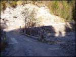
Because of the rockfall, access to the described starting point currently isn't possible (May 2018).
We leave the Gorenjska highway at exit Hrušica and follow the road ahead in the direction of Kranjska Gora. Only a little after the village Belca, a forest road to Kepa branches off to the right. We head onto this road, which through the tunnel and above precipices brings us to a parking lot in front of the gate, where we park (further driving is forbidden).
Route description:
The path to Kepa at first leads by the stream (beginning of the path is marked), then after a few minutes turns left and starts ascending steeper. Ahead we ascend through the forest, which is occasionally interrupted by some shorter clearing covered with bushes. Marked mountain path then twice crosses a forest road; when we step onto it the third time, we follow it to the right to a somewhat larger parking lot by the border ridge (to here possible also by road).
From the parking lot, we in a few steps ascend to the border ridge and follow the path ahead towards the east. A relatively gently sloping path, which runs along the border ridge, quickly brings us to a smaller bivouac (2 berths), which is situated on the Slovenian side of the ridge.
From the bivouac, we continue on the marked trail to which soon joins the path from Austria. The path then ascends somewhat steeper and further leads us along an ever narrower ridge. The increasingly panoramic path then crosses some slightly exposed gullies and then turns right (entirely on the Slovenian side). The path ahead ascends diagonally across a steep and well-secured slope, which is very exposed to falling rocks. Higher, the path turns left and then ascends the steep summit slope of Kepa. The steep and scree-filled path then higher brings us again to the border ridge, where the next junction is.
We continue right (left Kepa 2 minutes) along the path, which gently descends panoramic grassy slopes. The path, which runs along the edge of the ridge, then starts descending steeper and soon brings us to a smaller saddle, where the path from Austria joins us. We continue straight along the path, which still runs on the Austrian side of the ridge. The path, which further crosses very steep slopes, soon brings us to the saddle between Kepa and Dovška Mala Kepa.
Here the path returns to the Slovenian side and further crosses very steep and crumbly slopes. The path then starts ascending and with the help of fixed safety gear brings us to the eastern side of Dovška Mala Kepa. The marked path then again brings us to the main ridge and continues towards the east (left along an unmarked path Dovška Mala Kepa 10 minutes).
A considerably panoramic path then brings us to an exposed gully, which we cross with the help of fixed safety gear. The path then turns somewhat more to the right and after a while brings us to an indistinct and wide grassy southern ridge of Gubno. Here we leave the marked path and along a poorly trodden path in a few minutes ascend to the summit.
Starting point - bivouac 1:45, bivouac - Kepa 2:00, Kepa - Dovška Mala Kepa 45 minutes, Dovška Mala Kepa - Gubno 30 minutes.

Photos:
 1
1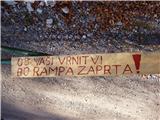 2
2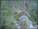 3
3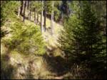 4
4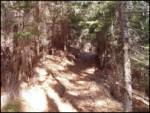 5
5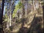 6
6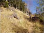 7
7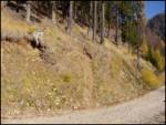 8
8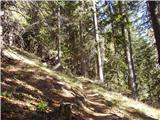 9
9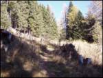 10
10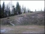 11
11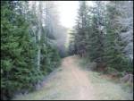 12
12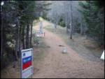 13
13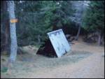 14
14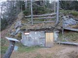 15
151122000.th.jpg) 16
16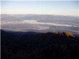 17
17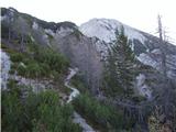 18
18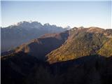 19
19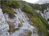 20
20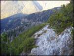 21
21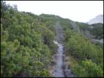 22
22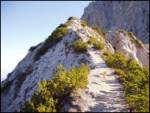 23
23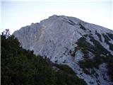 24
24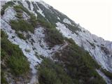 25
25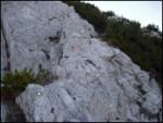 26
26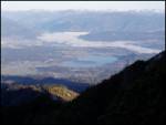 27
27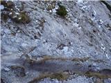 28
28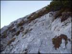 29
29 30
30 31
31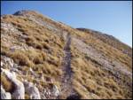 32
32 33
33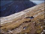 34
34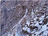 35
35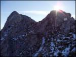 36
36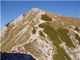 37
37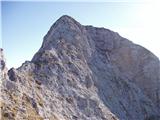 38
38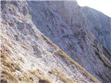 39
39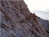 40
40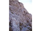 41
41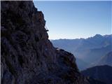 42
42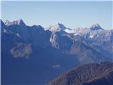 43
43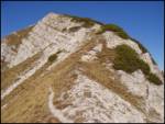 44
44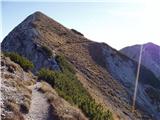 45
45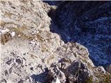 46
46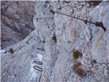 47
47 48
48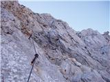 49
49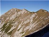 50
50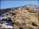 51
51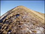 52
52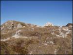 53
53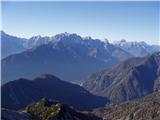 54
54
Discussion about the trip Zapornica (Belca) - Huhnerkogel/Gubno
|
| andrej jerina12. 10. 2008 |
The path description holds completely, the path is nicely visible and trodden, in wet there's great risk of slipping at some places. Helmet on, at least through the notch. From the top truly wonderful views. Best regards Andrej
|
|
|
To post a comment you must log in:
If you do not yet have a username, you must first
register.