Globoka dolina - Kofce gora
Starting point: Globoka dolina (1050 m)
| Latitude/Longitude: | 46,41070°N 14,34130°E |
| |
Walking time: 2 h 15 min
Difficulty: partly demanding marked way
Elevation gain: 917 m
Elevation difference along the route: 917 m
Map: Karavanke - osrednji del 1:50.000
Recommended equipment (summer):
Recommended equipment (winter): ice axe, crampons
Views: 14.841
 | 2 people like this post |
Access to starting point:
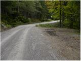
From the Ljubljana - Jesenice highway, take the Tržič (Ljubelj) exit, then continue driving on the quick road towards Tržič. Here, just before the gas station, turn right and descend to the center of Tržič. We continue driving on a somewhat narrower road which through the Dolžanova soteska gorge brings us to the village Dolina and a little higher to Jelendol. Here we continue left (straight on the lower road Medvodje) and we continue driving on at first still asphalted road in the direction of the mountain pastures Kofce, Šija and Pungrat. The road then soon becomes macadam and starts ascending steeply on an occasionally quite rough road. Higher, the road moves away from the riverbed of the stream Dolžanka and gradually brings us into a somewhat less dense forest. Here we will approximately 50 meters before the smaller wooden cottage, which we see on the left side, notice the beginning of the mountain path which leads towards Kofce. We park on one of the several suitable parking spaces by the road.
Route description:
At the starting point, we notice a red mountain directional sign with the inscription "Kofce čez Dovžanko", which directs us left onto a marked footpath that ascends through a belt of dense forest. Already after a shorter ascent, we step onto a cart track, which we continue to follow to the left through the forest. The cart track soon flattens completely, then crosses several successive springs. A short descent follows, then over a smaller wooden bridge we cross the Dolžanka stream, after which we already step onto the eponymous mountain pasture.
Immediately after the bridge, we continue right in the direction of Kofce and continue the path on a somewhat steeper cart track, which we follow for approximately 5 minutes, then the blazes direct us slightly right onto a footpath that further ascends parallel to the mentioned cart track. The path higher turns somewhat to the right and gradually begins to ascend ever steeper. Higher we cross a belt of young forest, then return to dense forest, where the path ascends very steeply for a few minutes. After a few-minute steep ascent we step onto the road, which we follow to the right and walk on it only approximately 20 m, then the signs for Kofce direct us left onto the ascending path. Some 10 m higher, a path from a higher starting point joins us from the right, we continue slightly left and after a few minutes of further walking arrive at the chapel below the Kofce mountain pasture.
The marked path bypasses the mentioned chapel on the right side, which a little higher brings us to a wide cart track, along which we walk to the pasture fence. When we cross the pasture fence we also step out of the forest, and we continue the path on a somewhat less visible path, along which in less than 10 minutes of further walking we arrive at the mountain hut on Kofce.
From the mountain hut we continue in the direction of Veliki vrh and Kladivo on an initially somewhat less visible path that begins to ascend across a panoramic meadow. After 15 minutes of walking from the hut on Kofce we come to a nice viewpoint at the cross.
The path then descends slightly and brings us in a few minutes to the steeper slopes of Košuta. The path then ascends through a belt of dwarf pines, where it brings us to a junction. We continue right (straight Veliki vrh) on the path to which already after a few meters an unmarked but signed path from the Šija mountain pasture joins. We continue left upward on the path that ascends steeply and quickly brings us to an exposed passage. Without fixed protection we cross a short but crumbly and slightly exposed ledge after which we step into a belt of dwarf pines. The path ahead ascends through a short belt of dwarf pines, then continues along the side ridge of Košuta. The increasingly panoramic and quite steep path then higher joins the ridge path.
We continue straight upward on the unmarked path, which after 10 steps brings us to the summit (left Veliki vrh, right Kladivo).
Starting point - Kofce 1:15, Kofce - Kofce gora 1:00.

Photos:
 1
1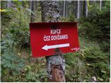 2
2 3
3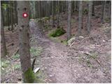 4
4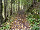 5
5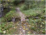 6
6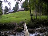 7
7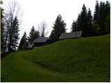 8
8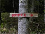 9
9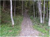 10
10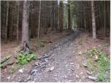 11
11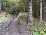 12
12 13
13 14
14 15
15 16
16 17
17 18
18 19
19 20
20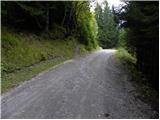 21
21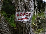 22
22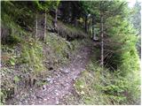 23
23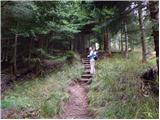 24
24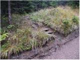 25
25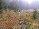 26
26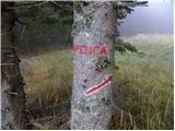 27
27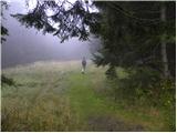 28
28 29
29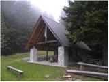 30
30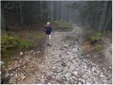 31
31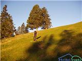 32
32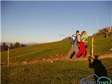 33
33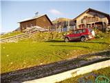 34
34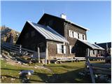 35
35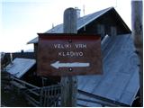 36
36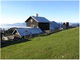 37
37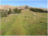 38
38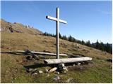 39
39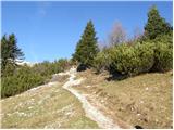 40
40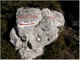 41
41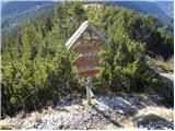 42
42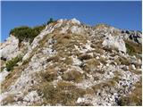 43
43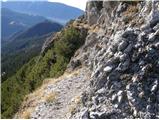 44
44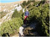 45
45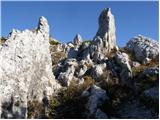 46
46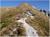 47
47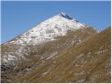 48
48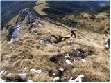 49
49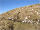 50
50 51
51
Discussion about the trip Globoka dolina - Kofce gora
|
| Lapuh20720. 06. 2019 |
Is the road to Jelendol (path to Kofce) passable?
|
|
|
|
| narava21. 06. 2019 |
It is normally passable 
|
|
|
To post a comment you must log in:
If you do not yet have a username, you must first
register.