Golnik - Tolsti vrh (via Kriška goro)
Starting point: Golnik (510 m)
| Latitude/Longitude: | 46,32760°N 14,33000°E |
| |
Route name: via Kriška goro
Walking time: 3 h 30 min
Difficulty: easy marked way
Elevation gain: 1205 m
Elevation difference along the route: 1225 m
Map: Karavanke - osrednji del 1:50.000
Recommended equipment (summer):
Recommended equipment (winter): ice axe, crampons
Views: 16.813
 | 1 person like this post |
Access to starting point:
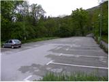
From the highway Ljubljana - Jesenice, we take the exit Kranj - west and follow the road ahead in the direction of Golnik. When we arrive at Golnik, at the top of the hill, we turn right in the direction of Golnik hospital. We park on one of the large parking lots, which is situated a little below the hospital.
Route description:
From the parking lot, we walk to the hospital, which we bypass on the left side, and then we come to mountain signposts, which direct us to a footpath that ascends along the fence. After a few steps, we cross the road, and then the footpath, which ascends above the village, leads us into the forest, where it starts to ascend more steeply. The path after a short ascent joins a wide cart track, on which we continue an easy ascent. After a few minutes, a marked footpath branches off to the right from the cart track, which soon brings us to another cart track, which we also soon leave. We continue the ascent on a rather steep path, which higher brings us to a vantage point (view of Gorenjska and Jelovica).
After the vantage point, the path flattens and turns quite to the left, where it then continues in a moderate ascent. Higher, the footpath turns a little to the right, where it then brings us to the village Gozd in a few minutes of further walking. Here we continue past a few houses, and then we join the path from Zavetišče v Gozdu.
We continue right in the direction of Kriška gora, and we follow the road, which leads us past two successive NOB monuments, to its end. From the end of the road, we continue slightly left and continue the ascent on a wide and steep cart track, which quickly brings us to the spot where it splits into two parts. We continue on the left in the direction of Koča na Kriški gori (right Tolsti vrh). The cart track then passes the water supply structure and a weekend cabin and enters the forest, where it continues in a moderate ascent.
A little further ahead, the signs for Kriška gora direct us right (straight ahead unmarked path to Kriška gora) onto a somewhat more eroded cart track, which higher turns into a relatively steep path. Further on, we ascend on a well-maintained path, along which we notice numerous benches and beside them the names of the benches. Higher, the path brings us to a grazing fence and a little higher turns left, where it then ascends diagonally. After a few minutes of diagonal ascent, we step out of the forest, where we already see Koča na Kriški gori ahead of us, to which only a few dozen easy steps remain.
From the hut, we return a few steps back, and then continue the path in the direction of Tolsti vrh. Ahead, the path ascends gently along and on the main ridge of Kriška gora, then gradually passes onto the southern slopes, where it crosses the slopes of Vrat. The path then gradually returns to the ridge, along and on which it continues for quite some time. Higher, we reach a scenic forepeak, from which the first closer view towards the summit opens up. A short descent follows, then the path starts to ascend steeply up the summit slope of the mountain. Higher, we cross a short stretch of forest, then the increasingly scenic path quickly brings us to the 1715 m high summit.
Golnik - Gozd 1:00, Gozd - Kriška gora 1:30, Kriška gora - Tolsti vrh 1:00.

Photos:
 1
1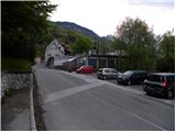 2
2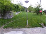 3
3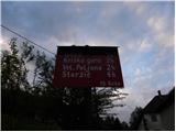 4
4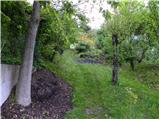 5
5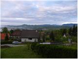 6
6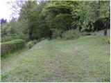 7
7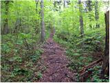 8
8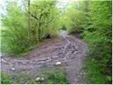 9
9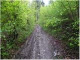 10
10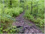 11
11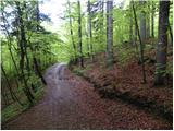 12
12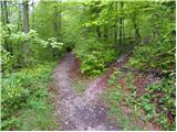 13
13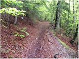 14
14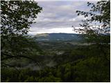 15
15 16
16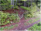 17
17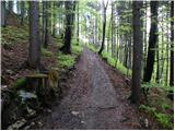 18
18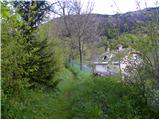 19
19 20
20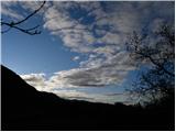 21
21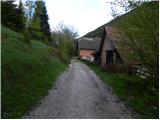 22
22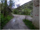 23
23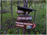 24
24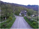 25
25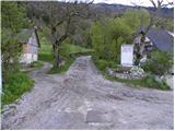 26
26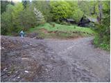 27
27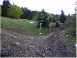 28
28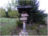 29
29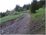 30
30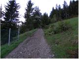 31
31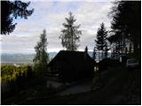 32
32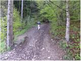 33
33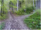 34
34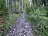 35
35 36
36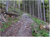 37
37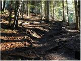 38
38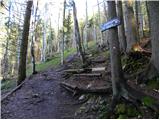 39
39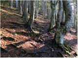 40
40 41
41 42
42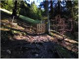 43
43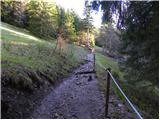 44
44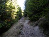 45
45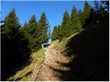 46
46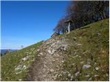 47
47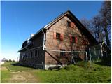 48
48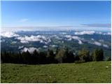 49
49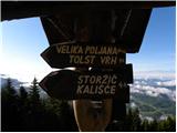 50
50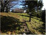 51
51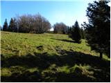 52
52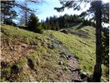 53
53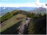 54
54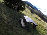 55
55 56
56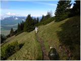 57
57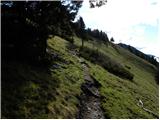 58
58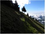 59
59 60
60 61
61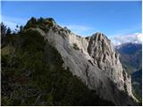 62
62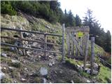 63
63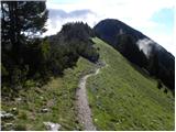 64
64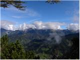 65
65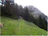 66
66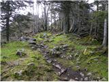 67
67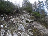 68
68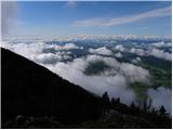 69
69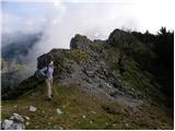 70
70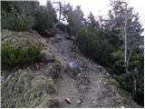 71
71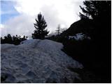 72
72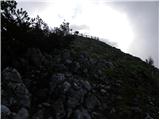 73
73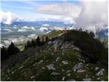 74
74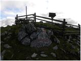 75
75 76
76
Discussion about the trip Golnik - Tolsti vrh (via Kriška goro)
|
| istrumel24. 04. 2012 |
does anyone know what the uphill trail is like, as I'd go up on Sunday if weather permits. thanks.
|
|
|
|
| sla25. 04. 2012 |
The trail is without any special features, only at the end of the village Gozd it is quite muddy due to timber hauling.
|
|
|
|
| Loni25. 04. 2012 |
But you can nicely bypass it across the meadow on the left side, the horses are not grazing yet and there is no fence. Now it's already quite trodden...
|
|
|
|
| istrumel25. 04. 2012 |
thanks. Is there any snow on the top?
|
|
|
|
| ajda25. 04. 2012 |
Hello, Kriška gora and Tolsti vrh are clear.
|
|
|
|
| istrumel26. 04. 2012 |
Super, just cheerfully up. Thanks.
|
|
|
To post a comment you must log in:
If you do not yet have a username, you must first
register.