Gora - Trstelj (mimo Stjenkove koče)
Starting point: Gora (400 m)
| Latitude/Longitude: | 45,86550°N 13,72200°E |
| |
Route name: mimo Stjenkove koče
Walking time: 50 min
Difficulty: easy marked way
Elevation gain: 243 m
Elevation difference along the route: 243 m
Map: Goriška 1:50.000
Recommended equipment (summer):
Recommended equipment (winter):
Views: 43.460
 | 1 person like this post |
Access to starting point:
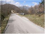
From the Razdrto–Nova Gorica highway, we take the Selo exit and continue towards the village of Dornberk. In the village of Dornberk, we turn left towards Koper and then after 100 meters right towards Trstelj (the turnoff for Trstelj is marked). We follow the ascending road to the parking lot on the left side (the parking lot is recognizable by a small chapel located in the middle of a rock, and on top of the mentioned rock we can see a small Aljaž Tower).
From the Nova Gorica side, we can also reach the village of Dornberk via Šempeter and Volčja Draga.
Route description:
From the parking lot by the main road, we first continue walking on an asphalt surface, which in a gentle ascent takes us in a few minutes to the idyllic hamlet of Gora. Immediately after the last residential house in the village, the markings direct us right onto a well-trodden path. After a short but somewhat steeper ascent across a grassy slope, the path briefly returns to the asphalt road. We follow this section for a few more minutes of moderate walking, all the way to the important road junction at Železna vrata, where there are a large number of hiking signposts and boards.
Here we turn onto a wide and initially quite rutted cart track, which quickly takes us to the place where the route is crossed by high wires of the power line (transmission line). Exactly at this spot we leave the cart track and continue left onto a pleasant forest footpath. The path immediately turns into the embrace of the shady forest and begins to ascend moderately but steadily.
After a short ascent the slope noticeably eases, and the forest thins out. The path leads us onto bare, scenic slopes, from which we get our first beautiful view towards the summit of Trstelj, on which we can clearly see the tall radio transmitters. The path then leads us back into the forest shelter, where after a few minutes of walking a marked path joins from the right, coming from the direction of Renče.
We continue left on the gentle section and after a few steps step onto a poorer gravel road. We turn right and follow this road towards Stjenkova koča on Trstelj, whose roof and building we can already see among the trees directly ahead.
From the mountain hut we continue towards the summit on a clearly visible footpath, which begins to ascend gently through sparse forest. After a few dozen steps the path again leads us onto a poorer gravel road. We then follow this road, with ever wider and more beautiful views that on a clear day reach all the way to the Adriatic Sea and the Julian Alps, all the way to the very summit, where the transmitters and a registration box with a stamp stand.

Photos:
 1
1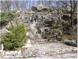 2
2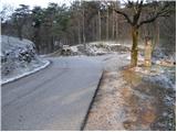 3
3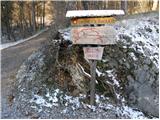 4
4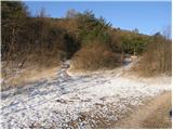 5
5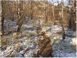 6
6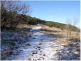 7
7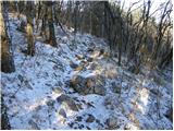 8
8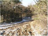 9
9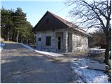 10
10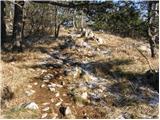 11
11 12
12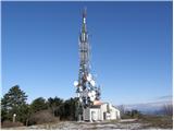 13
13
Discussion about the trip Gora - Trstelj (mimo Stjenkove koče)
|
| grega_p28. 12. 2009 |
In the wet it's not pleasant, as it quite properly slips on the rocks on the steep part.
As a curiosity: From Trstelj the Slovenian coast between Trst and Gradež appears. ???. Check the maps or ask the caretaker - thanks!
lp
Grega
|
|
|
|
| ksena9. 05. 2010 |
Today on Trstelj by bike. Nice tour to open the cycling season... I've already ended it here with ski touring  An island of clear sky was right above the summit, everything around was foggy, so no views. Otherwise, from this 643 m high hill, you can nicely see from the Alps to the sea. An island of clear sky was right above the summit, everything around was foggy, so no views. Otherwise, from this 643 m high hill, you can nicely see from the Alps to the sea.
|
|
|
|
| Kokta10. 03. 2012 |
Another Primorska gem . I must praise the kitchen at Stjenkova koča.
|
|
|
|
| mortysus11. 03. 2012 |
repe doesn't know how to cook.....
|
|
|
|
| ivanka.zrna2. 05. 2018 |
I was looking for the path through the stream, and when I returned I realized that this Potok is a settlement.
|
|
|
|
| ibresc2. 05. 2019 |
I don't know how old the path description to Trstelj from Železna vrata or from Gora is, but the trail from the forest road crossed by the power line is mostly quite steep with stones rolling underfoot, and we reach the partially overgrown slopes only shortly before the junction with the trail from Renče.
|
|
|
|
| Borut115. 03. 2023 22:24:13 |
Nice trail. The trail between pictures 5 and 7 is quite long and steep, but shown only with picture 6. In reality, we spend more time in the forest than depicted in the pictures.
|
|
|
|
| zaspanka15. 06. 2023 12:27:36 |
The trail is well marked, but a bit more strenuous than I expected for an almost coastal hill. 
In case the mentioned parking lot is occupied, there's another parking lot a bit further at the hunting lodge. The parking lot at the iron gates offers quite a bit of shade (now that the days are finally getting a bit warmer).
|
|
|
|
| Hribolazec8118. 01. 2026 17:18:58 |
Very nice peak, it impressed me, the path is really very slippery when wet, when you're already there, it's worth visiting Štanjel castle, Lipica,...
|
|
|
To post a comment you must log in:
If you do not yet have a username, you must first
register.