Starting point: Göriach (1443 m)
| Latitude/Longitude: | 47,24080°N 13,74530°E |
| |
Walking time: 3 h 30 min
Difficulty: difficult marked way
Elevation gain: 1055 m
Elevation difference along the route: 1055 m
Map:
Recommended equipment (summer):
Recommended equipment (winter): ice axe, crampons
Views: 3.247
 | 1 person like this post |
Access to starting point:
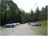
From the highway Beljak/Villach - Salzburg we go to the exit St. Michael (the exit is located between both larger tunnels). We follow the road ahead towards the settlements St. Martin, Mariapharr and Göriach. We then follow the ascending road through the mentioned villages to the parking lot, which is located a few kilometers above the village Göriach, where we park on a large parking lot.
Route description:
From the parking lot, we continue on the road which brings us in 5 minutes of walking to a larger meadow in the middle of which we notice a larger number of wooden cottages. One of the cottages is also the mountain hut, which is situated on the right side of the path.
The path ahead gradually starts ascending and over two successive small bridges brings us to the spot, from where a nice view opens up on the waterfall. After the waterfall the worse road ascends one level higher and after half an hour of walking from the starting point brings us to a hamlet of private cottages. The path, which still runs on the road, along numerous streams brings us to a crossing, where the path to Hochgolling branches off to the right. We still continue on the road which turns to the left and after additional 40 minutes of moderate ascent on the more and more panoramic slope brings us to the mountain hut.
From the mountain hut, we continue slightly left in the direction of the summit Scharnock and the path past a cross in 5 minutes brings us to the lower (unterer) Landawirsee lake.
From the lake the path starts ascending a little more and after 15 minutes of moderate ascent, which runs by the clear mountain stream, brings us to the upper lake, which is covered with snow and ice long into the summer.
From the upper lake we continue on its right side and on a somewhat poorly visible path in places, which a little higher brings us to the next crossing, where we continue left (right Pitrach). The path ahead turns a little to the left and in a moderate diagonal ascent crosses a larger number of smaller streams, which are fed by snow fields above us. The path, which occasionally is almost invisible, starts ascending steeply and after an ascent lasting a little less than half an hour brings us to a smaller saddle a little below the summit. Here we continue right towards the cliffs, which we see in front of us, and we avoid them on the left side of the ridge. The path ahead becomes exposed and is in wet and snow dangerous for slipping. We cross the exposed ledge in a moderate ascent over steep grassy slopes. Further, the path turns a little to the right and after additional few dozen steps of steep ascent brings us to the summit.

Photos:
 1
1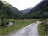 2
2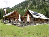 3
3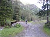 4
4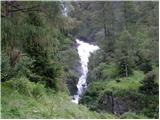 5
5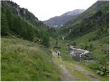 6
6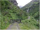 7
7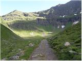 8
8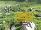 9
9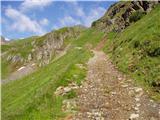 10
10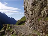 11
11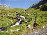 12
12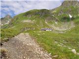 13
13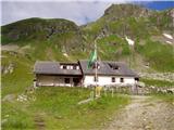 14
14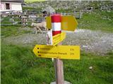 15
15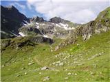 16
16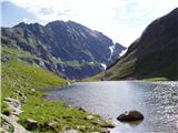 17
17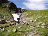 18
18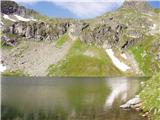 19
19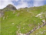 20
20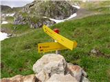 21
21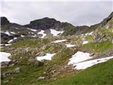 22
22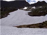 23
23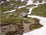 24
24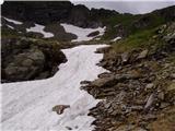 25
25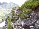 26
26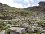 27
27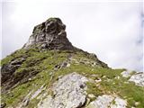 28
28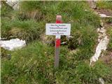 29
29 30
30 31
31
Discussion about the trip Göriach - Scharnock
To post a comment you must log in:
If you do not yet have a username, you must first
register.