Gornje Ležeče - Vremščica
Starting point: Gornje Ležeče (502 m)
| Latitude/Longitude: | 45,66480°N 14,07030°E |
| |
Walking time: 1 h 40 min
Difficulty: easy marked way
Elevation gain: 525 m
Elevation difference along the route: 535 m
Map:
Recommended equipment (summer):
Recommended equipment (winter): crampons
Views: 23.868
 | 2 people like this post |
Access to starting point:
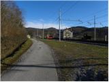
From the Ljubljana - Koper highway we go to the Divača exit and follow the road ahead in the direction of Divača and Matavun. After approximately 1 km of driving from the spot when we left the highway, we turn left in the direction of the villages Zavrhek and Ribnica. Further, we drive through a few villages, and then a little after the village Gornje Vreme, we continue left in the direction of Gornje Ležeče. We continue driving on a narrower and also steeper road which higher through the underpass brings us to the railway station Gornje Ležeče. After the underpass, we continue right (straight Gornje Ležeče) and then we park on a suitable place by the railway station.
Route description:
From the railway station, we return to the underpass, and then at the crossroads we continue in the direction of the village Gornje Ležeče. After a short ascent on an asphalt road, we come to the beginning of the village, where we notice the first blaze. After a good 10 minutes of walking from the starting point, we come above the village, where signs for Vremščica point us on a gently sloping cart track which crosses a shorter, but panoramic meadow. Cart track ahead passes into at first a thin, and then a dense lane of forest and gradually starts ascending steeper. Cart track, which has a few crossings, but they are well marked, higher flattens, passes on the other side of indistinct Črni vrh (695 m) and after a few steps of descent brings us to the road which connects Divača and Pivka.
The mentioned road we only cross and continue the ascent on a marked footpath in the direction of Vremščica. The path ahead continues on a moderately steep cart track which mostly crosses slopes towards the left. Higher the path brings us out of the forest, and it starts ascending steeper. The path from which increasingly beautiful views are opening up on Slavnik, Čičarija and Učka, after a few minutes of additional walking brings us to the summit of Vremščica.
From the top, we can extend the trip also to a nearby newly built church of St. Urban (direction Volče 5 minutes).

Photos:
 1
1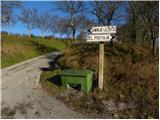 2
2 3
3 4
4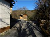 5
5 6
6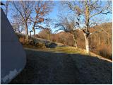 7
7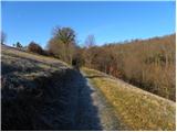 8
8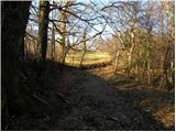 9
9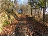 10
10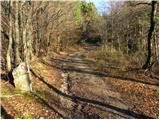 11
11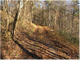 12
12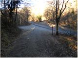 13
13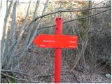 14
14 15
15 16
16 17
17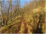 18
18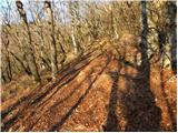 19
19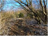 20
20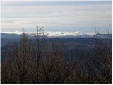 21
21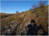 22
22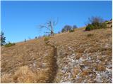 23
23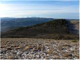 24
24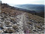 25
25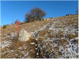 26
26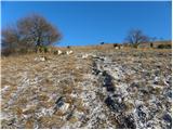 27
27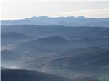 28
28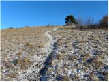 29
29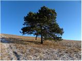 30
30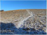 31
31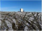 32
32 33
33
Discussion about the trip Gornje Ležeče - Vremščica
|
| B222. 04. 2011 |
From the ŽP Gornje Ležeče, right after the station we step onto the narrow, asphalted village path and go straight uphill. After about 200m ascent we join the previously described route. This saves about 600 m of unpleasant asphalt and half of that length of steep ascent. There is also a mountain signpost on the ŽP building. The mentioned shortcut is also marked (faded markers), but the path in the description above past the railway overpass was never marked!
|
|
|
|
| tavzentroza20. 05. 2025 18:34:07 |
The purpose of my post is to inspire, encourage, and "inform" someone else about the beauties in our surroundings.
Today sustainably to Vremščica. By train (it was even on time) to Gornje Ležeče station.
Then a paradise garden... so many flowers, more than many paid parks around the world have.
Narcises (Urbanščice) are coming to an end, but there are countless other flowers.
I walked the entire ridge of Vremščica so as not to miss any beautiful flower, via Gabrče to Senožeče and bus home.
There's also the option to take the bus already in Gabrče. Some stop there.
I would like to add some photos, but I don't know how to do it.
|
|
|
|
| Tadej20. 05. 2025 18:43:29 |
|
|
|
To post a comment you must log in:
If you do not yet have a username, you must first
register.