Gornji Grad - Lepenatka (via Kal)
Starting point: Gornji Grad (436 m)
| Latitude/Longitude: | 46,29500°N 14,80680°E |
| |
Route name: via Kal
Walking time: 3 h
Difficulty: easy marked way
Elevation gain: 989 m
Elevation difference along the route: 1020 m
Map: Kamniške in Savinjske Alpe 1:50.000
Recommended equipment (summer):
Recommended equipment (winter): ice axe, crampons
Views: 16.943
 | 2 people like this post |
Access to starting point:
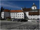
From the Savinja Valley or from Kamnik via the Črnivec Pass, we drive to Gornji Grad, where we park on the well-maintained parking lot by the main bus station.
Route description:
From the main bus stop in Gornji Grad, we continue along the main road towards the Črnivec Pass and Kamnik, and we walk along it approximately 5 minutes, or to the crossroad, where a narrower asphalt road towards Lenart branches off to the right.
The path ahead leads us on the mentioned road, which at first ascends gently over ample meadows. A little higher the road passes into the valley of the stream Kanolščica, through which we then ascend gently to moderately for quite some time. At all crossroads we follow the road on the bottom of the valley, and after approximately 1 hour of walking from the starting point we notice mountain path markers, which direct us left onto a path that ascends below the power line poles. After some 10 m we cross a torrent, and then the path starts to ascend steeply over occasionally quite overgrown slopes. Higher the path leads us over a short partly demanding section, where a landslide carried away a few meters of the marked path. The path then returns into a dense forest, through which it ascends steeply for a short time, then flattens and brings us to the nearby road. We follow the road to the left, and we walk along it to the first bend, where at the end of it we continue left on the marked footpath, along which we quickly ascend to the Knebovšek farmstead. We walk through the yard, then continue in the direction of Lepenatka and Rogatec. A little above the farm the road changes into a cart track, which turns right into the forest, where it crosses slopes to the right. A little further we cross a somewhat exposed torrent, then along an occasionally overgrown path we arrive at the forest road. We follow the road to the right and past the chapel in a gentle descent we walk to the marked junction. From the junction we continue in the direction of St. Lenart and continue along the wide cart track, along which in 3 minutes of further walking we arrive at the already mentioned church.
From the church we continue left in the direction of the Kal saddle and Lepenatka (straight ahead Zgornji Špeh and Veliki Rogatec) along the path that ascends above the cart track. After a short ascent a path about a minute shorter joins us from the left, which bypasses the church of St. Lenart. We continue straight and after a further short ascent we step onto the macadam road, which we follow to the right, and we walk along it to the nearby crossroad.
From here we continue right in the direction of the Kal saddle (left Lepenatka "along the ridge"), where after 2 minutes of further walking we arrive at the end of the road below Lepenatka.
From the end of the road the markers direct us into the torrent gully and then right onto steep and especially in wet slippery-dangerous slopes (in winter there is also avalanche danger on this section). In a few minutes along the well-maintained mountain path we ascend to the forested ridge, where the path and the slope flatten. The path ahead leads us for some time along and beside the forested ridge, then turns right and in a traversing ascent brings us below the Kal saddle. Here we step onto a narrower cart track, along which in a few minutes we ascend to the already mentioned saddle.
From the saddle we continue left (right Bivak na Kalu 3 minutes and Veliki Rogatec 50 minutes) and first ascend along the edge of the forest, then the path brings us to the extensive grassy slopes of Lepenatka. The path ahead leads along an increasingly panoramic ridge, then the path levels somewhat and brings us to the main ridge of Lepenatka, where the path "along the ridge" joins from the left. Here we continue right and in one minute of further walking we arrive at the grassy and panoramic summit.

The trip can be extended to the following destinations: Rogatec
Photos:
 1
1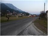 2
2 3
3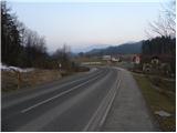 4
4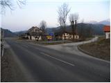 5
5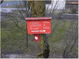 6
6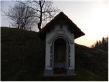 7
7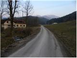 8
8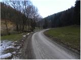 9
9 10
10 11
11 12
12 13
13 14
14 15
15 16
16 17
17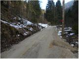 18
18 19
19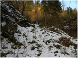 20
20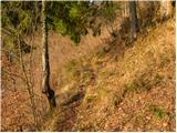 21
21 22
22 23
23 24
24 25
25 26
26 27
27 28
28 29
29 30
30 31
31 32
32 33
33 34
34 35
35 36
36 37
37 38
38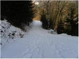 39
39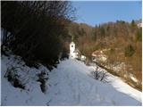 40
40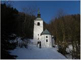 41
41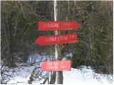 42
42 43
43 44
44 45
45 46
46 47
47 48
48 49
49 50
50 51
51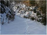 52
52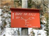 53
53 54
54 55
55 56
56 57
57 58
58 59
59 60
60 61
61 62
62 63
63 64
64 65
65 66
66 67
67 68
68 69
69 70
70 71
71 72
72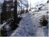 73
73 74
74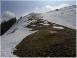 75
75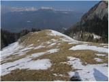 76
76 77
77 78
78 79
79 80
80 81
81 82
82 83
83 84
84 85
85
Discussion about the trip Gornji Grad - Lepenatka (via Kal)
To post a comment you must log in:
If you do not yet have a username, you must first
register.